TopoQuest Logo
Do you find TopoQuest useful?
Help keep TopoQuest running and adding new maps/features by donating!
Bitcoin:  19c7KJd3qBynnjoSw5npx9KScwjBe4ifkT
Litecoin:  LXs6TkuXGGXo1vDsWCkWVdjQX94eUKd6ui
Home View Maps Find Maps Find Places Resources & Links


Spirit, Washington Topographic Map

USGS Map Title: Spirit, WA
USGS Map MRC: 48117G6
DRG (GeoTIFF) Download: o48117g6.tif


Neighboring USGS Topographic Map Quads:


  Northport, WA  
48117H7
 

  Boundary, WA  
48117H6
 

  Leadpoint, WA  
48117H5
 

  Onion Creek, WA  
48117G7
 

  Spirit, WA  
48117G6
 

  Deep Lake, WA  
48117G5
 

  Gillette Mountain, WA  
48117F7
 

  Aladdin, WA  
48117F6
 

  Aladdin Mountain, WA  
48117F5


Map MRC Location:

N49°
W118°
N49°
W117°
H8 H7 H6 H5 H4 H3 H2 H1
G8 G7 G6 G5 G4 G3 G2 G1
F8 F7 F6 F5 F4 F3 F2 F1
E8 E7 E6 E5 E4 E3 E2 E1
D8 D7 D6 D5 D4 D3 D2 D1
C8 C7 C6 C5 C4 C3 C2 C1
B8 B7 B6 B5 B4 B3 B2 B1
A8 A7 A6 A5 A4 A3 A2 A1
N48°
W118°
N48°
W117°

Spirit, WA USGS 1:24K Topographic Map Preview:
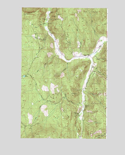
Spirit, WA USGS Topographic Map
Click on map above to begin viewing in our Map Viewer.

This topographic map contains these locations and features:
Feature Name Type Latitude Longitude GNIS ID View Map
Black Rock MineMineN48.8702°W117.7069°1516628View Map
Blue RidgeRidgeN48.7699°W117.6816°1516715View Map
Blue Ridge MineMineN48.7744°W117.6691°1516716View Map
Copper King MineMineN48.7810°W117.6544°1518085View Map
Deep Creek MineMineN48.8635°W117.7155°1518591View Map
Frederickson HillSummitN48.7919°W117.6730°1519774View Map
Goldfield MillPopulated PlaceN48.7741°W117.6672°1520121View Map
Great Western MineMineN48.8688°W117.6966°1520281View Map
Harrier CreekStreamN48.7835°W117.6594°1520562View Map
Ione HillSummitN48.7546°W117.6472°1521218View Map
Koski HillSummitN48.8496°W117.7291°1521765View Map
Last Chance Mine 3057MineN48.8660°W117.7008°1521920View Map
Lime CreekStreamN48.8410°W117.6305°1522107View Map
Little Johnson CreekStreamN48.8585°W117.7155°1522247View Map
Little Smackout CreekStreamN48.8224°W117.6466°1522306View Map
Lookout CreekStreamN48.7832°W117.6991°1522424View Map
Magma MineMineN48.7669°W117.6411°1522637View Map
Marble QuarryMineN48.8596°W117.7111°1522714View Map
Martella CreekStreamN48.8246°W117.6808°1522749View Map
Miller CreekStreamN48.7963°W117.6600°1523178View Map
New England MineMineN48.8591°W117.7175°1523633View Map
North Fork Deep CreekStreamN48.8282°W117.6533°1523771View Map
Pick CreekStreamN48.8435°W117.7158°1524398View Map
Quinns MeadowsLakeN48.8088°W117.7458°1524781View Map
Raisio CreekStreamN48.8324°W117.6933°1524847View Map
Smackout CreekStreamN48.8316°W117.6428°1525956View Map
South Fork Deep CreekStreamN48.8282°W117.6530°1526188View Map
South Fork GrangeLocaleN48.8294°W117.6605°1526201View Map
SpiritPopulated PlaceN48.8296°W117.6505°1526375View Map
Spirit SchoolSchoolN48.8182°W117.6433°1526382View Map
Stevens County Fire District 10 - Deep LakeBuildingN48.8274°W117.6466°2643971View Map
Stoddard MountainSummitN48.8666°W117.7453°1526579View Map
Stonewall MineMineN48.8702°W117.7389°1526587View Map
Todd CreekStreamN48.8285°W117.6619°1527270View Map
Waymire CreekStreamN48.8516°W117.7089°1527862View Map
West Fork Lime CreekStreamN48.8577°W117.6478°1527954View Map

Note: Coordinates in the location and feature list above are referenced to NAD83 datum.


Copyright (C) 2008-2024 Ryan Niemi / Sunset Dynamics ... All Rights Reserved