TopoQuest Logo
Do you find TopoQuest useful?
Help keep TopoQuest running and adding new maps/features by donating!
Bitcoin:  19c7KJd3qBynnjoSw5npx9KScwjBe4ifkT
Litecoin:  LXs6TkuXGGXo1vDsWCkWVdjQX94eUKd6ui
Home View Maps Find Maps Find Places Resources & Links


Holbrook, Pennsylvania Topographic Map

USGS Map Title: Holbrook, PA
USGS Map MRC: 39080G3
DRG (GeoTIFF) Download: o39080g3.tif


Neighboring USGS Topographic Map Quads:


  Wind Ridge, PA  
39080H4
 

  Rogersville, PA  
39080H3
 

  Waynesburg, PA  
39080H2
 

  New Freeport, PA  
39080G4
 

  Holbrook, PA  
39080G3
 

  Oak Forest, PA  
39080G2
 

  Hundred, WV  
39080F4
 

  Wadestown, WV  
39080F3
 

  Blacksville, WV  
39080F2


Map MRC Location:

N40°
W81°
N40°
W80°
H8 H7 H6 H5 H4 H3 H2 H1
G8 G7 G6 G5 G4 G3 G2 G1
F8 F7 F6 F5 F4 F3 F2 F1
E8 E7 E6 E5 E4 E3 E2 E1
D8 D7 D6 D5 D4 D3 D2 D1
C8 C7 C6 C5 C4 C3 C2 C1
B8 B7 B6 B5 B4 B3 B2 B1
A8 A7 A6 A5 A4 A3 A2 A1
N39°
W81°
N39°
W80°

Holbrook, PA USGS 1:24K Topographic Map Preview:
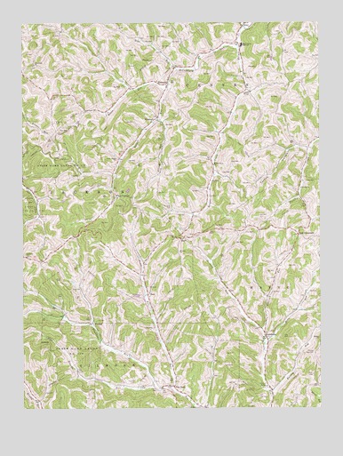
Holbrook, PA USGS Topographic Map
Click on map above to begin viewing in our Map Viewer.

This topographic map contains these locations and features:
Feature Name Type Latitude Longitude GNIS ID View Map
AshtreePopulated PlaceN39.7729°W80.3626°1202993View Map
Bells RunStreamN39.7712°W80.2731°1169187View Map
Bethany ChurchChurchN39.7995°W80.3731°1169338View Map
Blockhouse RunStreamN39.7570°W80.3201°1169827View Map
BluffPopulated PlaceN39.8051°W80.3073°1169905View Map
Bulldog RunStreamN39.7551°W80.2703°1170656View Map
BuzzPopulated PlaceN39.7873°W80.3223°1203201View Map
Fordyce CemeteryCemeteryN39.7581°W80.3282°1174961View Map
Fordyce CemeteryCemeteryN39.8146°W80.3132°1174962View Map
Garner RunStreamN39.8545°W80.3128°1175457View Map
Grinage RunStreamN39.8442°W80.3173°1176244View Map
Hargus CreekStreamN39.8737°W80.2803°1176525View Map
Higgins CemeteryCemeteryN39.8431°W80.3609°1176998View Map
Hoge RunStreamN39.8598°W80.3095°1192619View Map
HolbrookPopulated PlaceN39.8554°W80.3137°1203824View Map
Holbrook Post OfficePost OfficeN39.8570°W80.3134°2772746View Map
House RunStreamN39.8554°W80.3137°1177507View Map
KuhntownPopulated PlaceN39.7729°W80.2726°1203967View Map
Macedonia ChurchChurchN39.8615°W80.3698°1180150View Map
McCourtney RunStreamN39.8670°W80.2831°1180663View Map
Morris CemeteryCemeteryN39.7560°W80.3188°1181569View Map
Phillips ChurchChurchN39.7726°W80.2503°1183671View Map
Phillips New CemeteryCemeteryN39.7676°W80.2524°1183675View Map
Pine BankPopulated PlaceN39.7570°W80.3112°1204394View Map
Pine Bank CemeteryCemeteryN39.7501°W80.2999°1183758View Map
Pursley ChurchChurchN39.8212°W80.2576°1184503View Map
Roberts RunStreamN39.7570°W80.3123°1185210View Map
Rush CrossroadsPopulated PlaceN39.8062°W80.2590°1204559View Map
Township of JacksonCivilN39.8200°W80.3578°1216492View Map
TriumphPopulated PlaceN39.7776°W80.3456°1204829View Map
Turkey HollowValleyN39.8331°W80.2635°1189939View Map
Tustin RunStreamN39.7754°W80.2748°1189989View Map
Valley Chapel ChurchChurchN39.8312°W80.3342°1190288View Map
West Greene High SchoolSchoolN39.8679°W80.2820°1191034View Map
White CottageLocaleN39.8187°W80.3356°1191263View Map
Willow Grove ChurchChurchN39.8290°W80.2942°1191501View Map
WoodruffPopulated PlaceN39.8442°W80.3181°1204989View Map

Note: Coordinates in the location and feature list above are referenced to NAD83 datum.


Copyright (C) 2008-2024 Ryan Niemi / Sunset Dynamics ... All Rights Reserved