TopoQuest Logo
Do you find TopoQuest useful?
Help keep TopoQuest running and adding new maps/features by donating!
Bitcoin:  19c7KJd3qBynnjoSw5npx9KScwjBe4ifkT
Litecoin:  LXs6TkuXGGXo1vDsWCkWVdjQX94eUKd6ui
Home View Maps Find Maps Find Places Resources & Links


Spokane, Missouri Topographic Map

USGS Map Title: Spokane, MO
USGS Map MRC: 36093G3
DRG (GeoTIFF) Download: o36093g3.tif


Neighboring USGS Topographic Map Quads:


  Hurley, MO  
36093H4
 

  Highlandville, MO  
36093H3
 

  Selmore, MO  
36093H2
 

  Galena, MO  
36093G4
 

  Spokane, MO  
36093G3
 

  Day, MO  
36093G2
 

  Reeds Spring, MO  
36093F4
 

  Garber, MO  
36093F3
 

  Branson, MO  
36093F2


Map MRC Location:

N37°
W94°
N37°
W93°
H8 H7 H6 H5 H4 H3 H2 H1
G8 G7 G6 G5 G4 G3 G2 G1
F8 F7 F6 F5 F4 F3 F2 F1
E8 E7 E6 E5 E4 E3 E2 E1
D8 D7 D6 D5 D4 D3 D2 D1
C8 C7 C6 C5 C4 C3 C2 C1
B8 B7 B6 B5 B4 B3 B2 B1
A8 A7 A6 A5 A4 A3 A2 A1
N36°
W94°
N36°
W93°

Spokane, MO USGS 1:24K Topographic Map Preview:
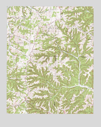
Spokane, MO USGS Topographic Map
Click on map above to begin viewing in our Map Viewer.

This topographic map contains these locations and features:
Feature Name Type Latitude Longitude GNIS ID View Map
AbesvillePopulated PlaceN36.8398°W93.3707°713127View Map
Antioch (historical)ChurchN36.7795°W93.2599°733619View Map
Antioch School (historical)SchoolN36.7801°W93.2602°733618View Map
ChestnutridgePopulated PlaceN36.8367°W93.2518°740739View Map
Dry BranchStreamN36.7798°W93.2588°749702View Map
Eisenhour ChurchChurchN36.8245°W93.3377°717428View Map
Highlandville Fire Protection District Station 2BuildingN36.8403°W93.3713°2620641View Map
Hollow CreekStreamN36.7856°W93.2707°733617View Map
Hurricane CreekStreamN36.8134°W93.2727°720036View Map
Hurricane HollowValleyN36.8148°W93.2727°733179View Map
Keystone ChurchChurchN36.7623°W93.3391°720563View Map
Keystone School (historical)SchoolN36.7631°W93.3474°732912View Map
Pignut HollowValleyN36.7859°W93.2716°724337View Map
Ponce De Leon Post OfficePost OfficeN36.8745°W93.3514°2783223View Map
RenoLocaleN36.8223°W93.2907°733180View Map
Reno SpringSpringN36.8223°W93.2902°725219View Map
Schupbach CemeteryCemeteryN36.8448°W93.2605°726127View Map
Seaton CemeteryCemeteryN36.7828°W93.2646°726172View Map
Shepherd of the Hills Camp (historical)LocaleN36.7623°W93.3492°2646700View Map
Southern Stone County Fire Protection District Station 8BuildingN36.7924°W93.3488°2620798View Map
SpokanePopulated PlaceN36.8681°W93.2969°726870View Map
Spokane Census Designated PlaceCensusN36.8632°W93.3056°2393244View Map
Spokane Post OfficePost OfficeN36.8684°W93.2975°2779454View Map
Spokane SchoolSchoolN36.8628°W93.2969°733181View Map
Stults CemeteryCemeteryN36.7564°W93.3474°727201View Map
StuttsPopulated PlaceN36.7653°W93.3474°727208View Map
TauriaPopulated PlaceN36.8059°W93.3460°737927View Map
Township of South GallowayCivilN36.8573°W93.2689°766487View Map
West Fork Bear CreekStreamN36.7831°W93.2677°728553View Map

Note: Coordinates in the location and feature list above are referenced to NAD83 datum.


Copyright (C) 2008-2024 Ryan Niemi / Sunset Dynamics ... All Rights Reserved