TopoQuest Logo
Do you find TopoQuest useful?
Help keep TopoQuest running and adding new maps/features by donating!
Bitcoin:  19c7KJd3qBynnjoSw5npx9KScwjBe4ifkT
Litecoin:  LXs6TkuXGGXo1vDsWCkWVdjQX94eUKd6ui
Home View Maps Find Maps Find Places Resources & Links


Dinsmore, California Topographic Map

USGS Map Title: Dinsmore, CA
USGS Map MRC: 40123D5
DRG (GeoTIFF) Download: o40123d5.tif


Neighboring USGS Topographic Map Quads:


  Showers Mountain, CA  
40123E6
 

  Blake Mountain, CA  
40123E5
 

  Hyampom, CA  
40123E4
 

  Larabee Valley, CA  
40123D6
 

  Dinsmore, CA  
40123D5
 

  Sportshaven, CA  
40123D4
 

  Blocksburg, CA  
40123C6
 

  Black Lassic, CA  
40123C5
 

  Ruth Lake, CA  
40123C4


Map MRC Location:

N41°
W124°
N41°
W123°
H8 H7 H6 H5 H4 H3 H2 H1
G8 G7 G6 G5 G4 G3 G2 G1
F8 F7 F6 F5 F4 F3 F2 F1
E8 E7 E6 E5 E4 E3 E2 E1
D8 D7 D6 D5 D4 D3 D2 D1
C8 C7 C6 C5 C4 C3 C2 C1
B8 B7 B6 B5 B4 B3 B2 B1
A8 A7 A6 A5 A4 A3 A2 A1
N40°
W124°
N40°
W123°

Dinsmore, CA USGS 1:24K Topographic Map Preview:
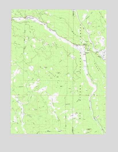
Dinsmore, CA USGS Topographic Map
Click on map above to begin viewing in our Map Viewer.

This topographic map contains these locations and features:
Feature Name Type Latitude Longitude GNIS ID View Map
Browns CanyonValleyN40.4118°W123.5242°257504View Map
Browns RockPillarN40.4226°W123.5609°257516View Map
Buck MountainSummitN40.4424°W123.5881°257575View Map
Buck RockPillarN40.4321°W123.5659°257588View Map
Cobb RanchLocaleN40.4574°W123.5300°276138View Map
County Line CreekStreamN40.4993°W123.5448°266605View Map
Crooks CreekStreamN40.3943°W123.5192°258936View Map
Crooks RidgeRidgeN40.3946°W123.5428°258937View Map
Dairy CreekStreamN40.4054°W123.6136°259012View Map
Deer CreekStreamN40.3854°W123.6117°259219View Map
DinsmorePopulated PlaceN40.4915°W123.6070°259385View Map
Dinsmore AirportAirportN40.4927°W123.6008°1653401View Map
Dinsmore PitMineN40.4636°W123.5414°2677347View Map
Hastings CreekStreamN40.4863°W123.5339°261140View Map
Jack Rabbit ValleyGapN40.4424°W123.5803°261851View Map
Kuntz CanyonValleyN40.4599°W123.5423°262247View Map
Lamb CreekStreamN40.4501°W123.5036°266895View Map
Low GapGapN40.4604°W123.5236°262992View Map
Mad RiverPopulated PlaceN40.4524°W123.5098°263105View Map
Mad River Post OfficePost OfficeN40.4525°W123.5083°2789121View Map
Mad River Ranger StationLocaleN40.4649°W123.5311°263106View Map
Mill CreekStreamN40.4896°W123.6184°263588View Map
Panther CreekStreamN40.3957°W123.6095°264473View Map
Red MountainSummitN40.3774°W123.5781°1656250View Map
Scott GladesFlatN40.3921°W123.5120°265941View Map
Senteney CreekStreamN40.3807°W123.5073°234674View Map
Simmons Camp (historical)LocaleN40.4810°W123.5306°1665427View Map
Southern Trinity Area RescueBuildingN40.4599°W123.5292°2662209View Map
Southern Trinity High SchoolSchoolN40.4562°W123.5287°267543View Map
Sulphur CreekStreamN40.4821°W123.6078°267890View Map
Sulphur ValleyBasinN40.4649°W123.6178°267908View Map
Swayback RidgeRidgeN40.3871°W123.5628°268011View Map
Tierney CanyonValleyN40.4385°W123.5300°268272View Map
Tierney PeakSummitN40.4363°W123.5650°268273View Map
Van Duzen Elementary SchoolSchoolN40.4554°W123.5288°268666View Map
Van Duzen Public Camp (historical)LocaleN40.4865°W123.5939°1665553View Map
Woodmans ButteSummitN40.3799°W123.5248°269297View Map

Note: Coordinates in the location and feature list above are referenced to NAD83 datum.


Copyright (C) 2008-2024 Ryan Niemi / Sunset Dynamics ... All Rights Reserved