TopoQuest Logo
Do you find TopoQuest useful?
Help keep TopoQuest running and adding new maps/features by donating!
Bitcoin:  19c7KJd3qBynnjoSw5npx9KScwjBe4ifkT
Litecoin:  LXs6TkuXGGXo1vDsWCkWVdjQX94eUKd6ui
Home View Maps Find Maps Find Places Resources & Links


Halfway Ridge, California Topographic Map

USGS Map Title: Halfway Ridge, CA
USGS Map MRC: 40123E3
DRG (GeoTIFF) Download: o40123e3.tif


Neighboring USGS Topographic Map Quads:


  Hyampom Mountain, CA  
40123F4
 

  Big Bar, CA  
40123F3
 

  Hayfork Bally, CA  
40123F2
 

  Hyampom, CA  
40123E4
 

  Halfway Ridge, CA  
40123E3
 

  Hayfork, CA  
40123E2
 

  Sportshaven, CA  
40123D4
 

  Naufus Creek, CA  
40123D3
 

  Dubakella Mountain, CA  
40123D1


Map MRC Location:

N41°
W124°
N41°
W123°
H8 H7 H6 H5 H4 H3 H2 H1
G8 G7 G6 G5 G4 G3 G2 G1
F8 F7 F6 F5 F4 F3 F2 F1
E8 E7 E6 E5 E4 E3 E2 E1
D8 D7 D6 D5 D4 D3 D2 D1
C8 C7 C6 C5 C4 C3 C2 C1
B8 B7 B6 B5 B4 B3 B2 B1
A8 A7 A6 A5 A4 A3 A2 A1
N40°
W124°
N40°
W123°

Halfway Ridge, CA USGS 1:24K Topographic Map Preview:
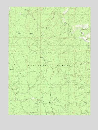
Halfway Ridge, CA USGS Topographic Map
Click on map above to begin viewing in our Map Viewer.

This topographic map contains these locations and features:
Feature Name Type Latitude Longitude GNIS ID View Map
Bear CreekStreamN40.6040°W123.2845°256646View Map
Big CanyonValleyN40.6185°W123.3420°256901View Map
Buck GulchValleyN40.5171°W123.3111°257566View Map
Butter Creek MeadowsFlatN40.5618°W123.3286°257777View Map
Camp CarterLocaleN40.5346°W123.3289°257859View Map
Camp SpringtimeLocaleN40.5140°W123.2539°1665324View Map
Corral GulchValleyN40.5246°W123.3611°258733View Map
Cow GulchValleyN40.5138°W123.3086°258808View Map
Dinner GulchValleyN40.6226°W123.3061°259384View Map
Fir Root SpringSpringN40.5938°W123.3614°274664View Map
Friend MountainSummitN40.5021°W123.3409°260419View Map
Grassy FlatFlatN40.5940°W123.3634°260804View Map
Grassy MountainSummitN40.5929°W123.3436°260809View Map
Green GulchValleyN40.5176°W123.3267°260851View Map
Halfway RidgeRidgeN40.5976°W123.3184°261020View Map
Hayfork DivisionCivilN40.5365°W123.2593°1935130View Map
Indian ValleyValleyN40.5160°W123.3550°261772View Map
Indian Valley StationLocaleN40.5188°W123.3384°261776View Map
James CreekStreamN40.5976°W123.2667°261897View Map
Jim River SpringSpringN40.5135°W123.2561°1665376View Map
Jud CreekStreamN40.5971°W123.2817°262031View Map
Little CreekStreamN40.5854°W123.2592°262577View Map
Oak RidgeRidgeN40.5538°W123.3667°267092View Map
Rail GulchValleyN40.5110°W123.3098°267151View Map
Rusch CreekStreamN40.5888°W123.2645°265675View Map
Sardine SpringSpringN40.5135°W123.3350°1665419View Map
Sheep Camp SpringsSpringN40.5522°W123.3686°1665425View Map
Sheep GulchValleyN40.5151°W123.3298°266071View Map
Springtime FlatFlatN40.5104°W123.2545°267611View Map
Vaughn SpringSpringN40.5146°W123.3270°268678View Map

Note: Coordinates in the location and feature list above are referenced to NAD83 datum.


Copyright (C) 2008-2025 Ryan Niemi / Sunset Dynamics ... All Rights Reserved