TopoQuest Logo
Do you find TopoQuest useful?
Help keep TopoQuest running and adding new maps/features by donating!
Bitcoin:  19c7KJd3qBynnjoSw5npx9KScwjBe4ifkT
Litecoin:  LXs6TkuXGGXo1vDsWCkWVdjQX94eUKd6ui
Home View Maps Find Maps Find Places Resources & Links


Sprague River West, Oregon Topographic Map

USGS Map Title: Sprague River West, OR
USGS Map MRC: 42121D5
DRG (GeoTIFF) Download: o42121d5.tif


Neighboring USGS Topographic Map Quads:


  S'Ocholis Canyon, OR  
42121E6
 

  Buttes of the Gods, OR  
42121E5
 

  Cooks Mountain, OR  
42121E4
 

  Swan Lake Point, OR  
42121D6
 

  Sprague River West, OR  
42121D5
 

  Sprague River East, OR  
42121D4
 

  Whiteline Reservoir, OR  
42121C6
 

  Swan Lake, OR  
42121C5
 

  Yonna, OR  
42121C4


Map MRC Location:

N43°
W122°
N43°
W121°
H8 H7 H6 H5 H4 H3 H2 H1
G8 G7 G6 G5 G4 G3 G2 G1
F8 F7 F6 F5 F4 F3 F2 F1
E8 E7 E6 E5 E4 E3 E2 E1
D8 D7 D6 D5 D4 D3 D2 D1
C8 C7 C6 C5 C4 C3 C2 C1
B8 B7 B6 B5 B4 B3 B2 B1
A8 A7 A6 A5 A4 A3 A2 A1
N42°
W122°
N42°
W121°

Sprague River West, OR USGS 1:24K Topographic Map Preview:
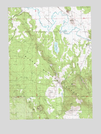
Sprague River West, OR USGS Topographic Map
Click on map above to begin viewing in our Map Viewer.

This topographic map contains these locations and features:
Feature Name Type Latitude Longitude GNIS ID View Map
Bear WallowsSwampN42.3874°W121.5878°1137777View Map
Calico GulchValleyN42.3790°W121.5511°1154942View Map
Calico SpringSpringN42.3973°W121.5735°1139156View Map
Cherry CreekStreamN42.4410°W121.5322°1139590View Map
Cowboy SpringSpringN42.3979°W121.5931°1140293View Map
Cruikshank ButteSummitN42.3874°W121.5817°1140496View Map
Cruikshank SpringSpringN42.3942°W121.5976°1140497View Map
Devils GardenAreaN42.4040°W121.5650°1140951View Map
Eagle ButteSummitN42.4946°W121.5356°1141458View Map
East Switchback (historical)LocaleN42.4251°W121.5536°1699672View Map
Klamath County Fire District 3BuildingN42.4984°W121.5170°2577159View Map
Klamath County Library Sprague River BranchBuildingN42.4551°W121.5037°2700000View Map
North Fork Trout CreekStreamN42.4876°W121.6175°1147011View Map
Riddle FieldLakeN42.4545°W121.5543°1148430View Map
Round MountainSummitN42.3901°W121.5331°1148780View Map
Shaws CampLocaleN42.4218°W121.5964°1149302View Map
Skeen RanchLocaleN42.4963°W121.6031°1149580View Map
South Boundary SpringSpringN42.4016°W121.6072°1149904View Map
South Fork Trout CreekStreamN42.4876°W121.6175°1150032View Map
Sprague RiverPopulated PlaceN42.4554°W121.5042°1150145View Map
Sprague River Post OfficePost OfficeN42.4551°W121.5039°1165973View Map
Switchback FlatFlatN42.3901°W121.5594°1150274View Map
Switchback HillSummitN42.4246°W121.5569°1150795View Map
Switchback SpringSpringN42.4263°W121.5547°1639094View Map
Trout CreekStreamN42.4999°W121.5970°1151432View Map
Watchdog ButteSummitN42.4838°W121.5289°1151932View Map
West Switchback (historical)LocaleN42.4138°W121.5483°1163966View Map
Yainax Forest Service StationLocaleN42.4199°W121.5394°1639093View Map
Yainax Guard StationLocaleN42.4165°W121.5428°1162469View Map

Note: Coordinates in the location and feature list above are referenced to NAD83 datum.


Copyright (C) 2008-2024 Ryan Niemi / Sunset Dynamics ... All Rights Reserved