TopoQuest Logo
Do you find TopoQuest useful?
Help keep TopoQuest running and adding new maps/features by donating!
Bitcoin:  19c7KJd3qBynnjoSw5npx9KScwjBe4ifkT
Litecoin:  LXs6TkuXGGXo1vDsWCkWVdjQX94eUKd6ui
Home View Maps Find Maps Find Places Resources & Links


Spruce Knob, West Virginia Topographic Map

USGS Map Title: Spruce Knob, WV
USGS Map MRC: 38079F5
DRG (GeoTIFF) Download: o38079f5.tif


Neighboring USGS Topographic Map Quads:


  Glady, WV  
38079G6
 

  Whitmer, WV  
38079G5
 

  Onego, WV  
38079G4
 

  Sinks of Gandy, WV  
38079F6
 

  Spruce Knob, WV  
38079F5
 

  Circleville, WV  
38079F4
 

  Thornwood, WV  
38079E6
 

  Snowy Mountain, WV  
38079E5
 

  Moatstown, WV  
38079E4


Map MRC Location:

N39°
W80°
N39°
W79°
H8 H7 H6 H5 H4 H3 H2 H1
G8 G7 G6 G5 G4 G3 G2 G1
F8 F7 F6 F5 F4 F3 F2 F1
E8 E7 E6 E5 E4 E3 E2 E1
D8 D7 D6 D5 D4 D3 D2 D1
C8 C7 C6 C5 C4 C3 C2 C1
B8 B7 B6 B5 B4 B3 B2 B1
A8 A7 A6 A5 A4 A3 A2 A1
N38°
W80°
N38°
W79°

Spruce Knob, WV USGS 1:24K Topographic Map Preview:
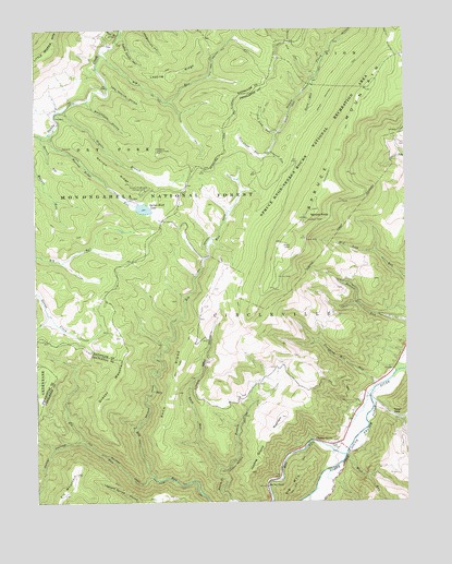
Spruce Knob, WV USGS Topographic Map
Click on map above to begin viewing in our Map Viewer.

This topographic map contains these locations and features:
Feature Name Type Latitude Longitude GNIS ID View Map
Allegheny MountainsRangeN38.7001°W79.5331°1550089View Map
Back RidgeRidgeN38.6523°W79.5812°1550140View Map
Back Ridge TrailTrailN38.6468°W79.5831°1550141View Map
Back RunStreamN38.6343°W79.5642°1550142View Map
Beech RunStreamN38.7365°W79.5317°1550249View Map
Big RunStreamN38.7434°W79.6020°1550325View Map
Big RunStreamN38.6251°W79.5459°1550331View Map
Big Run ChapelChurchN38.6293°W79.5476°1550339View Map
Big Run TrailTrailN38.7323°W79.5831°1550341View Map
Big SpringSpringN38.6668°W79.5664°1677783View Map
Camp Seven HollowValleyN38.7479°W79.5945°1550613View Map
Cherry GrovePopulated PlaceN38.6407°W79.5228°1550682View Map
Collar HollowValleyN38.6412°W79.6101°1550769View Map
Dayton Police DepartmentBuildingN38.6942°W79.5767°2085954View Map
Devers RunStreamN38.7221°W79.6220°1550908View Map
Elk MountainSummitN38.6326°W79.6117°1554384View Map
Elk RunStreamN38.6318°W79.5853°1551033View Map
Gatewood Group CampgroundLocaleN38.7173°W79.5853°1553645View Map
Gatewood Lookout TowerTowerN38.7179°W79.5839°1557839View Map
Gatewood Nature TrailTrailN38.7015°W79.5703°1553646View Map
Grants BranchStreamN38.7290°W79.6148°1551268View Map
Grassy MountainSummitN38.6526°W79.6026°1551274View Map
Horton Riverton TrailTrailN38.7437°W79.5023°1551507View Map
Huckleberry TrailTrailN38.7254°W79.5187°1551514View Map
Hunting Ground MountainSummitN38.6476°W79.5426°1551529View Map
Judy SpringSpringN38.7168°W79.5442°1677784View Map
Lafe Hedrick HollowValleyN38.7351°W79.5989°1551679View Map
Leading RidgeRidgeN38.7382°W79.5767°1551755View Map
Mick RunStreamN38.6373°W79.5206°1552059View Map
Nans BranchStreamN38.7498°W79.5951°1552272View Map
Narrow RidgeRidgeN38.7129°W79.5984°1552274View Map
Narrow RidgeStreamN38.7226°W79.6195°1557463View Map
North Fork Big Run TrailTrailN38.7421°W79.5648°1552324View Map
Pounding Mill RunStreamN38.6548°W79.5112°1552549View Map
Slab Camp RunStreamN38.7179°W79.5464°1552909View Map
Spruce KnobSummitN38.6998°W79.5328°1553014View Map
Spruce Knob LakeReservoirN38.7026°W79.5883°1553015View Map
Spruce Knob Lake CampgroundLocaleN38.7076°W79.5878°1553016View Map
Spruce Knob Lake DamDamN38.7034°W79.5898°1559284View Map
Spruce Knob Picnic AreaLocaleN38.6843°W79.5431°1553644View Map
Spruce MountainSummitN38.6998°W79.5328°1553020View Map
Spruce Mountain SpringSpringN38.6876°W79.5387°1677782View Map
Switchback HollowValleyN38.7301°W79.6064°1553166View Map
Teter GapGapN38.6479°W79.5045°1553199View Map
Teter RunStreamN38.6521°W79.5120°1553200View Map
Tom Lick RunStreamN38.7226°W79.5434°1553247View Map
Trussel RunStreamN38.7179°W79.5459°1553275View Map

Note: Coordinates in the location and feature list above are referenced to NAD83 datum.


Copyright (C) 2008-2024 Ryan Niemi / Sunset Dynamics ... All Rights Reserved