TopoQuest Logo
Do you find TopoQuest useful?
Help keep TopoQuest running and adding new maps/features by donating!
Bitcoin:  19c7KJd3qBynnjoSw5npx9KScwjBe4ifkT
Litecoin:  LXs6TkuXGGXo1vDsWCkWVdjQX94eUKd6ui
Home View Maps Find Maps Find Places Resources & Links


Star City, Indiana Topographic Map

USGS Map Title: Star City, IN
USGS Map MRC: 40086H5
DRG (GeoTIFF) Download: o40086h5.tif


Neighboring USGS Topographic Map Quads:


  Ripley, IN  
41086A6
 

  Winamac, IN  
41086A5
 

  Kewanna, IN  
41086A4
 

  Buffalo, IN  
40086H6
 

  Star City, IN  
40086H5
 

  Grass Creek, IN  
40086H4
 

  Idaville, IN  
40086G6
 

  Burnettsville, IN  
40086G5
 

  Lucerne, IN  
40086G4


Map MRC Location:

N41°
W87°
N41°
W86°
H8 H7 H6 H5 H4 H3 H2 H1
G8 G7 G6 G5 G4 G3 G2 G1
F8 F7 F6 F5 F4 F3 F2 F1
E8 E7 E6 E5 E4 E3 E2 E1
D8 D7 D6 D5 D4 D3 D2 D1
C8 C7 C6 C5 C4 C3 C2 C1
B8 B7 B6 B5 B4 B3 B2 B1
A8 A7 A6 A5 A4 A3 A2 A1
N40°
W87°
N40°
W86°

Star City, IN USGS 1:24K Topographic Map Preview:
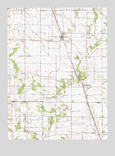
Star City, IN USGS Topographic Map
Click on map above to begin viewing in our Map Viewer.

This topographic map contains these locations and features:
Feature Name Type Latitude Longitude GNIS ID View Map
Bonnell Number Two DitchCanalN40.9239°W86.5992°431322View Map
Buck CemeteryCemeteryN40.9323°W86.5447°431710View Map
Fredricks DitchCanalN40.8784°W86.5314°434797View Map
Grassy CreekStreamN40.9248°W86.5089°435347View Map
Hancock DitchCanalN40.8931°W86.5486°435666View Map
Hoffman DitchCanalN40.9678°W86.6045°436278View Map
Independent Order of Odd Fellows CemeteryCemeteryN40.9698°W86.5728°436693View Map
Little Indian CreekStreamN40.9095°W86.6214°438077View Map
Moon DitchCanalN40.9448°W86.5595°439382View Map
Oak Post OfficePost OfficeN40.9259°W86.5295°453057View Map
Prather DitchCanalN40.9825°W86.5392°441568View Map
Skillen DitchCanalN40.9689°W86.5856°443576View Map
Star CityPopulated PlaceN40.9720°W86.5561°444071View Map
Star City Census Designated PlaceCensusN40.9745°W86.5613°2393247View Map
Star City Volunteer Fire DepartmentBuildingN40.9733°W86.5563°2626364View Map
Stout Gise DitchCanalN40.9923°W86.5958°444246View Map
ThornhopePopulated PlaceN40.9259°W86.5295°452943View Map
Township of Van BurenCivilN40.9537°W86.5258°453951View Map
Washburn DitchCanalN40.8867°W86.5925°445494View Map
Wilson Wiseley DitchCanalN40.9128°W86.5133°446160View Map

Note: Coordinates in the location and feature list above are referenced to NAD83 datum.


Copyright (C) 2008-2025 Ryan Niemi / Sunset Dynamics ... All Rights Reserved