TopoQuest Logo
Do you find TopoQuest useful?
Help keep TopoQuest running and adding new maps/features by donating!
Bitcoin:  19c7KJd3qBynnjoSw5npx9KScwjBe4ifkT
Litecoin:  LXs6TkuXGGXo1vDsWCkWVdjQX94eUKd6ui
Home View Maps Find Maps Find Places Resources & Links


Buffalo, Indiana Topographic Map

USGS Map Title: Buffalo, IN
USGS Map MRC: 40086H6
DRG (GeoTIFF) Download: o40086h6.tif


Neighboring USGS Topographic Map Quads:


  North Judson SE, IN  
41086A7
 

  Ripley, IN  
41086A6
 

  Winamac, IN  
41086A5
 

  Monon NE, IN  
40086H7
 

  Buffalo, IN  
40086H6
 

  Star City, IN  
40086H5
 

  Monticello North, IN  
40086G7
 

  Idaville, IN  
40086G6
 

  Burnettsville, IN  
40086G5


Map MRC Location:

N41°
W87°
N41°
W86°
H8 H7 H6 H5 H4 H3 H2 H1
G8 G7 G6 G5 G4 G3 G2 G1
F8 F7 F6 F5 F4 F3 F2 F1
E8 E7 E6 E5 E4 E3 E2 E1
D8 D7 D6 D5 D4 D3 D2 D1
C8 C7 C6 C5 C4 C3 C2 C1
B8 B7 B6 B5 B4 B3 B2 B1
A8 A7 A6 A5 A4 A3 A2 A1
N40°
W87°
N40°
W86°

Buffalo, IN USGS 1:24K Topographic Map Preview:
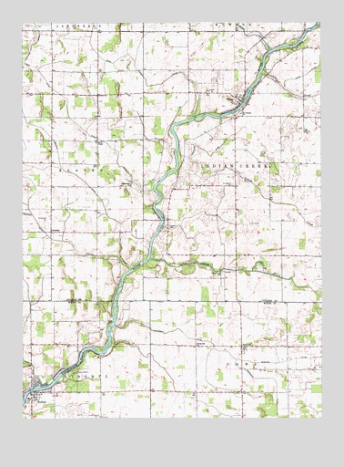
Buffalo, IN USGS Topographic Map
Click on map above to begin viewing in our Map Viewer.

This topographic map contains these locations and features:
Feature Name Type Latitude Longitude GNIS ID View Map
Allen Airport (historical)AirportN40.9162°W86.6778°449389View Map
Budd Fisher DitchCanalN40.9803°W86.6950°431759View Map
BuffaloPopulated PlaceN40.8825°W86.7453°431770View Map
Buffalo Census Designated PlaceCensusN40.8880°W86.7375°2393355View Map
Buffalo Elementary SchoolSchoolN40.8817°W86.7481°447508View Map
Buffalo Liberty Township Volunteer Fire DepartmentBuildingN40.8822°W86.7460°2626414View Map
Camp BuffaloParkN40.8895°W86.7281°432013View Map
Clark CemeteryCemeteryN40.9056°W86.7154°432554View Map
Dickey CreekStreamN40.9528°W86.6864°433538View Map
Harpster DitchCanalN40.9587°W86.6720°435770View Map
HeadleePopulated PlaceN40.8978°W86.6586°435944View Map
Headlee DitchCanalN40.8937°W86.6397°435945View Map
Hoover CemeteryCemeteryN40.9355°W86.6887°436422View Map
Indian CreekStreamN40.9256°W86.6970°436745View Map
Indian Creek CemeteryCemeteryN40.9212°W86.6661°436753View Map
LakesidePopulated PlaceN40.9342°W86.7378°437548View Map
Liberty LandfillLocaleN40.8872°W86.7003°2708759View Map
Mud CreekStreamN40.9839°W86.6497°439817View Map
Pauls ChapelChurchN40.9625°W86.7186°440941View Map
Pro ChurchChurchN40.9214°W86.6656°441603View Map
PulaskiPopulated PlaceN40.9753°W86.6583°441634View Map
Radersdorf DitchCanalN40.9353°W86.6917°452253View Map
Rawn DitchCanalN40.9834°W86.6317°441795View Map
Saint Josephs CemeteryCemeteryN40.9488°W86.6621°442635View Map
Saint Josephs CemeteryCemeteryN40.9782°W86.6735°442636View Map
Saint Josephs ChurchChurchN40.9714°W86.6583°442641View Map
Stout DitchCanalN40.9659°W86.7233°444245View Map
Swingle DitchCanalN40.9589°W86.7350°444496View Map
Tippecanoe ChurchChurchN40.9489°W86.7045°444778View Map
Township of Indian CreekCivilN40.9544°W86.6414°453427View Map
White Oak ChurchChurchN40.8984°W86.6775°445951View Map

Note: Coordinates in the location and feature list above are referenced to NAD83 datum.


Copyright (C) 2008-2025 Ryan Niemi / Sunset Dynamics ... All Rights Reserved