TopoQuest Logo
Do you find TopoQuest useful?
Help keep TopoQuest running and adding new maps/features by donating!
Bitcoin:  19c7KJd3qBynnjoSw5npx9KScwjBe4ifkT
Litecoin:  LXs6TkuXGGXo1vDsWCkWVdjQX94eUKd6ui
Home View Maps Find Maps Find Places Resources & Links


Starrucca, Pennsylvania Topographic Map

USGS Map Title: Starrucca, PA
USGS Map MRC: 41075H4
DRG (GeoTIFF) Download: o41075h4.tif


Neighboring USGS Topographic Map Quads:


  Gulf Summit, NY  
42075A5
 

  Deposit, NY  
42075A4
 

  Cannonsville Reservoir, NY  
42075A3
 

  Susquehanna, PA  
41075H5
 

  Starrucca, PA  
41075H4
 

  Hancock, NY  
41075H3
 

  Thompson, PA  
41075G5
 

  Orson, PA  
41075G4
 

  Lake Como, PA  
41075G3


Map MRC Location:

N42°
W76°
N42°
W75°
H8 H7 H6 H5 H4 H3 H2 H1
G8 G7 G6 G5 G4 G3 G2 G1
F8 F7 F6 F5 F4 F3 F2 F1
E8 E7 E6 E5 E4 E3 E2 E1
D8 D7 D6 D5 D4 D3 D2 D1
C8 C7 C6 C5 C4 C3 C2 C1
B8 B7 B6 B5 B4 B3 B2 B1
A8 A7 A6 A5 A4 A3 A2 A1
N41°
W76°
N41°
W75°

Starrucca, PA USGS 1:24K Topographic Map Preview:
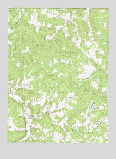
Starrucca, PA USGS Topographic Map
Click on map above to begin viewing in our Map Viewer.

This topographic map contains these locations and features:
Feature Name Type Latitude Longitude GNIS ID View Map
Beaver MeadowFlatN41.9351°W75.3982°1169015View Map
Beaver PondReservoirN41.8869°W75.4132°1169024View Map
Beaver Pond DamDamN41.8884°W75.4180°1195834View Map
Borough of StarruccaCivilN41.8996°W75.4530°1215688View Map
Bucks FallsFallsN41.8862°W75.4763°1170576View Map
Cat HollowValleyN41.9995°W75.4024°969969View Map
Fairmont School (historical)SchoolN41.9156°W75.4196°1197768View Map
FairmountPopulated PlaceN41.9170°W75.4182°1203548View Map
Farrell CornersLocaleN41.9490°W75.4380°1174632View Map
Finnegan CornersLocaleN41.9379°W75.4507°1174770View Map
Gardinier CornersLocaleN41.9793°W75.4385°1175440View Map
Island LakeLakeN41.9094°W75.3920°1177880View Map
Island PondReservoirN41.9076°W75.3955°1212969View Map
King Hill SchoolSchoolN41.8820°W75.4466°1197769View Map
Lake ShehawkenReservoirN41.8934°W75.3830°1195838View Map
Mach PondLakeN41.9220°W75.4456°1180153View Map
Maple GrovePopulated PlaceN41.9454°W75.4199°1204095View Map
Maple HillSummitN41.9559°W75.4213°1180344View Map
Merrigan CreekStreamN41.9040°W75.4502°1180955View Map
Mission ChapelChurchN41.9870°W75.4268°1181363View Map
Penn HillSummitN41.9181°W75.4605°1183477View Map
Pine SwampSwampN41.9353°W75.3907°1183914View Map
Pine Swamp PondLakeN41.9336°W75.3878°1183916View Map
Saint Pauls ChurchChurchN41.8973°W75.4724°1186633View Map
Scott CenterPopulated PlaceN41.9390°W75.3949°1204596View Map
Shadigee CreekStreamN41.9012°W75.4738°1187297View Map
ShehawkenPopulated PlaceN41.8895°W75.3930°1187436View Map
Shehawken DamDamN41.8934°W75.3830°1195839View Map
Shehawken LakeLakeN41.8924°W75.3892°1187438View Map
Shehawken SchoolSchoolN41.8895°W75.3941°1197880View Map
ShermanPopulated PlaceN41.9876°W75.4263°1187485View Map
Shrawder MountainSummitN41.9181°W75.3930°1187614View Map
Slocum HillSummitN41.9359°W75.4741°1187834View Map
Star PondLakeN41.9726°W75.3855°1188407View Map
Starboard CreekStreamN41.9951°W75.4205°970652View Map
StarruccaPopulated PlaceN41.8998°W75.4707°1188422View Map
Starrucca Post OfficePost OfficeN41.8992°W75.4724°2779628View Map
Starrucca StationLocaleN41.9026°W75.4805°1212953View Map
State Game Lands Number 299ParkN41.9918°W75.3788°1208376View Map
State Game Lands Number 70ParkN41.9640°W75.4605°1188527View Map
Tarbox BrookStreamN41.9420°W75.3874°1189275View Map
Township of ScottCivilN41.9539°W75.4071°1217250View Map

Note: Coordinates in the location and feature list above are referenced to NAD83 datum.


Copyright (C) 2008-2025 Ryan Niemi / Sunset Dynamics ... All Rights Reserved