TopoQuest Logo
Do you find TopoQuest useful?
Help keep TopoQuest running and adding new maps/features by donating!
Bitcoin:  19c7KJd3qBynnjoSw5npx9KScwjBe4ifkT
Litecoin:  LXs6TkuXGGXo1vDsWCkWVdjQX94eUKd6ui
Home View Maps Find Maps Find Places Resources & Links


Thompson, Pennsylvania Topographic Map

USGS Map Title: Thompson, PA
USGS Map MRC: 41075G5
DRG (GeoTIFF) Download: o41075g5.tif


Neighboring USGS Topographic Map Quads:


  Great Bend, PA  
41075H6
 

  Susquehanna, PA  
41075H5
 

  Starrucca, PA  
41075H4
 

  Harford, PA  
41075G6
 

  Thompson, PA  
41075G5
 

  Orson, PA  
41075G4
 

  Lenoxville, PA  
41075F6
 

  Clifford, PA  
41075F5
 

  Forest City, PA  
41075F4


Map MRC Location:

N42°
W76°
N42°
W75°
H8 H7 H6 H5 H4 H3 H2 H1
G8 G7 G6 G5 G4 G3 G2 G1
F8 F7 F6 F5 F4 F3 F2 F1
E8 E7 E6 E5 E4 E3 E2 E1
D8 D7 D6 D5 D4 D3 D2 D1
C8 C7 C6 C5 C4 C3 C2 C1
B8 B7 B6 B5 B4 B3 B2 B1
A8 A7 A6 A5 A4 A3 A2 A1
N41°
W76°
N41°
W75°

Thompson, PA USGS 1:24K Topographic Map Preview:
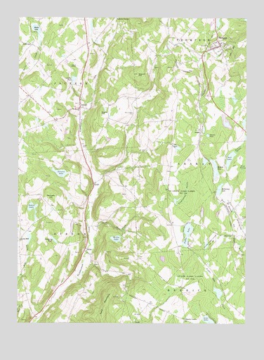
Thompson, PA USGS Topographic Map
Click on map above to begin viewing in our Map Viewer.

This topographic map contains these locations and features:
Feature Name Type Latitude Longitude GNIS ID View Map
Aldrich Airport (historical)AirportN41.8529°W75.5969°1194300View Map
AraratPopulated PlaceN41.8295°W75.5246°1168363View Map
Ararat ChurchChurchN41.8226°W75.5396°1168364View Map
Avery School (historical)SchoolN41.8192°W75.5577°1197755View Map
Ball LakeLakeN41.8174°W75.5083°1168663View Map
Borough of ThompsonCivilN41.8637°W75.5141°1215618View Map
Brooks School (historical)SchoolN41.8342°W75.5385°1197754View Map
BurnwoodPopulated PlaceN41.7862°W75.5069°1203194View Map
Butler LakeLakeN41.8703°W75.6148°1170802View Map
Chipmunk HollowValleyN41.7898°W75.5806°1197750View Map
Dimock CornersLocaleN41.7515°W75.5330°1173284View Map
East Jackson CemeteryCemeteryN41.8357°W75.5614°1173823View Map
Fairmount CemeteryCemeteryN41.8612°W75.5107°1174449View Map
Fiddle LakeLakeN41.7868°W75.5318°1174730View Map
Foster CemeteryCemeteryN41.7928°W75.5024°1175036View Map
GelattPopulated PlaceN41.8067°W75.5830°1175509View Map
Griffith PondReservoirN41.8499°W75.5945°1176229View Map
Hathaway LakeReservoirN41.8051°W75.5143°1176647View Map
Hathaway Pond DamDamN41.8034°W75.5163°1195793View Map
Hobbs School (historical)SchoolN41.8245°W75.5105°1197753View Map
JacksonPopulated PlaceN41.8381°W75.5907°1177910View Map
Jackson Post OfficePost OfficeN41.8424°W75.5920°2773167View Map
Kennedy HillSummitN41.7995°W75.6066°1178370View Map
Lake White LarkLakeN41.8322°W75.5009°2420869View Map
LakeviewPopulated PlaceN41.8640°W75.6177°1203974View Map
Lamb CemeteryCemeteryN41.8223°W75.5893°1178818View Map
Lowe LakeLakeN41.7505°W75.5192°1180002View Map
Mountain Top AirportAirportN41.8163°W75.5302°2443672View Map
Pickering PondLakeN41.7841°W75.6046°1183697View Map
Pine SwampSwampN41.8144°W75.5014°1183915View Map
Potter LakeLakeN41.7977°W75.6168°1184337View Map
Roberts PondLakeN41.8271°W75.5209°1185209View Map
Rock CreekStreamN41.7787°W75.5849°1185249View Map
Romobe LakeLakeN41.8136°W75.5168°1185416View Map
Romobe Lake DamDamN41.8101°W75.5146°1195803View Map
Saint Martins ChurchChurchN41.8379°W75.5913°1186352View Map
Sinkhole SwampLakeN41.8165°W75.5225°1197752View Map
Slocum HillSummitN41.8520°W75.5593°1187833View Map
SmileyPopulated PlaceN41.7806°W75.5874°1204667View Map
Smiley SchoolSchoolN41.7759°W75.5844°1197749View Map
Snake HillSummitN41.8359°W75.5796°1187928View Map
Spencer SpringSpringN41.8626°W75.5205°1202323View Map
State Game Lands Number 236ParkN41.7706°W75.5316°1188499View Map
Stearns LakeLakeN41.8115°W75.6016°1188576View Map
Stearns SwampSwampN41.8194°W75.5067°1188577View Map
ThompsonPopulated PlaceN41.8637°W75.5143°1189494View Map
Thompson Hose CompanyBuildingN41.8615°W75.5161°2653014View Map
Thompson Post OfficePost OfficeN41.8632°W75.5150°2780027View Map
Tinglepaugh SwampSwampN41.8030°W75.5338°1189579View Map
TirzahPopulated PlaceN41.7501°W75.5607°1204815View Map
Township of AraratCivilN41.8112°W75.5177°1217076View Map
Township of GibsonCivilN41.7726°W75.6101°1217083View Map
Township of JacksonCivilN41.8656°W75.6039°1217088View Map
Union HillPopulated PlaceN41.7840°W75.6232°1204851View Map
Walker School (historical)SchoolN41.7931°W75.5413°1197751View Map
Willis LakeLakeN41.7847°W75.5709°1191492View Map

Note: Coordinates in the location and feature list above are referenced to NAD83 datum.


Copyright (C) 2008-2025 Ryan Niemi / Sunset Dynamics ... All Rights Reserved