TopoQuest Logo
Do you find TopoQuest useful?
Help keep TopoQuest running and adding new maps/features by donating!
Bitcoin:  19c7KJd3qBynnjoSw5npx9KScwjBe4ifkT
Litecoin:  LXs6TkuXGGXo1vDsWCkWVdjQX94eUKd6ui
Home View Maps Find Maps Find Places Resources & Links


Chilcoot Mountain, Oregon Topographic Map

USGS Map Title: Chilcoot Mountain, OR
USGS Map MRC: 43122D6
DRG (GeoTIFF) Download: o43122d6.tif


Neighboring USGS Topographic Map Quads:


  Silica Mountain, OR  
43122E7
 

  Fairview Peak, OR  
43122E6
 

  Bearbones Mountain, OR  
43122E5
 

  Scaredman Creek, OR  
43122D7
 

  Chilcoot Mountain, OR  
43122D6
 

  Reynolds Ridge, OR  
43122D5
 

  Mace Mountain, OR  
43122C7
 

  Steamboat, OR  
43122C6
 

  Illahee Rock, OR  
43122C5


Map MRC Location:

N44°
W123°
N44°
W122°
H8 H7 H6 H5 H4 H3 H2 H1
G8 G7 G6 G5 G4 G3 G2 G1
F8 F7 F6 F5 F4 F3 F2 F1
E8 E7 E6 E5 E4 E3 E2 E1
D8 D7 D6 D5 D4 D3 D2 D1
C8 C7 C6 C5 C4 C3 C2 C1
B8 B7 B6 B5 B4 B3 B2 B1
A8 A7 A6 A5 A4 A3 A2 A1
N43°
W123°
N43°
W122°

Chilcoot Mountain, OR USGS 1:24K Topographic Map Preview:
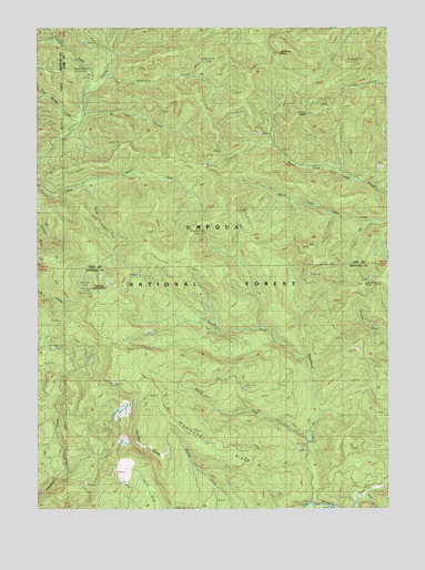
Chilcoot Mountain, OR USGS Topographic Map
Click on map above to begin viewing in our Map Viewer.

This topographic map contains these locations and features:
Feature Name Type Latitude Longitude GNIS ID View Map
Bona Fida ShelterLocaleN43.4882°W122.7248°1138404View Map
Champion (historical)LocaleN43.4151°W122.6331°1153348View Map
Chilcoot Junction ShelterLocaleN43.4521°W122.6801°1139642View Map
Chilcoot MountainSummitN43.4322°W122.7312°1139644View Map
Chilcoot RidgeRidgeN43.3893°W122.6842°1139645View Map
Chilcoot TrailTrailN43.4629°W122.6906°1139646View Map
Francis CreekStreamN43.4837°W122.7323°1142405View Map
Hipower BluffsCliffN43.3932°W122.7164°1143619View Map
Johnson ButteSummitN43.4330°W122.6343°1144320View Map
Johnson TrailTrailN43.4412°W122.6562°1144367View Map
Lemon ButteSummitN43.4775°W122.6552°1144939View Map
Lost Bucket CreekStreamN43.4760°W122.7359°1145498View Map
McKinley CreekStreamN43.4882°W122.7248°1146002View Map
McKinley RockPillarN43.4933°W122.6641°1146006View Map
No Man CreekStreamN43.4771°W122.7345°1146851View Map
North Fork Chilcoot CreekStreamN43.4590°W122.7356°1146926View Map
North Fork Steelhead CreekStreamN43.4132°W122.6537°1147006View Map
President RidgeRidgeN43.4707°W122.6845°1155273View Map
Singe CreekStreamN43.3787°W122.6334°1149535View Map
South Fork Chilcoot CreekStreamN43.4590°W122.7348°1149950View Map
South Fork Steelhead CreekStreamN43.3929°W122.6517°1150023View Map
Three SpringsSpringN43.4248°W122.6445°1151178View Map

Note: Coordinates in the location and feature list above are referenced to NAD83 datum.


Copyright (C) 2008-2024 Ryan Niemi / Sunset Dynamics ... All Rights Reserved