TopoQuest Logo
Do you find TopoQuest useful?
Help keep TopoQuest running and adding new maps/features by donating!
Bitcoin:  19c7KJd3qBynnjoSw5npx9KScwjBe4ifkT
Litecoin:  LXs6TkuXGGXo1vDsWCkWVdjQX94eUKd6ui
Home View Maps Find Maps Find Places Resources & Links


Steeple Rock, New Mexico Topographic Map

USGS Map Title: Steeple Rock, NM
USGS Map MRC: 32108G8
DRG (GeoTIFF) Download: o32108g8.tif


Neighboring USGS Topographic Map Quads:


  Tillie Hall Peak, NM  
32109H1
 

  Crookson Peak, NM  
32108H8
 

  Applegate Mountain, NM  
32108H7
 

  Goat Camp Spring, NM  
32109G1
 

  Steeple Rock, NM  
32108G8
 

  Walker Canyon, NM  
32108G7
 

  Duncan, AZ  
32109F1
 

  Canador Peak, NM  
32108F8
 

  Nichols Canyon, NM  
32108F7


Map MRC Location:

N33°
W109°
N33°
W108°
H8 H7 H6 H5 H4 H3 H2 H1
G8 G7 G6 G5 G4 G3 G2 G1
F8 F7 F6 F5 F4 F3 F2 F1
E8 E7 E6 E5 E4 E3 E2 E1
D8 D7 D6 D5 D4 D3 D2 D1
C8 C7 C6 C5 C4 C3 C2 C1
B8 B7 B6 B5 B4 B3 B2 B1
A8 A7 A6 A5 A4 A3 A2 A1
N32°
W109°
N32°
W108°

Steeple Rock, NM USGS 1:24K Topographic Map Preview:
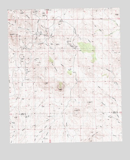
Steeple Rock, NM USGS Topographic Map
Click on map above to begin viewing in our Map Viewer.

This topographic map contains these locations and features:
Feature Name Type Latitude Longitude GNIS ID View Map
Alabama MineMineN32.8287°W108.9862°885606View Map
Angelo WindmillLocaleN32.8662°W108.9648°885755View Map
Barney TankReservoirN32.7914°W108.9865°886077View Map
Black HillSummitN32.7745°W108.9940°886410View Map
Bluebell WindmillLocaleN32.8487°W108.9206°886536View Map
Carlisle MineMineN32.8531°W108.9659°887198View Map
Cottonwood Ranch WindmillLocaleN32.8148°W108.8856°887923View Map
Coyote TankReservoirN32.7843°W108.9644°888035View Map
Croom RanchLocaleN32.8462°W108.9201°888089View Map
Davenport MineMineN32.8376°W108.9245°888209View Map
Davenport PeakSummitN32.7878°W108.9120°888210View Map
East Camp (historical)Populated PlaceN32.8412°W108.9295°919964View Map
East Camp (historical)BuildingN32.8412°W108.9295°931013View Map
East Camp MineMineN32.8412°W108.9295°888642View Map
East Camp Post Office (historical)Post OfficeN32.8412°W108.9295°937675View Map
Estes RanchLocaleN32.8570°W108.9487°888925View Map
Freestone TankReservoirN32.7691°W108.9972°906394View Map
Golden Nugget MineMineN32.8445°W108.9348°889472View Map
Golden Nugget MineMineN32.8434°W108.9389°914968View Map
Golden Rod MineMineN32.8409°W108.9464°929316View Map
Goldenrod MineMineN32.8417°W108.9476°889474View Map
Happy Hollow WindmillLocaleN32.7965°W108.9884°889755View Map
Hext PlaceLocaleN32.8159°W108.9287°899671View Map
Horse Camp PeakSummitN32.7801°W108.9262°890139View Map
Horse Camp WindmillLocaleN32.7612°W108.9239°890143View Map
Jim Crow MineMineN32.8192°W108.9806°890460View Map
Juniper SpringSpringN32.8712°W108.9620°890613View Map
Kelley SpringSpringN32.8431°W108.9532°890647View Map
Kemp CorralLocaleN32.8623°W108.8826°928967View Map
Kemp PeakSummitN32.8690°W108.8789°890664View Map
Laura CanyonValleyN32.8370°W108.9778°890980View Map
Laura MineMineN32.8506°W108.9881°890981View Map
Laura MineMineN32.7937°W108.9984°914914View Map
Little Juniper PeakSummitN32.8745°W108.9567°908029View Map
Lower RanchLocaleN32.7542°W108.9623°891447View Map
McDonald TunnelTunnelN32.8398°W108.9276°891751View Map
McKelvey PlaceLocaleN32.8234°W108.8903°899761View Map
Mount RoyalSummitN32.8062°W108.9592°894206View Map
Mount Royal MineMineN32.8101°W108.9787°892269View Map
Mount Royal WindmillLocaleN32.8070°W108.9848°892270View Map
Mud Springs PeaksRidgeN32.7595°W108.9095°892311View Map
New Seep WindmillLocaleN32.8292°W108.9267°892457View Map
Old Man Hext WindmillLocaleN32.8009°W108.9301°892874View Map
Ontario MineMineN32.8495°W108.9509°892921View Map
Pablos WindmillLocaleN32.7576°W108.9878°892995View Map
Park SpringSpringN32.7746°W108.9807°893082View Map
Pennsylvania CanyonValleyN32.8442°W108.9717°893175View Map
Piņon MountainSummitN32.8251°W108.9526°893312View Map
Possum HollowValleyN32.8437°W108.9595°893427View Map
Raeburn WindmillLocaleN32.8637°W108.9398°893604View Map
Road CanyonValleyN32.7773°W108.8806°893991View Map
Silver Bar CanyonValleyN32.8270°W108.9759°894839View Map
Steeple RockSummitN32.7998°W108.9439°920711View Map
Steeplerock (historical)Populated PlaceN32.8531°W108.9659°919963View Map
Summit MineMineN32.8726°W108.9717°895431View Map
Summit PeakSummitN32.8717°W108.9851°895432View Map
Telephone RidgeRidgeN32.8570°W108.9601°895573View Map
Thanksgiving SpringSpringN32.8301°W108.9137°914372View Map
Upper RanchLocaleN32.7745°W108.9545°896035View Map
Vanderbilt PeakSummitN32.8517°W108.9970°896100View Map
Whiskey CreekStreamN32.8445°W108.9717°896476View Map
White Oak SpringSpringN32.8690°W108.9618°896512View Map

Note: Coordinates in the location and feature list above are referenced to NAD83 datum.


Copyright (C) 2008-2025 Ryan Niemi / Sunset Dynamics ... All Rights Reserved