TopoQuest Logo
Do you find TopoQuest useful?
Help keep TopoQuest running and adding new maps/features by donating!
Bitcoin:  19c7KJd3qBynnjoSw5npx9KScwjBe4ifkT
Litecoin:  LXs6TkuXGGXo1vDsWCkWVdjQX94eUKd6ui
Home View Maps Find Maps Find Places Resources & Links


Applegate Mountain, New Mexico Topographic Map

USGS Map Title: Applegate Mountain, NM
USGS Map MRC: 32108H7
DRG (GeoTIFF) Download: o32108h7.tif


Neighboring USGS Topographic Map Quads:


  Mule Creek, NM  
33108A8
 

  Bear Mountain, NM  
33108A7
 

  Buckhorn, NM  
33108A6
 

  Crookson Peak, NM  
32108H8
 

  Applegate Mountain, NM  
32108H7
 

  Antelope Ridge, NM  
32108H6
 

  Steeple Rock, NM  
32108G8
 

  Walker Canyon, NM  
32108G7
 

  Brushy Mountain, NM  
32108G6


Map MRC Location:

N33°
W109°
N33°
W108°
H8 H7 H6 H5 H4 H3 H2 H1
G8 G7 G6 G5 G4 G3 G2 G1
F8 F7 F6 F5 F4 F3 F2 F1
E8 E7 E6 E5 E4 E3 E2 E1
D8 D7 D6 D5 D4 D3 D2 D1
C8 C7 C6 C5 C4 C3 C2 C1
B8 B7 B6 B5 B4 B3 B2 B1
A8 A7 A6 A5 A4 A3 A2 A1
N32°
W109°
N32°
W108°

Applegate Mountain, NM USGS 1:24K Topographic Map Preview:
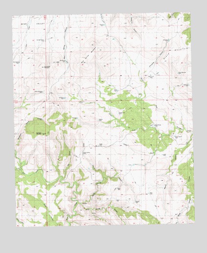
Applegate Mountain, NM USGS Topographic Map
Click on map above to begin viewing in our Map Viewer.

This topographic map contains these locations and features:
Feature Name Type Latitude Longitude GNIS ID View Map
Applegate MountainSummitN32.9301°W108.8556°885858View Map
Big CanyonValleyN32.9028°W108.8423°886287View Map
Black Mountain TankReservoirN32.9641°W108.7604°886440View Map
Cottonwood TankReservoirN32.9412°W108.8023°902224View Map
Dickerson TankReservoirN32.9570°W108.7528°888376View Map
Dry Section MountainSummitN32.9690°W108.8537°888543View Map
Dry Section TankReservoirN32.9723°W108.8710°902238View Map
Farm TankReservoirN32.9547°W108.8030°902245View Map
Fish Pond TankReservoirN32.9389°W108.8312°889043View Map
Foster DrawValleyN32.9267°W108.7717°889163View Map
Foster TankReservoirN32.9223°W108.8166°889169View Map
Horse Pasture TankReservoirN32.9269°W108.7636°902266View Map
Lewis TankReservoirN32.9161°W108.7723°902288View Map
Malpais TankReservoirN32.9374°W108.8165°891553View Map
Mayo TankReservoirN32.8968°W108.8044°891699View Map
Mesa TankReservoirN32.8934°W108.7822°902301View Map
Mud Spring MountainSummitN32.9787°W108.8148°892304View Map
Mud Spring TankReservoirN32.9728°W108.8384°892305View Map
Mud Spring WindmillLocaleN32.9856°W108.8395°892306View Map
North Fork Sycamore CreekStreamN32.9323°W108.7623°892597View Map
North Spring CanyonValleyN32.8890°W108.8292°892660View Map
Porcupine CanyonValleyN32.9651°W108.7839°893409View Map
Porcupine TankReservoirN32.9837°W108.7662°893415View Map
Reece CanyonValleyN32.9281°W108.7506°893841View Map
Rock House TankReservoirN32.9335°W108.7776°894051View Map
Sheeley TankReservoirN32.8885°W108.7920°894767View Map
South Fork Sycamore CreekStreamN32.9326°W108.7623°895055View Map
Spring CanyonValleyN32.8876°W108.8301°895258View Map
Steep HollowValleyN32.9037°W108.8134°895329View Map
Steep Hollow Spring CanyonValleyN32.9278°W108.8284°924801View Map
Steep Hollow TankReservoirN32.9180°W108.8280°895330View Map
Summer Resort TankReservoirN32.9847°W108.8526°895426View Map
Sycamore CampLocaleN32.9481°W108.8264°895464View Map
Sycamore TankReservoirN32.9508°W108.8399°895469View Map
Thompson TankReservoirN32.9385°W108.8554°895637View Map
Tinsley TankReservoirN32.9934°W108.8112°895696View Map
Willis Dickerson TankReservoirN32.9546°W108.8550°896646View Map
Wire Corral TankReservoirN32.9633°W108.7794°896720View Map

Note: Coordinates in the location and feature list above are referenced to NAD83 datum.


Copyright (C) 2008-2024 Ryan Niemi / Sunset Dynamics ... All Rights Reserved