TopoQuest Logo
Do you find TopoQuest useful?
Help keep TopoQuest running and adding new maps/features by donating!
Bitcoin:  19c7KJd3qBynnjoSw5npx9KScwjBe4ifkT
Litecoin:  LXs6TkuXGGXo1vDsWCkWVdjQX94eUKd6ui
Home View Maps Find Maps Find Places Resources & Links


Crookson Peak, New Mexico Topographic Map

USGS Map Title: Crookson Peak, NM
USGS Map MRC: 32108H8
DRG (GeoTIFF) Download: o32108h8.tif


Neighboring USGS Topographic Map Quads:


  Big Lue Mountains, AZ  
33109A1
 

  Mule Creek, NM  
33108A8
 

  Bear Mountain, NM  
33108A7
 

  Tillie Hall Peak, NM  
32109H1
 

  Crookson Peak, NM  
32108H8
 

  Applegate Mountain, NM  
32108H7
 

  Goat Camp Spring, NM  
32109G1
 

  Steeple Rock, NM  
32108G8
 

  Walker Canyon, NM  
32108G7


Map MRC Location:

N33°
W109°
N33°
W108°
H8 H7 H6 H5 H4 H3 H2 H1
G8 G7 G6 G5 G4 G3 G2 G1
F8 F7 F6 F5 F4 F3 F2 F1
E8 E7 E6 E5 E4 E3 E2 E1
D8 D7 D6 D5 D4 D3 D2 D1
C8 C7 C6 C5 C4 C3 C2 C1
B8 B7 B6 B5 B4 B3 B2 B1
A8 A7 A6 A5 A4 A3 A2 A1
N32°
W109°
N32°
W108°

Crookson Peak, NM USGS 1:24K Topographic Map Preview:
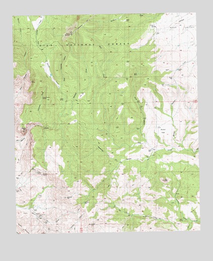
Crookson Peak, NM USGS Topographic Map
Click on map above to begin viewing in our Map Viewer.

This topographic map contains these locations and features:
Feature Name Type Latitude Longitude GNIS ID View Map
Agate SpringSpringN32.9520°W108.9673°2038345View Map
Alexander CanyonValleyN32.9203°W108.9064°903073View Map
Alexander TankReservoirN32.9629°W108.9730°899272View Map
Alexander WindmillLocaleN32.9162°W108.9276°903082View Map
Apache BoxValleyN32.9326°W108.9959°903210View Map
Apache Box Wilderness Study AreaParkN32.9340°W108.9934°934256View Map
Apache Creek Trick TankReservoirN32.9928°W108.9573°899262View Map
B 17 WindmillLocaleN32.9351°W108.9020°903478View Map
Bank MineMineN32.8767°W108.9795°903542View Map
Bathtub DrawValleyN32.9426°W108.9676°903609View Map
Billalli MineMineN32.8890°W108.9887°903829View Map
Black Willow ProspectMineN32.9001°W108.9990°914865View Map
Blue Creek WindmillLocaleN32.9534°W108.9453°899278View Map
Brushy MountainSummitN32.9890°W108.9609°904119View Map
Brushy Mountain Radar StationLocaleN32.9890°W108.9606°899260View Map
Brushy Mountain TankReservoirN32.9890°W108.9720°899261View Map
Buckhorn TankReservoirN32.9938°W108.9409°899258View Map
Burtcher CanyonValleyN32.9231°W108.8859°903831View Map
Burtcher FlatsFlatN32.9303°W108.9001°903832View Map
Burtcher TankReservoirN32.9568°W108.9050°912625View Map
Chapman PlaceLocaleN32.8909°W108.9928°905033View Map
Chapman Place WindmillLocaleN32.8898°W108.9934°899283View Map
Crookson PeakSummitN32.8953°W108.9662°905518View Map
Dan Neal TankReservoirN32.9678°W108.9906°899273View Map
Dark Thunder SpringSpringN32.9622°W108.9886°899277View Map
Deer PeakSummitN32.9045°W108.8989°905702View Map
Estes PlaceLocaleN32.8853°W108.9212°906199View Map
Fish SpringSpringN32.9122°W108.9896°906281View Map
Flo CanyonValleyN32.9878°W108.9039°2038798View Map
Forrest TankReservoirN32.9796°W108.9185°899263View Map
Geronimo DrawValleyN32.9384°W108.9842°906525View Map
Geronimo Water TankReservoirN32.9587°W108.9767°899276View Map
Horse Pasture SpringSpringN32.9528°W108.9820°2038503View Map
Indian SpringSpringN32.9102°W108.9862°907223View Map
Jerky ParkFlatN32.9967°W108.9240°907349View Map
Jerky Park Pasture TankReservoirN32.9969°W108.9281°899259View Map
Jerky Park TankReservoirN32.9959°W108.9415°899257View Map
Juniper PeakSummitN32.8803°W108.9498°907490View Map
Juniper TankReservoirN32.9674°W108.8891°907494View Map
Juniper TankReservoirN32.9719°W108.9442°899266View Map
Lemmons CanyonValleyN32.8803°W108.8753°907936View Map
Lower Blue TankReservoirN32.9725°W108.9346°899267View Map
Malpais TankReservoirN32.9658°W108.9611°899270View Map
McCarty WindmillLocaleN32.9315°W108.9370°908493View Map
McNaire SpringSpringN32.9090°W108.9822°908542View Map
Moore PlaceLocaleN32.8915°W108.9876°908888View Map
Moore Place WindmillLocaleN32.8906°W108.9870°899282View Map
Norman King MineMineN32.8859°W108.9848°909120View Map
O L D BasinBasinN32.9651°W108.9156°924760View Map
O L D CanyonValleyN32.9251°W108.9103°909336View Map
O L D RanchLocaleN32.9217°W108.9078°924761View Map
Old Big TankReservoirN32.9819°W108.9354°899268View Map
Old Number Two TankReservoirN32.9662°W108.9162°899264View Map
Old TankReservoirN32.9554°W108.9265°899279View Map
Quien Sabe TankReservoirN32.9927°W108.9052°899265View Map
Rally TankReservoirN32.9633°W108.9307°899275View Map
Red Kelly TankReservoirN32.8925°W108.9543°910066View Map
Rough Canyon TankReservoirN32.9754°W108.9545°899271View Map
SchaleLocaleN32.9201°W108.9064°929289View Map
Sid PlaceLocaleN32.9370°W108.9698°911031View Map
Snow GapGapN32.9634°W108.8920°911178View Map
Summit MountainsRangeN32.8806°W108.9976°920715View Map
Thompson CanyonValleyN32.9209°W108.8770°911659View Map
Thygerson RanchLocaleN32.9648°W108.9756°911695View Map
Trail TankReservoirN32.9743°W108.9764°899269View Map
Upper Alexander CanyonValleyN32.9587°W108.9692°903074View Map
Utah Bill SpringSpringN32.8870°W108.9665°899281View Map
Utah Bill WellWellN32.8867°W108.9670°912013View Map
Warm SpringSpringN32.8815°W108.8874°912159View Map
West TankReservoirN32.9724°W108.9818°899274View Map
Wood Yard WindmillLocaleN32.9392°W108.9584°912486View Map

Note: Coordinates in the location and feature list above are referenced to NAD83 datum.


Copyright (C) 2008-2025 Ryan Niemi / Sunset Dynamics ... All Rights Reserved