TopoQuest Logo
Do you find TopoQuest useful?
Help keep TopoQuest running and adding new maps/features by donating!
Bitcoin:  19c7KJd3qBynnjoSw5npx9KScwjBe4ifkT
Litecoin:  LXs6TkuXGGXo1vDsWCkWVdjQX94eUKd6ui
Home View Maps Find Maps Find Places Resources & Links


Stenulson Coulee, Wisconsin Topographic Map

USGS Map Title: Stenulson Coulee, WI
USGS Map MRC: 44090C8
DRG (GeoTIFF) Download: o44090c8.tif


Neighboring USGS Topographic Map Quads:


  Hixton, WI  
44091D1
 

  Alma Center, WI  
44090D8
 

  Merrillan, WI  
44090D7
 

  Taylor, WI  
44091C1
 

  Stenulson Coulee, WI  
44090C8
 

  Black River Falls, WI  
44090C7
 

  North Bend NE, WI  
44091B1
 

  Melrose, WI  
44090B8
 

  Shamrock, WI  
44090B7


Map MRC Location:

N45°
W91°
N45°
W90°
H8 H7 H6 H5 H4 H3 H2 H1
G8 G7 G6 G5 G4 G3 G2 G1
F8 F7 F6 F5 F4 F3 F2 F1
E8 E7 E6 E5 E4 E3 E2 E1
D8 D7 D6 D5 D4 D3 D2 D1
C8 C7 C6 C5 C4 C3 C2 C1
B8 B7 B6 B5 B4 B3 B2 B1
A8 A7 A6 A5 A4 A3 A2 A1
N44°
W91°
N44°
W90°

Stenulson Coulee, WI USGS 1:24K Topographic Map Preview:
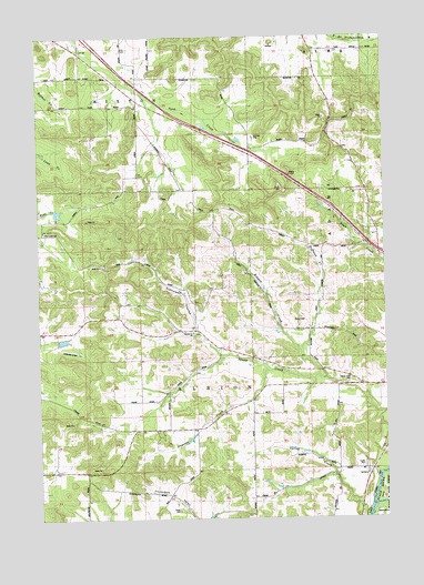
Stenulson Coulee, WI USGS Topographic Map
Click on map above to begin viewing in our Map Viewer.

This topographic map contains these locations and features:
Feature Name Type Latitude Longitude GNIS ID View Map
0.94 ReservoirReservoirN44.2962°W90.9916°1792502View Map
1.18 ReservoirReservoirN44.3293°W90.9932°1792482View Map
Cloverdale School (historical)SchoolN44.2513°W90.9457°1845433View Map
County Farm CemeteryCemeteryN44.2861°W90.8893°1563446View Map
Hoffman CreekStreamN44.2866°W90.8974°1566513View Map
Kenyon CreekStreamN44.2933°W90.9063°1567422View Map
Kenyon School (historical)SchoolN44.3000°W90.9129°1845471View Map
Lewis AirportAirportN44.2937°W90.9891°1581889View Map
Lewis E6092 DamDamN44.2966°W90.9901°1792501View Map
Ludeman G924 DamDamN44.3300°W90.9951°1792481View Map
Oak Grove School (historical)SchoolN44.3716°W90.8918°1845490View Map
Papoose CreekStreamN44.2891°W90.9179°1571014View Map
Papoose Creek School (historical)SchoolN44.2800°W90.9238°1845492View Map
Pine Creek CemeteryCemeteryN44.3241°W90.9982°1571441View Map
Shady Glen School (historical)SchoolN44.3572°W90.9643°1845510View Map
Spring CreekStreamN44.2519°W90.8840°1574615View Map
Spring Creek School (historical)SchoolN44.2633°W90.8929°1845515View Map
Squaw Creek ChurchChurchN44.2980°W90.9457°1574766View Map
Squaw Creek SchoolSchoolN44.2938°W90.9374°1574767View Map
Stenulson CouleeValleyN44.2995°W90.9426°1574860View Map
Stiehl CemeteryCemeteryN44.2519°W90.9507°1845517View Map
Town Creek School (historical)SchoolN44.3214°W90.8826°1845525View Map
Town of AlbionCivilN44.2857°W90.9620°1582669View Map
WWIS-FM (Black River Falls)TowerN44.3197°W90.8921°1582378View Map

Note: Coordinates in the location and feature list above are referenced to NAD83 datum.


Copyright (C) 2008-2025 Ryan Niemi / Sunset Dynamics ... All Rights Reserved