TopoQuest Logo
Do you find TopoQuest useful?
Help keep TopoQuest running and adding new maps/features by donating!
Bitcoin:  19c7KJd3qBynnjoSw5npx9KScwjBe4ifkT
Litecoin:  LXs6TkuXGGXo1vDsWCkWVdjQX94eUKd6ui
Home View Maps Find Maps Find Places Resources & Links


Hixton, Wisconsin Topographic Map

USGS Map Title: Hixton, WI
USGS Map MRC: 44091D1
DRG (GeoTIFF) Download: o44091d1.tif


Neighboring USGS Topographic Map Quads:


  Osseo, WI  
44091E2
 

  Price, WI  
44091E1
 

  Fairchild, WI  
44090E8
 

  Pigeon Falls, WI  
44091D2
 

  Hixton, WI  
44091D1
 

  Alma Center, WI  
44090D8
 

  Blair, WI  
44091C2
 

  Taylor, WI  
44091C1
 

  Stenulson Coulee, WI  
44090C8


Map MRC Location:

N45°
W92°
N45°
W91°
H8 H7 H6 H5 H4 H3 H2 H1
G8 G7 G6 G5 G4 G3 G2 G1
F8 F7 F6 F5 F4 F3 F2 F1
E8 E7 E6 E5 E4 E3 E2 E1
D8 D7 D6 D5 D4 D3 D2 D1
C8 C7 C6 C5 C4 C3 C2 C1
B8 B7 B6 B5 B4 B3 B2 B1
A8 A7 A6 A5 A4 A3 A2 A1
N44°
W92°
N44°
W91°

Hixton, WI USGS 1:24K Topographic Map Preview:
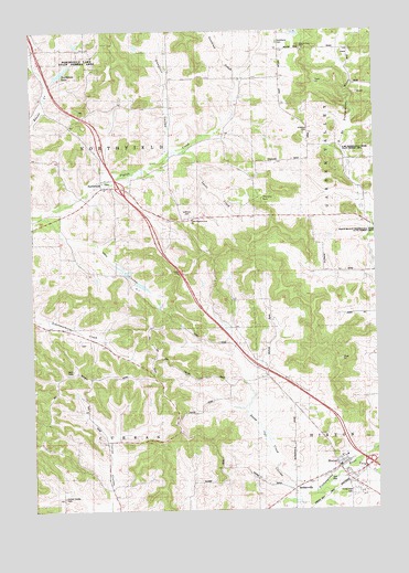
Hixton, WI USGS Topographic Map
Click on map above to begin viewing in our Map Viewer.

This topographic map contains these locations and features:
Feature Name Type Latitude Longitude GNIS ID View Map
Beaver Creek DamDamN44.4866°W91.1185°1791694View Map
Burton School (historical)SchoolN44.4122°W91.0390°1845428View Map
Cain's OrchardLocaleN44.4036°W91.0100°2612094View Map
Chimney RockSummitN44.4564°W91.0410°1563027View Map
Chimney Rock School (historical)SchoolN44.4508°W91.0643°1845431View Map
Curran Coulee CemeteryCemeteryN44.3783°W91.1146°1845436View Map
Curran Valley School (historical)SchoolN44.3783°W91.0957°1845437View Map
Diphtheria CemeteryCemeteryN44.4969°W91.0349°1845439View Map
Ellingson CouleeValleyN44.4691°W91.0749°1564537View Map
Ellingson School (historical)SchoolN44.4825°W91.0752°1845441View Map
Fall CouleeValleyN44.3813°W91.0306°1564838View Map
Gomsrud CreekStreamN44.4889°W91.0496°1565619View Map
Hillside School (historical)SchoolN44.4686°W91.0140°1845461View Map
HixtonPopulated PlaceN44.3858°W91.0143°1566491View Map
Hixton Elementary SchoolSchoolN44.3891°W91.0115°1845462View Map
Hixton Volunteer Fire DepartmentBuildingN44.3846°W91.0091°2698191View Map
Holen School (historical)SchoolN44.4847°W91.1202°1845463View Map
Holmes CreekStreamN44.3763°W91.0321°1566561View Map
Lutheran CemeteryCemeteryN44.4516°W91.0685°1845482View Map
Lyons CreekStreamN44.4686°W91.0702°1568853View Map
Marantha Discipleship Center H1240 DamDamN44.4433°W91.0852°1793226View Map
May CouleeValleyN44.4513°W91.1153°1569143View Map
Mound View RockSummitN44.4964°W91.0271°1569797View Map
Napstad School (historical)SchoolN44.4947°W91.0352°1845485View Map
NorthfieldPopulated PlaceN44.4591°W91.0996°1570525View Map
Northfield LakeReservoirN44.4892°W91.1137°1577277View Map
Northfield School (historical)SchoolN44.4597°W91.0954°1845487View Map
Sands CreekStreamN44.4519°W91.1227°1845508View Map
Smallpox CemeteryCemeteryN44.4733°W91.0243°1845512View Map
Spring Creek FarmsLocaleN44.3764°W91.0372°2611850View Map
Stony CreekStreamN44.3788°W91.0265°1574946View Map
Tank CreekStreamN44.3861°W91.0090°1575251View Map
Town of CurranCivilN44.3788°W91.1049°1583038View Map
Town of NorthfieldCivilN44.4662°W91.1046°1583826View Map
Trinity Rest CemeteryCemeteryN44.3791°W91.0090°1575640View Map
Upper Pigeon Creek ChurchChurchN44.4511°W91.0679°1575986View Map
Village of HixtonCivilN44.3831°W91.0153°1583396View Map
West Curran CouleeValleyN44.3759°W91.0992°1576492View Map

Note: Coordinates in the location and feature list above are referenced to NAD83 datum.


Copyright (C) 2008-2025 Ryan Niemi / Sunset Dynamics ... All Rights Reserved