TopoQuest Logo
Do you find TopoQuest useful?
Help keep TopoQuest running and adding new maps/features by donating!
Bitcoin:  19c7KJd3qBynnjoSw5npx9KScwjBe4ifkT
Litecoin:  LXs6TkuXGGXo1vDsWCkWVdjQX94eUKd6ui
Home View Maps Find Maps Find Places Resources & Links


Taylor, Wisconsin Topographic Map

USGS Map Title: Taylor, WI
USGS Map MRC: 44091C1
DRG (GeoTIFF) Download: o44091c1.tif


Neighboring USGS Topographic Map Quads:


  Pigeon Falls, WI  
44091D2
 

  Hixton, WI  
44091D1
 

  Alma Center, WI  
44090D8
 

  Blair, WI  
44091C2
 

  Taylor, WI  
44091C1
 

  Stenulson Coulee, WI  
44090C8
 

  Hegg, WI  
44091B2
 

  North Bend NE, WI  
44091B1
 

  Melrose, WI  
44090B8


Map MRC Location:

N45°
W92°
N45°
W91°
H8 H7 H6 H5 H4 H3 H2 H1
G8 G7 G6 G5 G4 G3 G2 G1
F8 F7 F6 F5 F4 F3 F2 F1
E8 E7 E6 E5 E4 E3 E2 E1
D8 D7 D6 D5 D4 D3 D2 D1
C8 C7 C6 C5 C4 C3 C2 C1
B8 B7 B6 B5 B4 B3 B2 B1
A8 A7 A6 A5 A4 A3 A2 A1
N44°
W92°
N44°
W91°

Taylor, WI USGS 1:24K Topographic Map Preview:
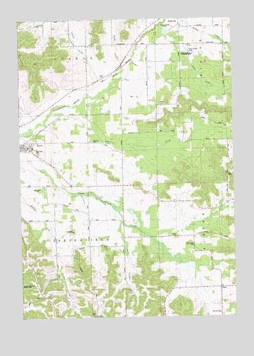
Taylor, WI USGS Topographic Map
Click on map above to begin viewing in our Map Viewer.

This topographic map contains these locations and features:
Feature Name Type Latitude Longitude GNIS ID View Map
Blair-Taylor Middle SchoolSchoolN44.3213°W91.1177°1845426View Map
Colwell CemeteryCemeteryN44.2838°W91.0346°1563291View Map
Curran CemeteryCemeteryN44.3497°W91.0749°1563626View Map
Curran CouleeValleyN44.3526°W91.0824°1563627View Map
Davis School (historical)SchoolN44.3186°W91.0654°1845438View Map
DiscoPopulated PlaceN44.2622°W91.0090°1563988View Map
French Creek CemeteryCemeteryN44.2805°W91.0246°1565310View Map
Halverson Landing Field (historical)AirportN44.2855°W91.0996°1845456View Map
Jackson School (historical)SchoolN44.2797°W91.0849°1845469View Map
Jonahs CouleeValleyN44.3357°W91.1216°1567260View Map
Lowe CreekStreamN44.3694°W91.0460°1568709View Map
Lowe Creek PondReservoirN44.3601°W91.0255°1568710View Map
Lowe Creek State Wildlife AreaParkN44.3605°W91.0271°1845480View Map
Pete CouleeValleyN44.2894°W91.0662°1571250View Map
Pine CreekStreamN44.3383°W91.0907°1571436View Map
Pine Creek School (historical)SchoolN44.3241°W91.0085°1845493View Map
SechlervillePopulated PlaceN44.3727°W91.0310°1573868View Map
Sechlerville CemeteryCemeteryN44.3680°W91.0313°1573869View Map
Sherwood CemeteryCemeteryN44.3238°W91.0824°1845511View Map
Skutley CouleeValleyN44.2824°W91.1047°1574256View Map
Smith CouleeValleyN44.3572°W91.0644°1574291View Map
Stockwell School (historical)SchoolN44.2961°W91.0038°1845518View Map
TaylorPopulated PlaceN44.3211°W91.1199°1575268View Map
Taylor Volunteer Fire DepartmentBuildingN44.3232°W91.1215°2697994View Map
The Elms School (historical)SchoolN44.3513°W91.0749°1845521View Map
Town of SpringfieldCivilN44.2906°W91.1036°1584193View Map
Village of TaylorCivilN44.3217°W91.1205°1584268View Map
Woodlawn CemeteryCemeteryN44.3047°W91.1163°1576999View Map

Note: Coordinates in the location and feature list above are referenced to NAD83 datum.


Copyright (C) 2008-2025 Ryan Niemi / Sunset Dynamics ... All Rights Reserved