TopoQuest Logo
Do you find TopoQuest useful?
Help keep TopoQuest running and adding new maps/features by donating!
Bitcoin:  19c7KJd3qBynnjoSw5npx9KScwjBe4ifkT
Litecoin:  LXs6TkuXGGXo1vDsWCkWVdjQX94eUKd6ui
Home View Maps Find Maps Find Places Resources & Links


Sterling NW, Michigan Topographic Map

USGS Map Title: Sterling NW, MI
USGS Map MRC: 44084B2
DRG (GeoTIFF) Download: o44084b2.tif


Neighboring USGS Topographic Map Quads:


  Ogemaw Springs, MI  
44084C3
 

  West Branch, MI  
44084C2
 

  Selkirk, MI  
44084C1
 

  Edwards, MI  
44084B3
 

  Sterling NW, MI  
44084B2
 

  Skidway Lake, MI  
44084B1
 

  Secord Lake, MI  
44084A3
 

  Sterling SW, MI  
44084A2
 

  Sterling, MI  
44084A1


Map MRC Location:

N45°
W85°
N45°
W84°
H8 H7 H6 H5 H4 H3 H2 H1
G8 G7 G6 G5 G4 G3 G2 G1
F8 F7 F6 F5 F4 F3 F2 F1
E8 E7 E6 E5 E4 E3 E2 E1
D8 D7 D6 D5 D4 D3 D2 D1
C8 C7 C6 C5 C4 C3 C2 C1
B8 B7 B6 B5 B4 B3 B2 B1
A8 A7 A6 A5 A4 A3 A2 A1
N44°
W85°
N44°
W84°

Sterling NW, MI USGS 1:24K Topographic Map Preview:
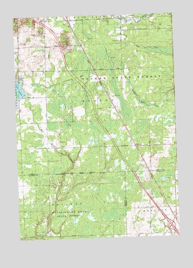
Sterling NW, MI USGS Topographic Map
Click on map above to begin viewing in our Map Viewer.

This topographic map contains these locations and features:
Feature Name Type Latitude Longitude GNIS ID View Map
Alger Rest AreaLocaleN44.1311°W84.1319°2515141View Map
Allegheny Wesleyan Methodist ChurchChurchN44.1764°W84.1328°2515092View Map
Bourret CemeteryCemeteryN44.1545°W84.2197°621780View Map
Cook HillsSummitN44.2453°W84.2308°623736View Map
Cooks CreekStreamN44.2095°W84.2206°623754View Map
Culver Post Office (historical)Post OfficeN44.1417°W84.1314°2515128View Map
Dale FarmsLocaleN44.2244°W84.2439°2725296View Map
GreenwoodPopulated PlaceN44.1761°W84.1567°627373View Map
Greenwood CampgroundLocaleN44.1764°W84.1383°2515091View Map
Greenwood Post Office (historical)Post OfficeN44.1761°W84.1567°2503039View Map
Greenwood StationLocaleN44.1758°W84.1564°2503029View Map
Interchange 202CrossingN44.1317°W84.1306°2515140View Map
Interchange 212CrossingN44.2450°W84.2250°2503059View Map
Kuhn HillSummitN44.2353°W84.2089°629885View Map
Lake GeorgeLakeN44.2092°W84.2467°626741View Map
LaPorte CreekStreamN44.1467°W84.2189°629915View Map
Loranger StationLocaleN44.2333°W84.1981°2503030View Map
Mierson FarmsLocaleN44.2394°W84.2242°2725297View Map
Ogemaw County Emergency Medical Services AuthorityBuildingN44.2472°W84.1808°2662085View Map
Rowena Post Office (historical)Post OfficeN44.1611°W84.1478°2515127View Map
Rowena Station (historical)LocaleN44.1622°W84.1478°2501257View Map
Spring CreekStreamN44.1672°W84.2064°638552View Map
Tolfee HillSummitN44.2470°W84.2483°1614932View Map
Township of HortonCivilN44.2048°W84.1861°1626491View Map
West Branch Community AirportAirportN44.2460°W84.1874°1624197View Map
West Branch Rest AreaLocaleN44.2158°W84.2000°2503060View Map

Note: Coordinates in the location and feature list above are referenced to NAD83 datum.


Copyright (C) 2008-2025 Ryan Niemi / Sunset Dynamics ... All Rights Reserved