TopoQuest Logo
Do you find TopoQuest useful?
Help keep TopoQuest running and adding new maps/features by donating!
Bitcoin:  19c7KJd3qBynnjoSw5npx9KScwjBe4ifkT
Litecoin:  LXs6TkuXGGXo1vDsWCkWVdjQX94eUKd6ui
Home View Maps Find Maps Find Places Resources & Links


Stewartsville, Virginia Topographic Map

USGS Map Title: Stewartsville, VA
USGS Map MRC: 37079C7
DRG (GeoTIFF) Download: o37079c7.tif


Neighboring USGS Topographic Map Quads:


  Daleville, VA  
37079D8
 

  Villamont, VA  
37079D7
 

  Montvale, VA  
37079D6
 

  Roanoke, VA  
37079C8
 

  Stewartsville, VA  
37079C7
 

  Irving, VA  
37079C6
 

  Garden City, VA  
37079B8
 

  Hardy, VA  
37079B7
 

  Goodview, VA  
37079B6


Map MRC Location:

N38°
W80°
N38°
W79°
H8 H7 H6 H5 H4 H3 H2 H1
G8 G7 G6 G5 G4 G3 G2 G1
F8 F7 F6 F5 F4 F3 F2 F1
E8 E7 E6 E5 E4 E3 E2 E1
D8 D7 D6 D5 D4 D3 D2 D1
C8 C7 C6 C5 C4 C3 C2 C1
B8 B7 B6 B5 B4 B3 B2 B1
A8 A7 A6 A5 A4 A3 A2 A1
N37°
W80°
N37°
W79°

Stewartsville, VA USGS 1:24K Topographic Map Preview:
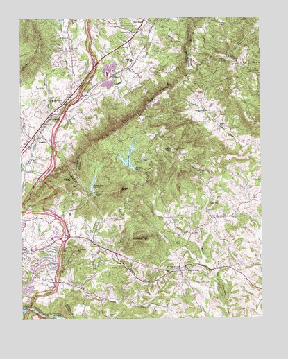
Stewartsville, VA USGS Topographic Map
Click on map above to begin viewing in our Map Viewer.

This topographic map contains these locations and features:
Feature Name Type Latitude Longitude GNIS ID View Map
Barnhardt ChurchChurchN37.2674°W79.7920°1481470View Map
Basham ChurchChurchN37.2690°W79.7992°1481484View Map
Beaverdam Creek DamDamN37.3127°W79.8155°1489221View Map
Beaverdam ReservoirReservoirN37.3169°W79.8189°1501951View Map
Blue Ridge CemeteryCemeteryN37.2646°W79.8584°1706587View Map
Blue Ridge CemeteryCemeteryN37.3712°W79.8236°1481859View Map
Blue Ridge ChurchChurchN37.2643°W79.8581°1481860View Map
Blue Ridge DistrictCivilN37.3608°W79.8299°1927104View Map
Blue Ridge Post OfficePost OfficeN37.3646°W79.8215°2766341View Map
Blue Ridge Volunteer Fire and Rescue Company 1BuildingN37.3749°W79.8110°2075551View Map
BonsackPopulated PlaceN37.3260°W79.8659°1481931View Map
Bonsack Baptist ChurchChurchN37.3224°W79.8692°1706589View Map
Bore Auger ChurchChurchN37.3362°W79.7786°1481937View Map
Bush Valley Swim ClubLocaleN37.2724°W79.8720°1706610View Map
Calvert CemeteryCemeteryN37.2507°W79.8289°1482239View Map
Carvin HouseBuildingN37.3558°W79.7589°2102480View Map
Chestnut MountainSummitN37.2787°W79.8467°1499252View Map
Colonial ChurchChurchN37.3690°W79.8178°1482660View Map
Colonial Elementary SchoolSchoolN37.3577°W79.8167°1482661View Map
Cook CreekStreamN37.3207°W79.8686°1482686View Map
Coyner BranchStreamN37.3357°W79.8586°1482779View Map
Coyner MountainSummitN37.3704°W79.8684°1499299View Map
Coyner Mountain OverlookPopulated PlaceN37.3410°W79.8475°1499300View Map
Coyner SpringsPopulated PlaceN37.3346°W79.8589°1482780View Map
CroftonPopulated PlaceN37.2718°W79.8678°1706641View Map
Curby BranchStreamN37.2726°W79.7800°1482881View Map
East Vinton Plaza Shopping CenterLocaleN37.2801°W79.8645°1706647View Map
Explore ParkParkN37.2585°W79.8650°1706650View Map
Falling CreekPopulated PlaceN37.2968°W79.8598°1706653View Map
Falling Creek DamDamN37.3024°W79.8369°1489233View Map
Falling Creek ReservoirReservoirN37.3035°W79.8376°1502013View Map
Foster KnobSummitN37.3724°W79.7720°1499443View Map
Foutz CemeteryCemeteryN37.2960°W79.7856°1483510View Map
FoxfirePopulated PlaceN37.2582°W79.8714°1706663View Map
Giles CemeteryCemeteryN37.3624°W79.7575°1483620View Map
Glade Creek ChurchChurchN37.3632°W79.8178°1483655View Map
Glade Creek Lutheran ChurchChurchN37.3604°W79.8161°1706563View Map
Goodview Elementary SchoolSchoolN37.2626°W79.7808°2498651View Map
Gray CemeteryCemeteryN37.3074°W79.7539°1483775View Map
Greens KnobSummitN37.3204°W79.7959°1499500View Map
HeatherstonePopulated PlaceN37.3549°W79.8423°1674355View Map
Horsepen MountainSummitN37.2821°W79.8175°1484227View Map
Jeters ChapelChurchN37.3160°W79.8092°1484445View Map
Jordontown ChurchChurchN37.2924°W79.7659°1484515View Map
KnollwoodPopulated PlaceN37.3501°W79.8431°1674356View Map
Lawhorn CemeteryCemeteryN37.3571°W79.7725°1484734View Map
LaymantownPopulated PlaceN37.3657°W79.8575°1867593View Map
Laymantown CemeteryCemeteryN37.3626°W79.8492°1484742View Map
Laymantown Census Designated PlaceCensusN37.3629°W79.8524°2390046View Map
Laymantown Community ChurchChurchN37.3671°W79.8489°1484743View Map
Laymantown CreekStreamN37.3371°W79.8564°1484744View Map
LindenwoodPopulated PlaceN37.2735°W79.8603°1706724View Map
Little Tree AcresPopulated PlaceN37.3182°W79.8731°1706725View Map
Lynn HavenPopulated PlaceN37.2799°W79.8734°1706729View Map
Lynn Haven ChurchChurchN37.2774°W79.8739°1485138View Map
Mays Memorial ChurchChurchN37.2710°W79.7948°1485245View Map
Mineral Springs Christian SchoolSchoolN37.2863°W79.8347°2498627View Map
Montgomery VillagePopulated PlaceN37.2629°W79.8709°1706747View Map
Mount View ChurchChurchN37.3576°W79.7642°1485653View Map
MusePopulated PlaceN37.2935°W79.8525°1706760View Map
Nat BranchStreamN37.2701°W79.7734°1485801View Map
NiagaraPopulated PlaceN37.2551°W79.8725°1499799View Map
Niagara DamDamN37.2551°W79.8748°1490794View Map
Niagara ReservoirReservoirN37.2548°W79.8735°1490795View Map
Norfolk and Western OverlookLocaleN37.3424°W79.8448°1485879View Map
PeachtreePopulated PlaceN37.3385°W79.8656°1674351View Map
Piney MountainSummitN37.2974°W79.7750°1486252View Map
Rainbow ForestPopulated PlaceN37.3571°W79.8553°1674352View Map
Rainbow Forest LakeReservoirN37.3631°W79.8510°1674353View Map
Read Mountain OverlookLocaleN37.3093°W79.8645°1486527View Map
River EdgePopulated PlaceN37.2601°W79.8728°1706805View Map
Roanoke Basin OverlookLocaleN37.2746°W79.8553°1486648View Map
Roanoke CemeteryCemeteryN37.3468°W79.8620°1486649View Map
Roanoke Juvenile HomeBuildingN37.3424°W79.8598°1486650View Map
Roanoke Nursing HomeBuildingN37.3410°W79.8581°1486651View Map
Roanoke Valley Juvenile Detention CenterBuildingN37.3426°W79.8595°2767189View Map
Roanoke Valley Juvenile Detention Center SchoolSchoolN37.3426°W79.8596°2767062View Map
Saint Clair CemeteryCemeteryN37.2940°W79.7786°1486845View Map
Sandy CreekStreamN37.2563°W79.8095°1486934View Map
Simmons CemeteryCemeteryN37.2868°W79.7578°1487247View Map
Smith CemeteryCemeteryN37.3349°W79.8578°1487334View Map
Spring GrovePopulated PlaceN37.2829°W79.8625°1706834View Map
Stepping StonePopulated PlaceN37.3479°W79.8495°1674354View Map
Stevens ChapelChurchN37.3299°W79.7714°1487561View Map
Stewart KnobSummitN37.3090°W79.8478°1487568View Map
Stewart Knob OverlookLocaleN37.2971°W79.8720°1487569View Map
StewartsvillePopulated PlaceN37.2707°W79.7925°1500162View Map
Stewartsville - Chamblissburg Volunteer Fire Department Company 13 Station 1BuildingN37.2716°W79.7933°2075575View Map
Stewartsville Elementary SchoolSchoolN37.2717°W79.7897°2498634View Map
Stewartsville First Aid and Rescue SquadBuildingN37.2647°W79.7917°2075576View Map
Stonebridge AcresPopulated PlaceN37.2871°W79.8573°1706839View Map
The Church of Jesus Christ of Latter Day SaintsChurchN37.2662°W79.8595°1706629View Map
Thompson CreekStreamN37.3360°W79.7778°1487881View Map
Tyler KnobSummitN37.3310°W79.7548°1500246View Map
Vinton Family Medical CenterHospitalN37.2790°W79.8695°1706864View Map
Waldron CemeteryCemeteryN37.2862°W79.8381°1488153View Map
Weaver KnobSummitN37.3040°W79.8234°1500289View Map
WebsterPopulated PlaceN37.3515°W79.8267°1500290View Map
West CemeteryCemeteryN37.2921°W79.7706°1488245View Map
Wheeler CemeteryCemeteryN37.3001°W79.7706°1488272View Map
Wheeler CemeteryCemeteryN37.3049°W79.7570°1488273View Map
William Byrd High SchoolSchoolN37.2840°W79.8585°1493869View Map
William Byrd Middle SchoolSchoolN37.2849°W79.8605°1706879View Map

Note: Coordinates in the location and feature list above are referenced to NAD83 datum.


Copyright (C) 2008-2024 Ryan Niemi / Sunset Dynamics ... All Rights Reserved