TopoQuest Logo
Do you find TopoQuest useful?
Help keep TopoQuest running and adding new maps/features by donating!
Bitcoin:  19c7KJd3qBynnjoSw5npx9KScwjBe4ifkT
Litecoin:  LXs6TkuXGGXo1vDsWCkWVdjQX94eUKd6ui
Home View Maps Find Maps Find Places Resources & Links


Hardy, Virginia Topographic Map

USGS Map Title: Hardy, VA
USGS Map MRC: 37079B7
DRG (GeoTIFF) Download: o37079b7.tif


Neighboring USGS Topographic Map Quads:


  Roanoke, VA  
37079C8
 

  Stewartsville, VA  
37079C7
 

  Irving, VA  
37079C6
 

  Garden City, VA  
37079B8
 

  Hardy, VA  
37079B7
 

  Goodview, VA  
37079B6
 

  Boones Mill, VA  
37079A8
 

  Redwood, VA  
37079A7
 

  Moneta SW, VA  
37079A6


Map MRC Location:

N38°
W80°
N38°
W79°
H8 H7 H6 H5 H4 H3 H2 H1
G8 G7 G6 G5 G4 G3 G2 G1
F8 F7 F6 F5 F4 F3 F2 F1
E8 E7 E6 E5 E4 E3 E2 E1
D8 D7 D6 D5 D4 D3 D2 D1
C8 C7 C6 C5 C4 C3 C2 C1
B8 B7 B6 B5 B4 B3 B2 B1
A8 A7 A6 A5 A4 A3 A2 A1
N37°
W80°
N37°
W79°

Hardy, VA USGS 1:24K Topographic Map Preview:
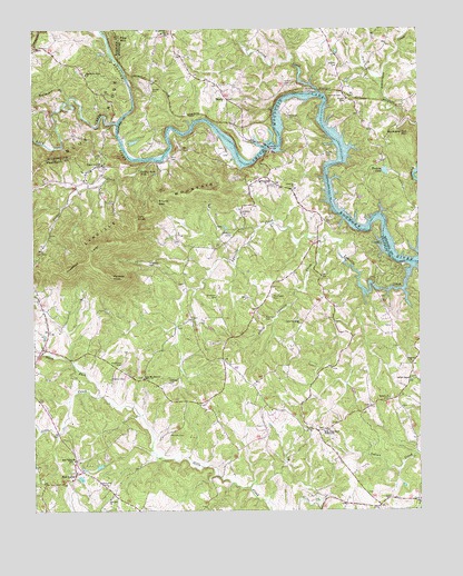
Hardy, VA USGS Topographic Map
Click on map above to begin viewing in our Map Viewer.

This topographic map contains these locations and features:
Feature Name Type Latitude Longitude GNIS ID View Map
Altice CemeteryCemeteryN37.1471°W79.8014°1791024View Map
Amos-Richardson CemeteryCemeteryN37.2174°W79.8114°1791026View Map
Back CreekStreamN37.2260°W79.8473°1462652View Map
Barton CemeteryCemeteryN37.2360°W79.7925°1462818View Map
Basham CemeteryCemeteryN37.1749°W79.7998°1462824View Map
Beard CemeteryCemeteryN37.1751°W79.8236°1791033View Map
Bellevue ChurchChurchN37.1632°W79.7525°1463048View Map
Bellevue School (historical)SchoolN37.1632°W79.7525°1494383View Map
Big BranchStreamN37.2243°W79.8231°1674822View Map
Blackwater FordCrossingN37.2263°W79.8464°1674823View Map
Booth CemeteryCemeteryN37.1954°W79.8284°1791039View Map
Booth CemeteryCemeteryN37.2176°W79.7795°1463673View Map
Brown-Meador CemeteryCemeteryN37.2193°W79.8125°1791044View Map
Buck and Doe MountainSummitN37.2226°W79.7525°1463973View Map
Chandler Boat MarinaLocaleN37.2046°W79.7759°1674829View Map
Chestnut LevelRidgeN37.1901°W79.8570°1464829View Map
Childress CemeteryCemeteryN37.1521°W79.7556°1791052View Map
Clearview LakeReservoirN37.2085°W79.8614°1489306View Map
Cooper Cove ChurchChurchN37.2146°W79.8525°1465220View Map
Coopers CovePopulated PlaceN37.2110°W79.8581°1494410View Map
Coopers Cove CemeteryCemeteryN37.2146°W79.8525°1791053View Map
Coopers Cove School (historical)SchoolN37.2101°W79.8606°1494411View Map
Dent CemeteryCemeteryN37.1462°W79.7811°1791060View Map
District 1CivilN37.2494°W79.7622°2750017View Map
Dudley CemeteryCemeteryN37.1596°W79.8498°1466024View Map
Falling CreekStreamN37.2338°W79.7814°1483351View Map
Falling Rock FallsFallsN37.2138°W79.8403°1466461View Map
First Mount Airy ChurchChurchN37.1596°W79.8392°1466588View Map
Garland-Ridgeway-Smith CemeteryCemeteryN37.1840°W79.8261°1791072View Map
Gravel Hill ChurchChurchN37.2488°W79.8314°1467383View Map
Hanabass CemeteryCemeteryN37.1635°W79.8461°1467697View Map
HardyPopulated PlaceN37.2318°W79.8106°1477396View Map
Hardy BridgeBridgeN37.2196°W79.7978°1495653View Map
Hardy FordPopulated PlaceN37.2118°W79.7984°1494444View Map
Hardy Life Saving and Rescue SquadBuildingN37.2316°W79.8122°2075573View Map
Hardy Post OfficePost OfficeN37.2092°W79.7928°2766371View Map
Hardy Volunteer Fire Department Company 12BuildingN37.2360°W79.8109°2075572View Map
Hardys FordCrossingN37.2199°W79.7986°1674851View Map
Hickory LakeReservoirN37.2130°W79.7604°1467987View Map
Holy Emmanuel CemeteryCemeteryN37.1460°W79.7809°1791081View Map
Holy Emmanuel TabernacleChurchN37.1457°W79.7809°1468186View Map
Hopkins CemeteryCemeteryN37.2024°W79.8067°1468235View Map
Horn CemeteryCemeteryN37.2162°W79.8298°1468239View Map
Horns FordCrossingN37.2179°W79.8445°1674853View Map
Horseshoe BranchStreamN37.2324°W79.8628°1468310View Map
Jeter CemeteryCemeteryN37.1857°W79.7659°1791085View Map
Jeter-Perdue CemeteryCemeteryN37.1296°W79.7681°1791086View Map
Kasey CemeteryCemeteryN37.1729°W79.7592°1791088View Map
Kennett CemeteryCemeteryN37.1449°W79.8311°1468957View Map
Little Falling River Number One DamDamN37.2085°W79.8614°1489305View Map
Little Lynville CreekStreamN37.1943°W79.7811°1469586View Map
Lynville CreekStreamN37.1879°W79.7520°1469960View Map
Lynville FordCrossingN37.1893°W79.7509°1674861View Map
Lynville MountainSummitN37.2099°W79.8148°1495885View Map
Lynville Ridge ChurchChurchN37.1735°W79.7881°1469961View Map
Martin CemeteryCemeteryN37.2324°W79.7731°1470126View Map
Mayflower HillsPopulated PlaceN37.2404°W79.8581°1706736View Map
Mayflower Hills ChurchChurchN37.2387°W79.8573°1470213View Map
McGuire CemeteryCemeteryN37.1260°W79.7639°1791095View Map
McKee CemeteryCemeteryN37.2343°W79.8364°1470268View Map
McVeighs FordCrossingN37.2168°W79.8325°1674862View Map
Meador CemeteryCemeteryN37.1990°W79.8153°1791097View Map
Meadow CemeteryCemeteryN37.1965°W79.8098°1470306View Map
Moorman CemeteryCemeteryN37.2268°W79.7917°1470723View Map
Moorman MarinaLocaleN37.2238°W79.7761°1674867View Map
Mount Airy CemeteryCemeteryN37.1596°W79.8395°1791102View Map
Mount Lebanon School (historical)SchoolN37.1674°W79.8706°1494462View Map
Neathawk CemeteryCemeteryN37.1801°W79.7970°1471356View Map
Newbill CemeteryCemeteryN37.1285°W79.7598°1791104View Map
Nichols CemeteryCemeteryN37.2329°W79.7739°1471535View Map
Nichols CemeteryCemeteryN37.2401°W79.7759°1471536View Map
Ninevah CemeteryCemeteryN37.2085°W79.7903°1494470View Map
Ninevah School (historical)SchoolN37.2093°W79.7959°1494471View Map
Nineveh ChurchChurchN37.2096°W79.7889°1471550View Map
North Fork Gills CreekStreamN37.1551°W79.8534°1471604View Map
Oak Hill CemeteryCemeteryN37.1290°W79.8495°1791106View Map
Oak Hill ChurchChurchN37.1282°W79.8503°1471753View Map
Old Mount Airy Church (historical)ChurchN37.1501°W79.8161°1494476View Map
Oylers ChapelChurchN37.1588°W79.7528°1472005View Map
Oylers Chapel CemeteryCemeteryN37.1593°W79.7525°1791108View Map
Panther KnobSummitN37.1863°W79.8492°1472047View Map
Pine MountainSummitN37.2474°W79.8459°1472362View Map
Prater CreekStreamN37.2163°W79.8353°1472760View Map
Red Gate School (historical)SchoolN37.1474°W79.7867°1494495View Map
Red ValleyPopulated PlaceN37.1351°W79.8614°1477669View Map
Red Valley CemeteryCemeteryN37.1382°W79.8625°1494496View Map
Red Valley ChurchChurchN37.1379°W79.8620°1473065View Map
Red Valley Rescue SquadBuildingN37.1334°W79.8553°2086259View Map
Richardson CemeteryCemeteryN37.2079°W79.8514°1791121View Map
Richardson CemeteryCemeteryN37.1940°W79.7625°1791122View Map
Ridgeway CemeteryCemeteryN37.1893°W79.8373°1473208View Map
Robertson CemeteryCemeteryN37.1537°W79.7595°1473321View Map
Sandy Land School (historical)SchoolN37.1860°W79.8242°1494506View Map
Scruggs CemeteryCemeteryN37.1276°W79.7503°1791126View Map
Shorts GapGapN37.2051°W79.8339°1474563View Map
Simmons CemeteryCemeteryN37.1807°W79.8148°1496228View Map
Stewartsville Station (historical)LocaleN37.2326°W79.7720°1674904View Map
Swain-Basham CemeteryCemeteryN37.1804°W79.7625°1791128View Map
Tory KnobSummitN37.2013°W79.8409°1475792View Map
Trinity Church (historical)ChurchN37.1263°W79.7636°1494524View Map
Webbs FordCrossingN37.2232°W79.7792°1674913View Map
West Fork Beaverdam CreekStreamN37.2365°W79.7628°1488250View Map
White Rock CemeteryCemeteryN37.2101°W79.8006°1791139View Map
Whiterock ChurchChurchN37.2104°W79.8003°1476660View Map
Wyatt (historical)Populated PlaceN37.1521°W79.8331°1494805View Map

Note: Coordinates in the location and feature list above are referenced to NAD83 datum.


Copyright (C) 2008-2025 Ryan Niemi / Sunset Dynamics ... All Rights Reserved