TopoQuest Logo
Do you find TopoQuest useful?
Help keep TopoQuest running and adding new maps/features by donating!
Bitcoin:  19c7KJd3qBynnjoSw5npx9KScwjBe4ifkT
Litecoin:  LXs6TkuXGGXo1vDsWCkWVdjQX94eUKd6ui
Home View Maps Find Maps Find Places Resources & Links


Villamont, Virginia Topographic Map

USGS Map Title: Villamont, VA
USGS Map MRC: 37079D7
DRG (GeoTIFF) Download: o37079d7.tif


Neighboring USGS Topographic Map Quads:


  Oriskany, VA  
37079E8
 

  Salisbury, VA  
37079E7
 

  Buchanan, VA  
37079E6
 

  Daleville, VA  
37079D8
 

  Villamont, VA  
37079D7
 

  Montvale, VA  
37079D6
 

  Roanoke, VA  
37079C8
 

  Stewartsville, VA  
37079C7
 

  Irving, VA  
37079C6


Map MRC Location:

N38°
W80°
N38°
W79°
H8 H7 H6 H5 H4 H3 H2 H1
G8 G7 G6 G5 G4 G3 G2 G1
F8 F7 F6 F5 F4 F3 F2 F1
E8 E7 E6 E5 E4 E3 E2 E1
D8 D7 D6 D5 D4 D3 D2 D1
C8 C7 C6 C5 C4 C3 C2 C1
B8 B7 B6 B5 B4 B3 B2 B1
A8 A7 A6 A5 A4 A3 A2 A1
N37°
W80°
N37°
W79°

Villamont, VA USGS 1:24K Topographic Map Preview:
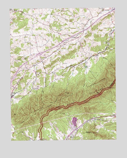
Villamont, VA USGS Topographic Map
Click on map above to begin viewing in our Map Viewer.

This topographic map contains these locations and features:
Feature Name Type Latitude Longitude GNIS ID View Map
Back Creek ChurchChurchN37.4668°W79.7587°1481375View Map
Beaverdam CreekStreamN37.4968°W79.7598°1481570View Map
Beckner BranchStreamN37.4815°W79.7853°1481577View Map
Blackhorse GapGapN37.4243°W79.7573°1481833View Map
Blue KnobSummitN37.4182°W79.7717°1499148View Map
Blue RidgePopulated PlaceN37.3785°W79.8070°1499150View Map
Blue Ridge Census Designated PlaceCensusN37.3783°W79.8206°2389220View Map
Blue Ridge QuarryMineN37.3914°W79.7969°2724857View Map
Booze CemeteryCemeteryN37.4651°W79.8473°1481935View Map
Botetourt Correctional CenterBuildingN37.4246°W79.8452°2767169View Map
Brushy RunStreamN37.4499°W79.8378°1674366View Map
Camp BethelLocaleN37.4446°W79.7839°1482245View Map
Curry CreekStreamN37.4451°W79.7978°1482883View Map
Curry Creek TrailTrailN37.4215°W79.8089°1488722View Map
Curry GapGapN37.4062°W79.8170°1482884View Map
Ebenezer ChurchChurchN37.4490°W79.8364°1483233View Map
FlattopSummitN37.4087°W79.8445°1483450View Map
Fullhart KnobSummitN37.4007°W79.8717°1483561View Map
Fullhart Knob ShelterLocaleN37.3982°W79.8550°1488719View Map
Gravel Hill ChurchChurchN37.4524°W79.8581°1483764View Map
Great Valley OverlookLocaleN37.4107°W79.7867°1483786View Map
Grindstone KnobSummitN37.4201°W79.8045°1499506View Map
Interchange 156CrossingN37.4571°W79.8392°1488721View Map
LithiaPopulated PlaceN37.4782°W79.7514°1499668View Map
Lynchburg Mines (historical)Populated PlaceN37.3924°W79.8284°1674365View Map
Mill Creek ChurchChurchN37.4712°W79.7959°1470520View Map
NacePopulated PlaceN37.4396°W79.8239°1499784View Map
New Bethel ChurchChurchN37.4499°W79.7873°1485837View Map
Pocket HollowValleyN37.4237°W79.8483°1486306View Map
Quarry OverlookLocaleN37.4060°W79.8073°1486464View Map
Rabbit CreekStreamN37.4446°W79.8028°1486473View Map
Saint Clair CemeteryCemeteryN37.3776°W79.8478°1486846View Map
Salt PondLakeN37.4104°W79.8248°1486902View Map
Shay HollowValleyN37.4486°W79.8376°1487166View Map
Simmons CemeteryCemeteryN37.4673°W79.8100°1487248View Map
SpecPopulated PlaceN37.4546°W79.7714°1500137View Map
Spec Mines BranchStreamN37.4579°W79.7681°1487428View Map
Stony Battle CreekStreamN37.4476°W79.8450°1487612View Map
Thompson CemeteriesCemeteryN37.4479°W79.8067°1487872View Map
TroutvillePopulated PlaceN37.4182°W79.8748°1493720View Map
Troutville Elementary SchoolSchoolN37.4413°W79.8474°1674368View Map
Valley DistrictCivilN37.3912°W79.8735°1927545View Map
Victory Mission ChurchChurchN37.3760°W79.8398°1488131View Map
VillamontPopulated PlaceN37.3954°W79.7761°1500259View Map
Wildcat KnobSummitN37.3815°W79.7781°1488372View Map
Wilson CreekStreamN37.4501°W79.7853°1488414View Map
Wilson Creek ShelterLocaleN37.4246°W79.7887°1488723View Map

Note: Coordinates in the location and feature list above are referenced to NAD83 datum.


Copyright (C) 2008-2025 Ryan Niemi / Sunset Dynamics ... All Rights Reserved