TopoQuest Logo
Do you find TopoQuest useful?
Help keep TopoQuest running and adding new maps/features by donating!
Bitcoin:  19c7KJd3qBynnjoSw5npx9KScwjBe4ifkT
Litecoin:  LXs6TkuXGGXo1vDsWCkWVdjQX94eUKd6ui
Home View Maps Find Maps Find Places Resources & Links


Stillman Valley, Illinois Topographic Map

USGS Map Title: Stillman Valley, IL
USGS Map MRC: 42089A2
DRG (GeoTIFF) Download: o42089a2.tif


Neighboring USGS Topographic Map Quads:


  Seward, IL  
42089B3
 

  Kishwaukee, IL  
42089B2
 

  Rockford South, IL  
42089B1
 

  Oregon, IL  
42089A3
 

  Stillman Valley, IL  
42089A2
 

  Kings, IL  
42089A1
 

  Daysville, IL  
41089H3
 

  Chana, IL  
41089H2
 

  Rochelle, IL  
41089H1


Map MRC Location:

N43°
W90°
N43°
W89°
H8 H7 H6 H5 H4 H3 H2 H1
G8 G7 G6 G5 G4 G3 G2 G1
F8 F7 F6 F5 F4 F3 F2 F1
E8 E7 E6 E5 E4 E3 E2 E1
D8 D7 D6 D5 D4 D3 D2 D1
C8 C7 C6 C5 C4 C3 C2 C1
B8 B7 B6 B5 B4 B3 B2 B1
A8 A7 A6 A5 A4 A3 A2 A1
N42°
W90°
N42°
W89°

Stillman Valley, IL USGS 1:24K Topographic Map Preview:
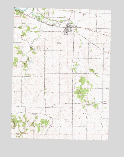
Stillman Valley, IL USGS Topographic Map
Click on map above to begin viewing in our Map Viewer.

This topographic map contains these locations and features:
Feature Name Type Latitude Longitude GNIS ID View Map
Beach CemeteryCemeteryN42.0786°W89.1301°403991View Map
Beach Cemetery Prairie Nature PreserveParkN42.0784°W89.1301°2013741View Map
Beach School (historical)SchoolN42.0784°W89.1343°1706029View Map
Black Walnut CreekStreamN42.1134°W89.2145°404506View Map
Black Walnut School (historical)SchoolN42.0845°W89.2220°1706024View Map
Bybee FarmLocaleN42.0458°W89.2386°2681136View Map
Chaney CemeteryCemeteryN42.0525°W89.1632°405952View Map
Hidden Valley LakeReservoirN42.0334°W89.1418°1691795View Map
Hidden Valley Lake DamDamN42.0334°W89.1418°1691794View Map
Highland Elementary SchoolSchoolN42.1022°W89.1823°1808238View Map
Marrill School (historical)SchoolN42.0481°W89.2379°1706025View Map
Meridian Junior High SchoolSchoolN42.1081°W89.1812°1808258View Map
Meridian School (historical)SchoolN42.0359°W89.1726°1706027View Map
Mount Pleasant CemeteryCemeteryN42.0259°W89.2062°1808264View Map
Paynes PointPopulated PlaceN42.0239°W89.2068°425694View Map
Paynes Point Lutheran CemeteryCemeteryN42.0264°W89.2073°1808274View Map
Simerick School (historical)SchoolN42.0242°W89.2498°1706023View Map
Slagle School (historical)SchoolN42.0517°W89.2090°1706026View Map
Stillman Fire Protection DistrictBuildingN42.1060°W89.1848°2640189View Map
Stillman ValleyPopulated PlaceN42.1072°W89.1793°419141View Map
Stillman Valley CemeteryCemeteryN42.1125°W89.1787°1808303View Map
Stillman Valley High SchoolSchoolN42.1017°W89.1776°1808304View Map
Stillman Valley Post OfficePost OfficeN42.1085°W89.1788°2788682View Map
Stinsonian CemeteryCemeteryN42.0236°W89.2176°419146View Map
Township of MarionCivilN42.0937°W89.2195°429325View Map
Traina PondReservoirN42.0169°W89.2198°1691863View Map
Traina Pond DamDamN42.0167°W89.2218°1691862View Map
Village of Stillman ValleyCivilN42.1041°W89.1800°2399901View Map
Von Glen AcresPopulated PlaceN42.1150°W89.2193°1808310View Map
Walnut PondReservoirN42.0733°W89.2263°1691837View Map
Walnut Pond DamDamN42.0734°W89.2301°1691836View Map
Weld Memorial ParkParkN42.0861°W89.2259°420723View Map
White RockPopulated PlaceN42.0364°W89.1340°421066View Map
Wilbur School (historical)SchoolN42.1050°W89.1529°1706028View Map
Youngs School (historical)SchoolN42.0636°W89.1723°1706030View Map

Note: Coordinates in the location and feature list above are referenced to NAD83 datum.


Copyright (C) 2008-2025 Ryan Niemi / Sunset Dynamics ... All Rights Reserved