TopoQuest Logo
Do you find TopoQuest useful?
Help keep TopoQuest running and adding new maps/features by donating!
Bitcoin:  19c7KJd3qBynnjoSw5npx9KScwjBe4ifkT
Litecoin:  LXs6TkuXGGXo1vDsWCkWVdjQX94eUKd6ui
Home View Maps Find Maps Find Places Resources & Links


Oregon, Illinois Topographic Map

USGS Map Title: Oregon, IL
USGS Map MRC: 42089A3
DRG (GeoTIFF) Download: o42089a3.tif


Neighboring USGS Topographic Map Quads:


  German Valley, IL  
42089B4
 

  Seward, IL  
42089B3
 

  Kishwaukee, IL  
42089B2
 

  Mount Morris, IL  
42089A4
 

  Oregon, IL  
42089A3
 

  Stillman Valley, IL  
42089A2
 

  Grand Detour, IL  
41089H4
 

  Daysville, IL  
41089H3
 

  Chana, IL  
41089H2


Map MRC Location:

N43°
W90°
N43°
W89°
H8 H7 H6 H5 H4 H3 H2 H1
G8 G7 G6 G5 G4 G3 G2 G1
F8 F7 F6 F5 F4 F3 F2 F1
E8 E7 E6 E5 E4 E3 E2 E1
D8 D7 D6 D5 D4 D3 D2 D1
C8 C7 C6 C5 C4 C3 C2 C1
B8 B7 B6 B5 B4 B3 B2 B1
A8 A7 A6 A5 A4 A3 A2 A1
N42°
W90°
N42°
W89°

Oregon, IL USGS 1:24K Topographic Map Preview:
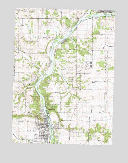
Oregon, IL USGS Topographic Map
Click on map above to begin viewing in our Map Viewer.

This topographic map contains these locations and features:
Feature Name Type Latitude Longitude GNIS ID View Map
Brooklyn School (historical)SchoolN42.0670°W89.3221°404913View Map
Byron Nuclear PlantLocaleN42.0742°W89.2822°1808196View Map
Church of the NazareneChurchN42.0145°W89.3387°1808207View Map
City of OregonCivilN42.0132°W89.3356°2396075View Map
Coon CreekStreamN42.0653°W89.3407°406531View Map
Crowell School (historical)SchoolN42.0534°W89.2573°406850View Map
Duane E Davis AirportAirportN42.1169°W89.3735°427441View Map
Ebenezer Reformed CemeteryCemeteryN42.0575°W89.2779°1808214View Map
Ebenezer Reformed ChurchChurchN42.0572°W89.2768°407746View Map
Entyre SchoolSchoolN42.0139°W89.3454°1706001View Map
Faith ChurchChurchN42.1092°W89.2529°1706000View Map
First Baptist ChurchChurchN42.0045°W89.3351°1808220View Map
First Presbyterian ChurchChurchN42.0131°W89.3343°1808223View Map
Jarrett Prairie Nature PreserveParkN42.1103°W89.2679°2013744View Map
Jefferson Elementary SchoolSchoolN42.0142°W89.3426°1808246View Map
Junction School (historical)SchoolN42.0978°W89.3279°411280View Map
Leaf RiverStreamN42.0972°W89.3223°411890View Map
Lowden State ParkParkN42.0323°W89.3265°1706006View Map
Lunn Seaplane Base (historical)AirportN42.1070°W89.3029°427093View Map
Margaret Fuller IslandIslandN42.0278°W89.3321°1706007View Map
Mill CreekStreamN42.1209°W89.2790°413551View Map
Mud CreekStreamN42.0525°W89.3471°414182View Map
Ogle CountyCivilN42.0426°W89.3207°1784894View Map
Ogle County CourthouseBuildingN42.0139°W89.3332°1808267View Map
Ogle County Sheriff's OfficeBuildingN42.0128°W89.3291°2756849View Map
OregonPopulated PlaceN42.0148°W89.3323°415165View Map
Oregon Bible CollegeSchoolN42.0164°W89.3357°1808269View Map
Oregon DamDamN42.0167°W89.3334°1692264View Map
Oregon Fire Protection District Ambulance ServiceBuildingN42.0116°W89.3292°2674022View Map
Oregon Fire Protection District Headquarters Station 1BuildingN42.0149°W89.3291°2640145View Map
Oregon Golf ClubLocaleN42.0128°W89.3193°1808270View Map
Oregon High SchoolSchoolN42.0128°W89.3423°1808271View Map
Oregon Police DepartmentBuildingN42.0152°W89.3309°2757019View Map
Oregon Post OfficePost OfficeN42.0149°W89.3342°1808272View Map
Oregon United Methodist ChurchChurchN42.0131°W89.3329°1808273View Map
Pine Rock Nature PreserveParkN42.0014°W89.2568°2013745View Map
Pleasant Grove School (historical)SchoolN42.0509°W89.2904°415815View Map
Prairie View Golf CourseLocaleN42.1125°W89.2562°1808280View Map
Riverside CemeteryCemeteryN42.0178°W89.3309°1706002View Map
Riverview CemeteryCemeteryN42.0275°W89.3401°1706003View Map
Riverview School (historical)SchoolN42.0950°W89.2962°416734View Map
Rock RiverReservoirN42.0167°W89.3334°1692265View Map
Rockvale Heights School (historical)SchoolN42.0503°W89.3723°416856View Map
Saint Brides ChurchChurchN42.0273°W89.3540°1706005View Map
Saint Mary Catholic ChurchChurchN42.0175°W89.3321°1808294View Map
Saint Mary's CemeteryCemeteryN42.1248°W89.2739°1718971View Map
Saint Marys SchoolSchoolN42.0273°W89.3523°1706004View Map
Saint Paul Lutheran ChurchChurchN42.0136°W89.3343°1808296View Map
Seitz QuarryMineN42.0167°W89.3093°1983744View Map
Silver CreekStreamN42.0622°W89.3365°418503View Map
Silver Creek SchoolSchoolN42.0859°W89.3696°418507View Map
Silver Ridge Golf CourseLocaleN42.0572°W89.3496°1808298View Map
Spring CreekStreamN42.0711°W89.3246°418934View Map
Stone School (historical)SchoolN42.1153°W89.3390°419170View Map
Sunshine ParkParkN42.1245°W89.2518°1808320View Map
Township of Oregon (historical)CivilN42.0028°W89.3468°429502View Map
Township of RockvaleCivilN42.0725°W89.3352°429661View Map
Waite SchoolSchoolN42.0728°W89.3415°420380View Map
Whitaker School (historical)SchoolN42.1034°W89.2584°421016View Map
White Oak CampgroundLocaleN42.0328°W89.3240°1808315View Map
Woodland CreekStreamN42.0981°W89.3112°421437View Map
Yost Airstrip (historical)AirportN42.0539°W89.2937°1706008View Map

Note: Coordinates in the location and feature list above are referenced to NAD83 datum.


Copyright (C) 2008-2024 Ryan Niemi / Sunset Dynamics ... All Rights Reserved