TopoQuest Logo
Do you find TopoQuest useful?
Help keep TopoQuest running and adding new maps/features by donating!
Bitcoin:  19c7KJd3qBynnjoSw5npx9KScwjBe4ifkT
Litecoin:  LXs6TkuXGGXo1vDsWCkWVdjQX94eUKd6ui
Home View Maps Find Maps Find Places Resources & Links


Sugar Grove, Arkansas Topographic Map

USGS Map Title: Sugar Grove, AR
USGS Map MRC: 35093A7
DRG (GeoTIFF) Download: o35093a7.tif


Neighboring USGS Topographic Map Quads:


  Booneville, AR  
35093B8
 

  Magazine, AR  
35093B7
 

  Blue Mountain, AR  
35093B6
 

  Golden City, AR  
35093A8
 

  Sugar Grove, AR  
35093A7
 

  Blue Mountain Dam, AR  
35093A6
 

  Bee Mountain, AR  
34093H8
 

  Freedom Mountain, AR  
34093H7
 

  Gravelly, AR  
34093H6


Map MRC Location:

N36°
W94°
N36°
W93°
H8 H7 H6 H5 H4 H3 H2 H1
G8 G7 G6 G5 G4 G3 G2 G1
F8 F7 F6 F5 F4 F3 F2 F1
E8 E7 E6 E5 E4 E3 E2 E1
D8 D7 D6 D5 D4 D3 D2 D1
C8 C7 C6 C5 C4 C3 C2 C1
B8 B7 B6 B5 B4 B3 B2 B1
A8 A7 A6 A5 A4 A3 A2 A1
N35°
W94°
N35°
W93°

Sugar Grove, AR USGS 1:24K Topographic Map Preview:
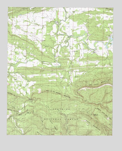
Sugar Grove, AR USGS Topographic Map
Click on map above to begin viewing in our Map Viewer.

This topographic map contains these locations and features:
Feature Name Type Latitude Longitude GNIS ID View Map
Bald KnobSummitN35.0004°W93.8383°66264View Map
Beason CoveBayN35.0973°W93.7521°64282View Map
Bethel CemeteryCemeteryN35.1212°W93.7835°64280View Map
Brown SchoolSchoolN35.0751°W93.7546°70846View Map
Buck RidgeRidgeN35.0154°W93.8260°70900View Map
Bud Davis CemeteryCemeteryN35.0490°W93.8594°64271View Map
Cedar CreekStreamN35.0887°W93.7585°71062View Map
Cold Springs Work CenterLocaleN35.0462°W93.8638°74465View Map
Dry CreekStreamN35.0756°W93.8188°71435View Map
Ethan Davis CemeteryCemeteryN35.0718°W93.8624°64272View Map
GraysonPopulated PlaceN35.0556°W93.8696°72223View Map
Grayson Volunteer Fire Department Station 1BuildingN35.0497°W93.8651°2116501View Map
Helton CemeteryCemeteryN35.0145°W93.8641°66292View Map
Hise Hill Recreation AreaParkN35.0834°W93.7730°64283View Map
Hole in the Ground MountainSummitN35.0409°W93.8283°72041View Map
Horseshoe BendBendN35.1101°W93.8169°64279View Map
Huckleberry CreekStreamN35.0259°W93.8558°72103View Map
Jack CreekStreamN35.0323°W93.8460°72159View Map
Jack Creek Recreation AreaParkN35.0343°W93.8471°64270View Map
Jack Creek Recreation SiteLocaleN35.0345°W93.8474°74463View Map
Knoppers Ford Recreation AreaLocaleN35.0195°W93.8635°74464View Map
Knoppers Ford Recreation AreaParkN35.0198°W93.8627°66299View Map
Lick CreekStreamN35.1112°W93.8199°72337View Map
Lick Creek ChurchChurchN35.0923°W93.8346°64277View Map
Lick Creek SchoolSchoolN35.0920°W93.8344°72339View Map
Logan CemeteryCemeteryN35.0723°W93.8205°64275View Map
Logan EddyFlatN35.0687°W93.8169°64274View Map
Long BranchStreamN35.0679°W93.8677°72470View Map
Middle CreekStreamN35.0312°W93.8452°72634View Map
Mixon CreekStreamN35.0723°W93.8513°72705View Map
Mountain GrovePopulated PlaceN35.0556°W93.8105°64273View Map
North Petit Jean MountainSummitN35.0229°W93.7663°66325View Map
Potts RidgeRidgeN35.1248°W93.8449°73181View Map
Ramsey CreekStreamN35.0201°W93.8041°73230View Map
Right Hand Sugar CreekStreamN35.0182°W93.8694°70398View Map
Rocky Springs CemeteryCemeteryN35.0576°W93.7957°73365View Map
Scott LakeLakeN35.0943°W93.7802°64281View Map
Shady Grove SchoolSchoolN35.1198°W93.8466°73521View Map
Smiths BranchStreamN35.0820°W93.8160°64276View Map
Sugar CreekStreamN35.0973°W93.8010°73754View Map
Sugar GrovePopulated PlaceN35.0820°W93.8013°78479View Map
Sugar Grove Fire DepartmentBuildingN35.0819°W93.8005°2117184View Map
Third BridgeBridgeN35.0968°W93.8010°64278View Map
Township of Petit JeanCivilN35.0714°W93.7655°68799View Map
Township of Sugar CreekCivilN35.0742°W93.8624°68806View Map

Note: Coordinates in the location and feature list above are referenced to NAD83 datum.


Copyright (C) 2008-2024 Ryan Niemi / Sunset Dynamics ... All Rights Reserved