TopoQuest Logo
Do you find TopoQuest useful?
Help keep TopoQuest running and adding new maps/features by donating!
Bitcoin:  19c7KJd3qBynnjoSw5npx9KScwjBe4ifkT
Litecoin:  LXs6TkuXGGXo1vDsWCkWVdjQX94eUKd6ui
Home View Maps Find Maps Find Places Resources & Links


Sugar Grove, West Virginia Topographic Map

USGS Map Title: Sugar Grove, WV
USGS Map MRC: 38079E3
DRG (GeoTIFF) Download: o38079e3.tif


Neighboring USGS Topographic Map Quads:


  Circleville, WV  
38079F4
 

  Franklin, WV  
38079F3
 

  Fort Seybert, WV  
38079F2
 

  Moatstown, WV  
38079E4
 

  Sugar Grove, WV  
38079E3
 

  Brandywine, WV  
38079E2
 

  Doe Hill, VA  
38079D4
 

  Palo Alto, VA  
38079D3
 

  Reddish Knob, VA  
38079D2


Map MRC Location:

N39°
W80°
N39°
W79°
H8 H7 H6 H5 H4 H3 H2 H1
G8 G7 G6 G5 G4 G3 G2 G1
F8 F7 F6 F5 F4 F3 F2 F1
E8 E7 E6 E5 E4 E3 E2 E1
D8 D7 D6 D5 D4 D3 D2 D1
C8 C7 C6 C5 C4 C3 C2 C1
B8 B7 B6 B5 B4 B3 B2 B1
A8 A7 A6 A5 A4 A3 A2 A1
N38°
W80°
N38°
W79°

Sugar Grove, WV USGS 1:24K Topographic Map Preview:
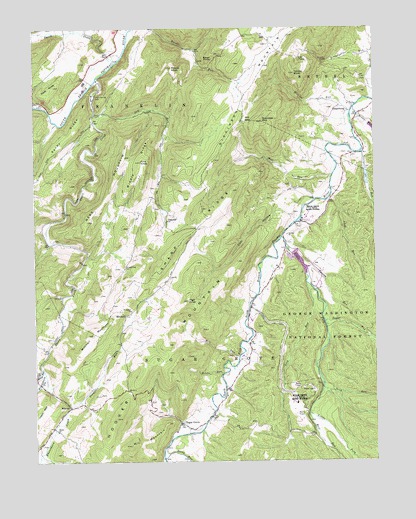
Sugar Grove, WV USGS Topographic Map
Click on map above to begin viewing in our Map Viewer.

This topographic map contains these locations and features:
Feature Name Type Latitude Longitude GNIS ID View Map
Beaver Dam SpringSpringN38.5446°W79.2956°1677805View Map
Bill RunStreamN38.5298°W79.3006°1550356View Map
Blackthorn CreekStreamN38.5254°W79.3712°1550379View Map
Calvary ChurchChurchN38.5654°W79.2820°1550585View Map
Cave KnobSummitN38.6085°W79.3673°1550655View Map
Cave SpringSpringN38.5182°W79.3692°1677800View Map
Cliff RunStreamN38.5771°W79.2653°1550724View Map
Cool HollowValleyN38.5712°W79.2814°1550783View Map
Cress SpringSpringN38.6015°W79.3525°1677814View Map
DahmerPopulated PlaceN38.5696°W79.3264°1550866View Map
Dickinson MountainRidgeN38.6229°W79.2806°1550922View Map
Dry RunStreamN38.6004°W79.3525°1550977View Map
Dry Run SpringSpringN38.5998°W79.3525°1677798View Map
Earl Kiser SpringSpringN38.5662°W79.2842°1677808View Map
Eastern DistrictCivilN38.6242°W79.2504°1928261View Map
Eckhard Farm SpringSpringN38.5362°W79.3650°1677804View Map
Falling SpringSpringN38.5715°W79.2859°1677810View Map
Flint KnobSummitN38.5865°W79.3353°1551145View Map
Franklin SpringSpringN38.6001°W79.3248°1677812View Map
George RunStreamN38.5890°W79.2545°1551220View Map
Harper Farm SpringSpringN38.5196°W79.3664°1677801View Map
High KnobSummitN38.5465°W79.3187°1551429View Map
Hiner Farm SpringSpringN38.5668°W79.3692°1677809View Map
Hiveley RunStreamN38.6007°W79.2584°1551459View Map
Hoover MountainRidgeN38.5246°W79.3359°1551489View Map
Jamison Farm SpringSpringN38.5557°W79.3581°1677806View Map
Kettle RunStreamN38.5251°W79.3056°1551644View Map
Lick RunStreamN38.5515°W79.2750°1551795View Map
Little ForkStreamN38.5643°W79.2837°1551854View Map
Little Stony RunStreamN38.5001°W79.3178°1551897View Map
Middle RidgeRidgeN38.5846°W79.3362°1552082View Map
Mill GapGapN38.5982°W79.2973°1552108View Map
Mill MountainSummitN38.5048°W79.3403°1552110View Map
Mill RunStreamN38.5857°W79.2637°1552122View Map
Miller RunStreamN38.6018°W79.2570°1552145View Map
MitchellPopulated PlaceN38.5423°W79.3414°1552166View Map
Mitchell Farm SpringSpringN38.5223°W79.3678°1677802View Map
Mitchell MountainSummitN38.5368°W79.3534°1552168View Map
MoyersPopulated PlaceN38.5160°W79.3623°1552248View Map
Naval Information Operation Command Sugar Grove Fire Department Station 6BuildingN38.5708°W79.2743°2577796View Map
Naval Information Operations Command Sugar GroveMilitaryN38.5176°W79.2827°2512339View Map
Neds MountainSummitN38.5879°W79.3414°1552284View Map
Pitzenbarger SpringSpringN38.5996°W79.3384°1677799View Map
Powder Mill SpringSpringN38.5571°W79.3553°1677807View Map
Propst Gap ChurchChurchN38.5562°W79.3414°1552564View Map
Propst KnobSummitN38.6137°W79.3242°1552565View Map
PropstburgPopulated PlaceN38.6010°W79.2592°1555418View Map
Raven RocksCliffN38.6151°W79.3109°1552590View Map
Rexrode Farm SpringSpringN38.5335°W79.3664°1677803View Map
Rexrode SpringSpringN38.5737°W79.3623°1677811View Map
Rocky RunStreamN38.5271°W79.3723°1552722View Map
Saint Lukes ChurchChurchN38.5437°W79.3398°1552771View Map
Sandy RidgeRidgeN38.5943°W79.3617°1552801View Map
Seng RunStreamN38.5210°W79.2689°1552836View Map
Sharp RidgeRidgeN38.5662°W79.3164°1552847View Map
Smith CreekStreamN38.6154°W79.3445°1552936View Map
Socrates MountainSummitN38.5982°W79.2909°1552961View Map
South Fork Structure Number 15 DamDamN38.5951°W79.2514°1559205View Map
South Fork Structure Number 16 DamDamN38.5851°W79.2531°1559206View Map
South Fork Structure Number 17 DamDamN38.5585°W79.2764°1559215View Map
South Fork Volunteer Fire DepartmentBuildingN38.5091°W79.3226°2581134View Map
Stauffles RunStreamN38.5162°W79.3625°1553044View Map
Stony RunStreamN38.5012°W79.3281°1553085View Map
Sugar GrovePopulated PlaceN38.5112°W79.3217°1553116View Map
Sugar Grove Post OfficePost OfficeN38.5110°W79.3216°2774615View Map
Sugar RunStreamN38.5404°W79.2684°1553123View Map
Thorn ChurchChurchN38.5090°W79.3667°1553216View Map
Thorn CreekStreamN38.6101°W79.3512°1553217View Map
Thorn Creek SpringSpringN38.6098°W79.3498°1677797View Map
Thorn Creek Wildlife Management AreaParkN38.5740°W79.3564°2043557View Map
Thorn SpringSpringN38.6051°W79.3531°1553610View Map
Thorny RunStreamN38.5562°W79.2759°1553227View Map
Turkey KnobSummitN38.6118°W79.2787°1553286View Map
Whitehorn CreekStreamN38.5001°W79.3748°1488322View Map
Whitehorn CreekStreamN38.5257°W79.3712°1553433View Map
Whitethorn CreekStreamN38.5254°W79.3712°1553437View Map
Wolf RunStreamN38.5140°W79.2742°1553503View Map

Note: Coordinates in the location and feature list above are referenced to NAD83 datum.


Copyright (C) 2008-2024 Ryan Niemi / Sunset Dynamics ... All Rights Reserved