TopoQuest Logo
Do you find TopoQuest useful?
Help keep TopoQuest running and adding new maps/features by donating!
Bitcoin:  19c7KJd3qBynnjoSw5npx9KScwjBe4ifkT
Litecoin:  LXs6TkuXGGXo1vDsWCkWVdjQX94eUKd6ui
Home View Maps Find Maps Find Places Resources & Links


Brandywine, West Virginia Topographic Map

USGS Map Title: Brandywine, WV
USGS Map MRC: 38079E2
DRG (GeoTIFF) Download: o38079e2.tif


Neighboring USGS Topographic Map Quads:


  Franklin, WV  
38079F3
 

  Fort Seybert, WV  
38079F2
 

  Cow Knob, VA  
38079F1
 

  Sugar Grove, WV  
38079E3
 

  Brandywine, WV  
38079E2
 

  Rawley Springs, VA  
38079E1
 

  Palo Alto, VA  
38079D3
 

  Reddish Knob, VA  
38079D2
 

  Briery Branch, VA  
38079D1


Map MRC Location:

N39°
W80°
N39°
W79°
H8 H7 H6 H5 H4 H3 H2 H1
G8 G7 G6 G5 G4 G3 G2 G1
F8 F7 F6 F5 F4 F3 F2 F1
E8 E7 E6 E5 E4 E3 E2 E1
D8 D7 D6 D5 D4 D3 D2 D1
C8 C7 C6 C5 C4 C3 C2 C1
B8 B7 B6 B5 B4 B3 B2 B1
A8 A7 A6 A5 A4 A3 A2 A1
N38°
W80°
N38°
W79°

Brandywine, WV USGS 1:24K Topographic Map Preview:
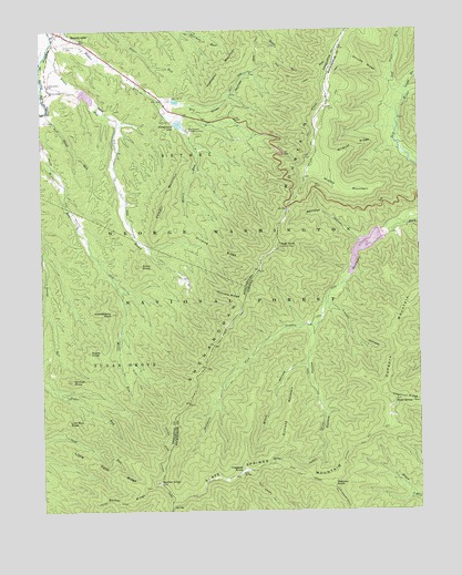
Brandywine, WV USGS Topographic Map
Click on map above to begin viewing in our Map Viewer.

This topographic map contains these locations and features:
Feature Name Type Latitude Longitude GNIS ID View Map
Bandywine Lake CampgroundLocaleN38.5971°W79.1998°1553622View Map
Block HollowValleyN38.5382°W79.1623°1481848View Map
Bother KnobSummitN38.5073°W79.2109°1481940View Map
Bother RidgeRidgeN38.5018°W79.2317°1550426View Map
Bother Ridge TrailTrailN38.5004°W79.2331°1550427View Map
BrandywinePopulated PlaceN38.6248°W79.2448°1550444View Map
Brandywine Census Designated PlaceCensusN38.6219°W79.2414°2586770View Map
Brandywine LakeReservoirN38.6007°W79.2041°1550445View Map
Brandywine Recreation AreaParkN38.5996°W79.2009°1550446View Map
Brandywine RunStreamN38.6182°W79.2486°1550447View Map
Broad RunStreamN38.6196°W79.2475°1550473View Map
Cedar Grove ChurchChurchN38.6107°W79.2473°1550662View Map
Cowger MountainSummitN38.5787°W79.2092°1554209View Map
Dam Number 13DamN38.6015°W79.2053°1557825View Map
Dam Number 27DamN38.6071°W79.2059°1557828View Map
Dividing RidgeRidgeN38.5671°W79.1909°1550931View Map
Dry River HollowValleyN38.6073°W79.2078°1550970View Map
Dundore MountainSummitN38.5298°W79.1353°1483169View Map
Dunkle HollowValleyN38.5479°W79.1605°1483174View Map
Evick KnobSummitN38.5637°W79.2170°1551073View Map
Flagpole KnobSummitN38.5098°W79.1842°1492940View Map
Granddaddy KnobSummitN38.5515°W79.2270°1551265View Map
Heavener MountainSummitN38.6215°W79.1823°1551401View Map
High KnobSummitN38.5687°W79.1706°1493083View Map
Hoovers RidgeRidgeN38.5557°W79.1878°1551490View Map
Laurel RunStreamN38.6098°W79.1289°1484725View Map
Left Hand RunStreamN38.6040°W79.2475°1551776View Map
Lick Run KnobSummitN38.5232°W79.2411°1554951View Map
Little Pond RidgeRidgeN38.5104°W79.2286°1551882View Map
Low Place RunStreamN38.6068°W79.1275°1485112View Map
Lower North River Number 81c DamDamN38.5701°W79.1364°1490818View Map
Maple SpringSpringN38.5276°W79.1331°1485175View Map
Marks KnobSummitN38.5412°W79.2342°1555049View Map
Martin Luther ChurchChurchN38.6098°W79.2464°1552004View Map
Meadow KnobSummitN38.5068°W79.1550°1493273View Map
Middle MountainSummitN38.5821°W79.1453°1493284View Map
Miller Run TrailTrailN38.5312°W79.2164°1552146View Map
Pine Hill CemeteryCemeteryN38.6209°W79.2411°1552484View Map
Railroad HollowValleyN38.5702°W79.1437°1486487View Map
Richland MountainSummitN38.5262°W79.1686°1493483View Map
Road Run TrailTrailN38.6118°W79.1661°1552682View Map
Shenandoah Wildlife Management AreaParkN38.6160°W79.2042°2043553View Map
Shriner KnobSummitN38.5343°W79.2398°1552883View Map
Skidmore Fork LakeReservoirN38.5684°W79.1429°1490819View Map
Skidmore Fork Scenic AreaParkN38.5198°W79.2059°1553623View Map
Skidmore Fork Scenic AreaParkN38.5198°W79.2059°1488811View Map
Slate Springs MountainSummitN38.5098°W79.1839°1493608View Map
Slate Springs Mountain TrailTrailN38.5073°W79.1575°1487301View Map
Smooth RidgeRidgeN38.6151°W79.1414°1487352View Map
South Fork Structure Number 13 DamDamN38.6018°W79.2064°1559203View Map
South Fork Structure Number 14 DamDamN38.6085°W79.2364°1559204View Map
South Fork Structure Number 27 DamDamN38.6068°W79.2064°1559209View Map
South Fork Volunteer Fire DepartmentBuildingN38.6204°W79.2453°2727450View Map
Switzer DamDamN38.5715°W79.1370°1488813View Map
Switzer LakeReservoirN38.5715°W79.1370°1488814View Map
Timber HollowValleyN38.5529°W79.1549°1487915View Map
Wildcat RidgeRidgeN38.5940°W79.1450°1488376View Map

Note: Coordinates in the location and feature list above are referenced to NAD83 datum.


Copyright (C) 2008-2024 Ryan Niemi / Sunset Dynamics ... All Rights Reserved