TopoQuest Logo
Do you find TopoQuest useful?
Help keep TopoQuest running and adding new maps/features by donating!
Bitcoin:  19c7KJd3qBynnjoSw5npx9KScwjBe4ifkT
Litecoin:  LXs6TkuXGGXo1vDsWCkWVdjQX94eUKd6ui
Home View Maps Find Maps Find Places Resources & Links


Sullivan, Ohio Topographic Map

USGS Map Title: Sullivan, OH
USGS Map MRC: 41082A2
DRG (GeoTIFF) Download: o41082a2.tif


Neighboring USGS Topographic Map Quads:


  Brighton, OH  
41082B3
 

  Wellington, OH  
41082B2
 

  Lagrange, OH  
41082B1
 

  Nova, OH  
41082A3
 

  Sullivan, OH  
41082A2
 

  Lodi, OH  
41082A1
 

  Ashland North, OH  
40082H3
 

  Polk, OH  
40082H2
 

  West Salem, OH  
40082H1


Map MRC Location:

N42°
W83°
N42°
W82°
H8 H7 H6 H5 H4 H3 H2 H1
G8 G7 G6 G5 G4 G3 G2 G1
F8 F7 F6 F5 F4 F3 F2 F1
E8 E7 E6 E5 E4 E3 E2 E1
D8 D7 D6 D5 D4 D3 D2 D1
C8 C7 C6 C5 C4 C3 C2 C1
B8 B7 B6 B5 B4 B3 B2 B1
A8 A7 A6 A5 A4 A3 A2 A1
N41°
W83°
N41°
W82°

Sullivan, OH USGS 1:24K Topographic Map Preview:
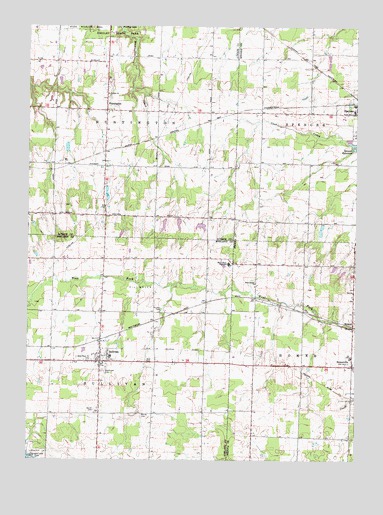
Sullivan, OH USGS Topographic Map
Click on map above to begin viewing in our Map Viewer.

This topographic map contains these locations and features:
Feature Name Type Latitude Longitude GNIS ID View Map
Black River High SchoolSchoolN41.0589°W82.1738°1038081View Map
Black River Intermediate SchoolSchoolN41.0298°W82.2182°1052655View Map
Black River Middle SchoolSchoolN41.1009°W82.1260°1058895View Map
Black River Primary SchoolSchoolN41.0295°W82.1265°1058896View Map
Centerville (historical)Populated PlaceN41.1001°W82.1424°1058894View Map
Gould CemeteryCemeteryN41.0145°W82.2243°1040985View Map
HomerPopulated PlaceN41.0448°W82.1257°1061127View Map
HomervillePopulated PlaceN41.0292°W82.1260°1064855View Map
Hubler CemeteryCemeteryN41.0429°W82.1997°1041845View Map
HuntingtonPopulated PlaceN41.1031°W82.2210°1064880View Map
Huntington Center CemeteryCemeteryN41.1041°W82.2206°1963555View Map
Huntington Post Office (historical)Post OfficeN41.1028°W82.2207°2026358View Map
Huntington Public School (historical)SchoolN41.1003°W82.2196°1069180View Map
Huntington Station (historical)LocaleN41.0889°W82.2207°1067450View Map
Huntington Township HallBuildingN41.1003°W82.2196°1059049View Map
Loretta LakeReservoirN41.0717°W82.1932°1077790View Map
Loretta Lake DamDamN41.0717°W82.1932°1077789View Map
Marsh CemeteryCemeteryN41.0153°W82.2063°1043011View Map
Newtons (historical)Populated PlaceN41.0273°W82.1499°1067471View Map
Rice CemeteryCemeteryN41.0286°W82.2042°1044968View Map
Rustic LakeReservoirN41.0717°W82.1982°1077788View Map
Rustic Lake DamDamN41.0717°W82.1982°1077787View Map
Southview CemeteryCemeteryN41.0253°W82.2207°1046509View Map
Spencer ReservoirReservoirN41.0911°W82.1265°1046521View Map
SullivanPopulated PlaceN41.0281°W82.2221°1046844View Map
Sullivan Post OfficePost OfficeN41.0278°W82.2221°1958906View Map
Sullivan Volunteer Fire Department Station 1 HeadquartersBuildingN41.0287°W82.2227°2550429View Map
Sullivan Volunteer Fire Department Station 2BuildingN41.0295°W82.2189°2549333View Map
Taylor LakeReservoirN41.0674°W82.1838°1077796View Map
Taylor Lake DamDamN41.0684°W82.1832°1077795View Map
Township of HomerCivilN41.0275°W82.1250°1086596View Map
Township of HuntingtonCivilN41.1008°W82.2204°1086512View Map
Township of SullivanCivilN41.0283°W82.2219°1085715View Map
United ChurchChurchN41.1076°W82.2204°1067033View Map
West Homer ChurchChurchN41.0534°W82.1635°1047767View Map
West Main Street CemeteryCemeteryN41.0287°W82.2257°1047779View Map

Note: Coordinates in the location and feature list above are referenced to NAD83 datum.


Copyright (C) 2008-2024 Ryan Niemi / Sunset Dynamics ... All Rights Reserved