TopoQuest Logo
Do you find TopoQuest useful?
Help keep TopoQuest running and adding new maps/features by donating!
Bitcoin:  19c7KJd3qBynnjoSw5npx9KScwjBe4ifkT
Litecoin:  LXs6TkuXGGXo1vDsWCkWVdjQX94eUKd6ui
Home View Maps Find Maps Find Places Resources & Links


Brighton, Ohio Topographic Map

USGS Map Title: Brighton, OH
USGS Map MRC: 41082B3
DRG (GeoTIFF) Download: o41082b3.tif


Neighboring USGS Topographic Map Quads:


  Berlin Heights, OH  
41082C4
 

  Kipton, OH  
41082C3
 

  Oberlin, OH  
41082C2
 

  Clarksfield, OH  
41082B4
 

  Brighton, OH  
41082B3
 

  Wellington, OH  
41082B2
 

  New London, OH  
41082A4
 

  Nova, OH  
41082A3
 

  Sullivan, OH  
41082A2


Map MRC Location:

N42°
W83°
N42°
W82°
H8 H7 H6 H5 H4 H3 H2 H1
G8 G7 G6 G5 G4 G3 G2 G1
F8 F7 F6 F5 F4 F3 F2 F1
E8 E7 E6 E5 E4 E3 E2 E1
D8 D7 D6 D5 D4 D3 D2 D1
C8 C7 C6 C5 C4 C3 C2 C1
B8 B7 B6 B5 B4 B3 B2 B1
A8 A7 A6 A5 A4 A3 A2 A1
N41°
W83°
N41°
W82°

Brighton, OH USGS 1:24K Topographic Map Preview:
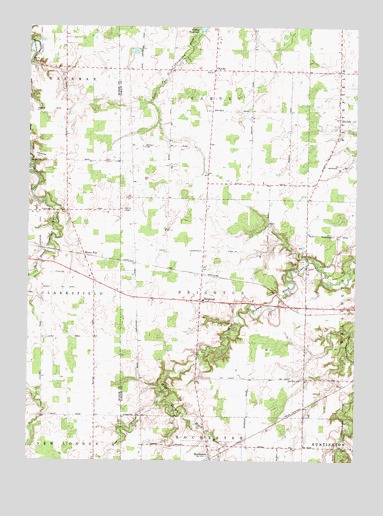
Brighton, OH USGS Topographic Map
Click on map above to begin viewing in our Map Viewer.

This topographic map contains these locations and features:
Feature Name Type Latitude Longitude GNIS ID View Map
BrightonPopulated PlaceN41.1709°W82.3096°1064492View Map
Brighton Congregational ChurchChurchN41.1714°W82.3093°1807548View Map
Brighton Post Office (historical)Post OfficeN41.1709°W82.3082°2026349View Map
Brighton Township CemeteryCemeteryN41.1678°W82.3096°1963559View Map
Brighton Township HallBuildingN41.1698°W82.3085°1059065View Map
Brighton United Methodist ChurchChurchN41.1703°W82.3093°1807549View Map
CamdenPopulated PlaceN41.2378°W82.3057°1038651View Map
Double S Farms AirportAirportN41.2054°W82.3322°1082774View Map
East CreekStreamN41.1423°W82.3254°1039982View Map
Echo Valley Golf CourseLocaleN41.1828°W82.2707°1059064View Map
Engelhardt FarmsLocaleN41.2272°W82.3589°2515265View Map
Janes School (historical)SchoolN41.1601°W82.3496°1050232View Map
Kipton ReservoirReservoirN41.2493°W82.3088°1042297View Map
Kosik Private AirportAirportN41.2383°W82.2696°1082773View Map
Old Brighton CemeteryCemeteryN41.1484°W82.2702°1963561View Map
RochesterPopulated PlaceN41.1264°W82.3052°1061618View Map
Rochester Post Office (historical)Post OfficeN41.1264°W82.3054°2026619View Map
Rochester Station CemeteryCemeteryN41.1287°W82.3077°1963563View Map
Rochester Township HallBuildingN41.1253°W82.3041°1059067View Map
Rowland School (historical)SchoolN41.1964°W82.3704°1050233View Map
Sherman CemeteryCemeteryN41.2384°W82.3643°1806325View Map
Thomas School (historical)SchoolN41.1256°W82.3302°1059068View Map
Todd School (historical)SchoolN41.2378°W82.3604°1050234View Map
Township of BrightonCivilN41.1698°W82.3053°1086502View Map
Township of CamdenCivilN41.2384°W82.3059°1086504View Map
White FoxPopulated PlaceN41.1842°W82.3535°1063090View Map
Whitefox Post Office (historical)Post OfficeN41.1848°W82.3541°2011580View Map
Ziegler School (historical)SchoolN41.1484°W82.2966°1059066View Map

Note: Coordinates in the location and feature list above are referenced to NAD83 datum.


Copyright (C) 2008-2024 Ryan Niemi / Sunset Dynamics ... All Rights Reserved