TopoQuest Logo
Do you find TopoQuest useful?
Help keep TopoQuest running and adding new maps/features by donating!
Bitcoin:  19c7KJd3qBynnjoSw5npx9KScwjBe4ifkT
Litecoin:  LXs6TkuXGGXo1vDsWCkWVdjQX94eUKd6ui
Home View Maps Find Maps Find Places Resources & Links


Wellington, Ohio Topographic Map

USGS Map Title: Wellington, OH
USGS Map MRC: 41082B2
DRG (GeoTIFF) Download: o41082b2.tif


Neighboring USGS Topographic Map Quads:


  Kipton, OH  
41082C3
 

  Oberlin, OH  
41082C2
 

  Grafton, OH  
41082C1
 

  Brighton, OH  
41082B3
 

  Wellington, OH  
41082B2
 

  Lagrange, OH  
41082B1
 

  Nova, OH  
41082A3
 

  Sullivan, OH  
41082A2
 

  Lodi, OH  
41082A1


Map MRC Location:

N42°
W83°
N42°
W82°
H8 H7 H6 H5 H4 H3 H2 H1
G8 G7 G6 G5 G4 G3 G2 G1
F8 F7 F6 F5 F4 F3 F2 F1
E8 E7 E6 E5 E4 E3 E2 E1
D8 D7 D6 D5 D4 D3 D2 D1
C8 C7 C6 C5 C4 C3 C2 C1
B8 B7 B6 B5 B4 B3 B2 B1
A8 A7 A6 A5 A4 A3 A2 A1
N41°
W83°
N41°
W82°

Wellington, OH USGS 1:24K Topographic Map Preview:
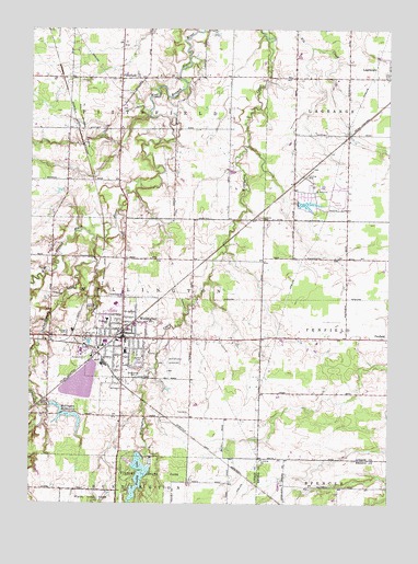
Wellington, OH USGS Topographic Map
Click on map above to begin viewing in our Map Viewer.

This topographic map contains these locations and features:
Feature Name Type Latitude Longitude GNIS ID View Map
Brookside Mobile Home ParkPopulated PlaceN41.1803°W82.2136°2515513View Map
Charlemont CreekStreamN41.1945°W82.2282°1039001View Map
Church of ChristChurchN41.1756°W82.2146°1807550View Map
Church of the NazareneChurchN41.1698°W82.2110°1807551View Map
East CemeteryCemeteryN41.2378°W82.2129°1963550View Map
Findley LakeReservoirN41.1384°W82.2082°1070746View Map
Findley Lake DamDamN41.1379°W82.2109°1078379View Map
Findley State ParkParkN41.1270°W82.2068°1040443View Map
First Baptist ChurchChurchN41.1673°W82.2099°1807552View Map
First Congregational ChurchChurchN41.1664°W82.2179°1807553View Map
Greenwood CemeteryCemeteryN41.1595°W82.2138°1041171View Map
Jackson CemeteryCemeteryN41.2000°W82.1693°1042025View Map
La Grange CemeteryCemeteryN41.2381°W82.1260°1963556View Map
Lorain County FairgroundsLocaleN41.1642°W82.2299°1059060View Map
McCormick Elementary SchoolSchoolN41.1651°W82.2165°1059062View Map
New Life Assembly of God ChurchChurchN41.1692°W82.2249°1807554View Map
Pheasant Run Airport (historical)AirportN41.2114°W82.1538°1082777View Map
Pheasant Run Census Designated PlaceCensusN41.2072°W82.1481°2633217View Map
Pheasant Run VillagePopulated PlaceN41.2062°W82.1532°1059059View Map
Pioneer CemeteryCemeteryN41.1684°W82.2227°1963562View Map
PittsfieldPopulated PlaceN41.2370°W82.2190°1061546View Map
Pittsfield Post Office (historical)Post OfficeN41.2376°W82.2193°2026410View Map
Pittsfield United ChurchChurchN41.2364°W82.2193°1807556View Map
Ponderosa Pines LakeReservoirN41.2038°W82.1533°1077802View Map
Ponderosa Pines Lake DamDamN41.2042°W82.1567°1077801View Map
Reader-Botsford AirportAirportN41.1654°W82.2009°1083101View Map
Saint Patricks ChurchChurchN41.1742°W82.2171°1069187View Map
Smith's Mobile Home ParkPopulated PlaceN41.1953°W82.2175°2515528View Map
South Lorain County AmbulanceBuildingN41.1688°W82.2141°2550729View Map
South Pittsfield CemeteryCemeteryN41.2287°W82.2185°1963565View Map
Township of PittsfieldCivilN41.2363°W82.2179°1086517View Map
Township of WellingtonCivilN41.1687°W82.2191°1086523View Map
Village of WellingtonCivilN41.1610°W82.2267°2400122View Map
WellingtonPopulated PlaceN41.1689°W82.2179°1047670View Map
Wellington Center Historic DistrictParkN41.1687°W82.2177°1069190View Map
Wellington Community Fire DistrictBuildingN41.1704°W82.2189°2549784View Map
Wellington Community Fire District Station 1BuildingN41.1680°W82.2166°2550602View Map
Wellington Community HospitalHospitalN41.1648°W82.2082°1059061View Map
Wellington Community Hospital HeliportAirportN41.1620°W82.2082°1083102View Map
Wellington High SchoolSchoolN41.1776°W82.2202°1059063View Map
Wellington Historic DistrictParkN41.1639°W82.2177°1069191View Map
Wellington Mobile Home ParkPopulated PlaceN41.1797°W82.2186°2515519View Map
Wellington Police DepartmentBuildingN41.1678°W82.2169°2732710View Map
Wellington Post OfficePost OfficeN41.1695°W82.2179°2026362View Map
Wellington Reservoir Number TwoReservoirN41.1501°W82.2432°1078942View Map
Wellington Reservoir Number Two DamDamN41.1501°W82.2432°1078941View Map
Wellington ReservoirsReservoirN41.1512°W82.2429°1047671View Map
Wellington Upground ReservoirReservoirN41.1501°W82.2332°1078967View Map
Wellington Upground Reservoir DamDamN41.1501°W82.2332°1078966View Map
West Lake ParkParkN41.1676°W82.2288°1047772View Map
Westwood Elementary SchoolSchoolN41.1737°W82.2229°1082051View Map

Note: Coordinates in the location and feature list above are referenced to NAD83 datum.


Copyright (C) 2008-2025 Ryan Niemi / Sunset Dynamics ... All Rights Reserved