TopoQuest Logo
Do you find TopoQuest useful?
Help keep TopoQuest running and adding new maps/features by donating!
Bitcoin:  19c7KJd3qBynnjoSw5npx9KScwjBe4ifkT
Litecoin:  LXs6TkuXGGXo1vDsWCkWVdjQX94eUKd6ui
Home View Maps Find Maps Find Places Resources & Links


Blessing, Texas Topographic Map

USGS Map Title: Blessing, TX
USGS Map MRC: 28096G2
DRG (GeoTIFF) Download: o28096g2.tif


Neighboring USGS Topographic Map Quads:


  Francitas NE, TX  
28096H3
 

  Midfield, TX  
28096H2
 

  Markham, TX  
28096H1
 

  Francitas, TX  
28096G3
 

  Blessing, TX  
28096G2
 

  Blessing SE, TX  
28096G1
 

  Turtle Bay, TX  
28096F3
 

  Palacios, TX  
28096F2
 

  Palacios NE, TX  
28096F1


Map MRC Location:

N29°
W97°
N29°
W96°
H8 H7 H6 H5 H4 H3 H2 H1
G8 G7 G6 G5 G4 G3 G2 G1
F8 F7 F6 F5 F4 F3 F2 F1
E8 E7 E6 E5 E4 E3 E2 E1
D8 D7 D6 D5 D4 D3 D2 D1
C8 C7 C6 C5 C4 C3 C2 C1
B8 B7 B6 B5 B4 B3 B2 B1
A8 A7 A6 A5 A4 A3 A2 A1
N28°
W97°
N28°
W96°

Blessing, TX USGS 1:24K Topographic Map Preview:
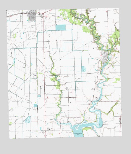
Blessing, TX USGS Topographic Map
Click on map above to begin viewing in our Map Viewer.

This topographic map contains these locations and features:
Feature Name Type Latitude Longitude GNIS ID View Map
Ashby CemeteryCemeteryN28.8344°W96.1339°1351309View Map
BlessingPopulated PlaceN28.8714°W96.2180°1372631View Map
Blessing CemeteryCemeteryN28.8594°W96.2227°1352416View Map
Blessing Census Designated PlaceCensusN28.8728°W96.2172°2407862View Map
Blessing Elementary SchoolSchoolN28.8708°W96.2105°2007741View Map
Blessing Post OfficePost OfficeN28.8721°W96.2232°2731476View Map
Blessing SchoolSchoolN28.8708°W96.2102°1352417View Map
Blessing Volunteer Fire DepartmentBuildingN28.8731°W96.2200°2552277View Map
Briar CreekStreamN28.8653°W96.1608°1352864View Map
Cashs CreekStreamN28.7586°W96.1802°1353923View Map
Grimes CemeteryCemeteryN28.8608°W96.1608°1358450View Map
Hotel BlessingBuildingN28.8444°W96.2225°2031027View Map
Johnsons Timber SloughStreamN28.7742°W96.1483°1360354View Map
KMKS-FM (Bay City)TowerN28.7967°W96.1550°1385771View Map
KXGJ-FM (Bay City)TowerN28.8436°W96.2075°1385770View Map
PheasantPopulated PlaceN28.8017°W96.2180°1380353View Map
Prairie Center MissionChurchN28.8075°W96.1752°1365713View Map
Tres Palacios Oaks Volunteer Fire DepartmentBuildingN28.8671°W96.2017°2334286View Map
Tres Palacios RiverStreamN28.7578°W96.1727°1372212View Map
Willow Dam SloughStreamN28.7611°W96.1586°1371648View Map
Wilson CreekStreamN28.8344°W96.1355°1371714View Map

Note: Coordinates in the location and feature list above are referenced to NAD83 datum.


Copyright (C) 2008-2025 Ryan Niemi / Sunset Dynamics ... All Rights Reserved