TopoQuest Logo
Do you find TopoQuest useful?
Help keep TopoQuest running and adding new maps/features by donating!
Bitcoin:  19c7KJd3qBynnjoSw5npx9KScwjBe4ifkT
Litecoin:  LXs6TkuXGGXo1vDsWCkWVdjQX94eUKd6ui
Home View Maps Find Maps Find Places Resources & Links


Summerville NW, South Carolina Topographic Map

USGS Map Title: Summerville NW, SC
USGS Map MRC: 33080B2
DRG (GeoTIFF) Download: o33080b2.tif


Neighboring USGS Topographic Map Quads:


  Sandridge, SC  
33080C3
 

  Cross, SC  
33080C2
 

  Chicora, SC  
33080C1
 

  Pringletown, SC  
33080B3
 

  Summerville NW, SC  
33080B2
 

  Moncks Corner, SC  
33080B1
 

  Ridgeville, SC  
33080A3
 

  Summerville, SC  
33080A2
 

  Mount Holly, SC  
33080A1


Map MRC Location:

N34°
W81°
N34°
W80°
H8 H7 H6 H5 H4 H3 H2 H1
G8 G7 G6 G5 G4 G3 G2 G1
F8 F7 F6 F5 F4 F3 F2 F1
E8 E7 E6 E5 E4 E3 E2 E1
D8 D7 D6 D5 D4 D3 D2 D1
C8 C7 C6 C5 C4 C3 C2 C1
B8 B7 B6 B5 B4 B3 B2 B1
A8 A7 A6 A5 A4 A3 A2 A1
N33°
W81°
N33°
W80°

Summerville NW, SC USGS 1:24K Topographic Map Preview:
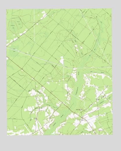
Summerville NW, SC USGS Topographic Map
Click on map above to begin viewing in our Map Viewer.

This topographic map contains these locations and features:
Feature Name Type Latitude Longitude GNIS ID View Map
Big RunStreamN33.1971°W80.1579°1220728View Map
Black CreekStreamN33.1971°W80.1579°1220762View Map
Black Tom (historical)Populated PlaceN33.1335°W80.1484°1234435View Map
Black Tom School (historical)SchoolN33.1432°W80.1426°1234436View Map
Blanton CemeteryCemeteryN33.1341°W80.2034°1234437View Map
Canaan ChurchChurchN33.1599°W80.1429°1247133View Map
Caton BaySwampN33.2067°W80.2425°1247191View Map
Caton CreekStreamN33.1727°W80.1648°1221408View Map
Ditch BaySwampN33.2364°W80.2346°1222032View Map
J Ballentine PondReservoirN33.1614°W80.1610°1238725View Map
LebanonPopulated PlaceN33.1410°W80.2148°1234539View Map
Lebanon CemeteryCemeteryN33.1410°W80.2154°1234540View Map
Lebanon ChurchChurchN33.1410°W80.2151°1246317View Map
Lebanon Fire DepartmentBuildingN33.1393°W80.2146°2368396View Map
Long RidgePopulated PlaceN33.1424°W80.1609°1234544View Map
Long RidgeRidgeN33.1633°W80.1328°1224184View Map
Long Ridge School (historical)SchoolN33.1496°W80.1440°1234545View Map
Longridge Fire DepartmentBuildingN33.1673°W80.1370°2368150View Map
Mill BranchStreamN33.1557°W80.2043°1224499View Map
Mill BranchStreamN33.1827°W80.1631°1224518View Map
Mosquito BaySwampN33.2328°W80.2396°1224668View Map
Omoooo Community Care CenterBuildingN33.1644°W80.1752°2489932View Map
Partridge CreekStreamN33.1443°W80.1815°1225312View Map
Rudd BranchStreamN33.1557°W80.2043°1226062View Map
Rudd CemeteryCemeteryN33.1518°W80.2095°1250483View Map
Saint James ChurchChurchN33.1399°W80.1615°1226113View Map
Sandy Run (historical)Populated PlaceN33.1307°W80.1704°1234618View Map
Simmons BaySwampN33.1580°W80.1369°1226628View Map
South Carolina Noname 08045 D-3465 DamDamN33.1602°W80.1615°1238724View Map
Wassamassaw (historical)Populated PlaceN33.1496°W80.1623°1234665View Map
Wassamassaw Baptist ChurchChurchN33.1499°W80.1623°1251334View Map
Wassamassaw CemeteryCemeteryN33.1499°W80.1623°1234664View Map
Wassamassaw SwampSwampN33.1789°W80.1624°1251335View Map

Note: Coordinates in the location and feature list above are referenced to NAD83 datum.


Copyright (C) 2008-2024 Ryan Niemi / Sunset Dynamics ... All Rights Reserved