TopoQuest Logo
Do you find TopoQuest useful?
Help keep TopoQuest running and adding new maps/features by donating!
Bitcoin:  19c7KJd3qBynnjoSw5npx9KScwjBe4ifkT
Litecoin:  LXs6TkuXGGXo1vDsWCkWVdjQX94eUKd6ui
Home View Maps Find Maps Find Places Resources & Links


Sandridge, South Carolina Topographic Map

USGS Map Title: Sandridge, SC
USGS Map MRC: 33080C3
DRG (GeoTIFF) Download: o33080c3.tif


Neighboring USGS Topographic Map Quads:


  Vance, SC  
33080D4
 

  Eutawville, SC  
33080D3
 

  Eadytown, SC  
33080D2
 

  Holly Hill, SC  
33080C4
 

  Sandridge, SC  
33080C3
 

  Cross, SC  
33080C2
 

  Harleyville, SC  
33080B4
 

  Pringletown, SC  
33080B3
 

  Summerville NW, SC  
33080B2


Map MRC Location:

N34°
W81°
N34°
W80°
H8 H7 H6 H5 H4 H3 H2 H1
G8 G7 G6 G5 G4 G3 G2 G1
F8 F7 F6 F5 F4 F3 F2 F1
E8 E7 E6 E5 E4 E3 E2 E1
D8 D7 D6 D5 D4 D3 D2 D1
C8 C7 C6 C5 C4 C3 C2 C1
B8 B7 B6 B5 B4 B3 B2 B1
A8 A7 A6 A5 A4 A3 A2 A1
N33°
W81°
N33°
W80°

Sandridge, SC USGS 1:24K Topographic Map Preview:
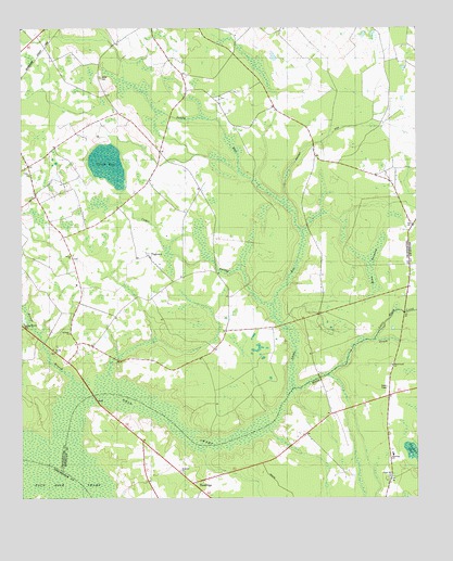
Sandridge, SC USGS Topographic Map
Click on map above to begin viewing in our Map Viewer.

This topographic map contains these locations and features:
Feature Name Type Latitude Longitude GNIS ID View Map
Antioch ChurchChurchN33.3182°W80.2509°1234265View Map
Bethany ChurchChurchN33.2941°W80.3598°1246758View Map
Bethel School (historical)SchoolN33.3085°W80.3565°1242517View Map
Bilton Chapel (historical)ChurchN33.3027°W80.2637°1242520View Map
Black CreekPopulated PlaceN33.2849°W80.2576°1234275View Map
Black CreekStreamN33.2791°W80.2893°1220766View Map
Black Creek ChurchChurchN33.2852°W80.2576°1246899View Map
Blaco Creek CemeteryCemeteryN33.2854°W80.2581°1234276View Map
Bright Church (historical)ChurchN33.2946°W80.3106°1242533View Map
Bright School (historical)SchoolN33.2946°W80.3106°1242534View Map
Briner BranchStreamN33.2799°W80.3579°1220964View Map
Briner ChurchChurchN33.2899°W80.3648°1246990View Map
Cedar SwampStreamN33.3013°W80.2956°1221468View Map
Church of Christ (historical)ChurchN33.3049°W80.2531°1242570View Map
Crosswinds-Wilson Private AirportAirportN33.2719°W80.2562°1251884View Map
Dean SwampStreamN33.2660°W80.3609°1221963View Map
EbenezerPopulated PlaceN33.2560°W80.3248°1234297View Map
Ebenezer ChurchChurchN33.2577°W80.3248°1222214View Map
Ebenezer School (historical)SchoolN33.2577°W80.3251°1234298View Map
Eutawville Fire Department Wesgar StationBuildingN33.3094°W80.2798°2578850View Map
Galbrigar School (historical)SchoolN33.3085°W80.3234°1242632View Map
Galilee ChurchChurchN33.3146°W80.3584°1222627View Map
HussertownPopulated PlaceN33.2557°W80.2581°1234321View Map
Joiner CemeteryCemeteryN33.3621°W80.3501°1223623View Map
Little Black CreekStreamN33.2924°W80.2631°1223958View Map
Moon SavannaSwampN33.3078°W80.2638°1224634View Map
Poplar Hill ChurchChurchN33.2557°W80.2581°1225623View Map
Powell Bay School (historical)SchoolN33.3138°W80.2768°1242783View Map
Pressley CemeteryCemeteryN33.3179°W80.2509°1234363View Map
Saint Paul School (historical)SchoolN33.3663°W80.2551°1242827View Map
Saint Paul School (historical)SchoolN33.3377°W80.2679°1242828View Map
SandridgePopulated PlaceN33.2552°W80.3159°1250758View Map
Sandridge SchoolSchoolN33.2616°W80.2573°1250759View Map
Sandy RunStreamN33.2791°W80.2895°1226384View Map
Spring Branch CemeteryCemeteryN33.2963°W80.3745°1226813View Map
Stutz School (historical)SchoolN33.3488°W80.2601°1242865View Map
Toney BayLakeN33.3388°W80.3474°1227174View Map
TugtownPopulated PlaceN33.3146°W80.3348°1227225View Map
Unity ChurchChurchN33.3363°W80.3723°1227314View Map
Unity School (historical)SchoolN33.3368°W80.3723°1242881View Map
Vandore BaySwampN33.2624°W80.2512°1227334View Map

Note: Coordinates in the location and feature list above are referenced to NAD83 datum.


Copyright (C) 2008-2025 Ryan Niemi / Sunset Dynamics ... All Rights Reserved