TopoQuest Logo
Do you find TopoQuest useful?
Help keep TopoQuest running and adding new maps/features by donating!
Bitcoin:  19c7KJd3qBynnjoSw5npx9KScwjBe4ifkT
Litecoin:  LXs6TkuXGGXo1vDsWCkWVdjQX94eUKd6ui
Home View Maps Find Maps Find Places Resources & Links


Ridgeville, South Carolina Topographic Map

USGS Map Title: Ridgeville, SC
USGS Map MRC: 33080A3
DRG (GeoTIFF) Download: o33080a3.tif


Neighboring USGS Topographic Map Quads:


  Harleyville, SC  
33080B4
 

  Pringletown, SC  
33080B3
 

  Summerville NW, SC  
33080B2
 

  Maple Cane Swamp, SC  
33080A4
 

  Ridgeville, SC  
33080A3
 

  Summerville, SC  
33080A2
 

  Cottageville, SC  
32080H4
 

  Clubhouse Crossroads, SC  
32080H3
 

  Stallsville, SC  
32080H2


Map MRC Location:

N34°
W81°
N34°
W80°
H8 H7 H6 H5 H4 H3 H2 H1
G8 G7 G6 G5 G4 G3 G2 G1
F8 F7 F6 F5 F4 F3 F2 F1
E8 E7 E6 E5 E4 E3 E2 E1
D8 D7 D6 D5 D4 D3 D2 D1
C8 C7 C6 C5 C4 C3 C2 C1
B8 B7 B6 B5 B4 B3 B2 B1
A8 A7 A6 A5 A4 A3 A2 A1
N33°
W81°
N33°
W80°

Ridgeville, SC USGS 1:24K Topographic Map Preview:
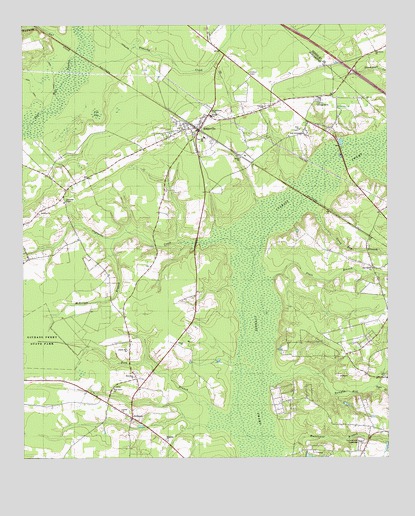
Ridgeville, SC USGS Topographic Map
Click on map above to begin viewing in our Map Viewer.

This topographic map contains these locations and features:
Feature Name Type Latitude Longitude GNIS ID View Map
Atlantic Industrial Park ALocaleN33.0616°W80.2896°2489466View Map
Atlantic Industrial Park BLocaleN33.0640°W80.2831°2489467View Map
Atlantic Industrial Park CLocaleN33.0631°W80.2724°2489468View Map
Bethel African Methodist Episcopal Church SouthChurchN33.0985°W80.3201°2490113View Map
Bethel ChurchChurchN33.0868°W80.3001°1246775View Map
Camel United Methodist ChurchChurchN33.0547°W80.2556°2490115View Map
Campbell Thicket School (historical)SchoolN33.0868°W80.3004°1241059View Map
Captains CreekStreamN33.0574°W80.2959°1221350View Map
Cat BaySwampN33.0996°W80.3493°1221390View Map
Chapel Ridge FarmLocaleN33.0536°W80.3500°2652429View Map
Clay Hill Middle SchoolSchoolN33.0926°W80.3126°1247304View Map
Cummings ChapelChurchN33.0738°W80.3598°1221873View Map
Cummings Chapel CemeteryCemeteryN33.0738°W80.3595°1248778View Map
Cypress CampgroundLocaleN33.1035°W80.2737°1247469View Map
Cypress CemeteryCemeteryN33.1021°W80.2918°1241076View Map
Cypress ChurchChurchN33.1016°W80.2915°1251810View Map
Cypress SwampSwampN33.0357°W80.2916°1221909View Map
GivhansPopulated PlaceN33.0116°W80.3376°1245748View Map
Green Bay BranchStreamN33.0702°W80.2743°1222864View Map
Halfway Gut CreekStreamN33.1174°W80.3565°1222982View Map
Hurricane BranchStreamN33.0029°W80.2859°1223408View Map
Inabinetts (historical)Populated PlaceN33.1104°W80.3429°1241126View Map
Laurence (historical)Populated PlaceN33.0638°W80.2562°1241138View Map
Liberty Hill ChurchChurchN33.0313°W80.3390°1223888View Map
Lieber Correctional InstitutionBuildingN33.0866°W80.2900°2489672View Map
Lieber Correctional Institution InfirmaryHospitalN33.0869°W80.2890°2640068View Map
MagnoliaChurchN33.0054°W80.3262°1224264View Map
McKeown BranchStreamN33.0635°W80.3434°1224414View Map
Negro BranchStreamN33.0204°W80.2543°1224948View Map
New Bethel ChurchChurchN33.0546°W80.2551°1224957View Map
New Hope ChurchChurchN33.0235°W80.3368°1224984View Map
New Jerusalem ChurchChurchN33.0935°W80.2790°1225001View Map
Oak Grove ChurchChurchN33.1174°W80.2537°1225099View Map
Old Fort Fire Department Station 6BuildingN33.0120°W80.3390°2368248View Map
Pine Grove ChurchChurchN33.0202°W80.3440°1250096View Map
Pine Hill School (historical)SchoolN33.0302°W80.2559°1241170View Map
Platt BranchStreamN33.0513°W80.2898°1225524View Map
RidgevillePopulated PlaceN33.0957°W80.3154°1250386View Map
Ridgeville Baptist ChurchChurchN33.0954°W80.3179°1241179View Map
Ridgeville DivisionCivilN33.0320°W80.3416°1938401View Map
Ridgeville Fire Department Station 8BuildingN33.0846°W80.3453°2368243View Map
Ridgeville Fire Department Substation 18BuildingN33.0990°W80.3115°2368158View Map
Ridgeville Lookout TowerTowerN33.1113°W80.2970°1241180View Map
Ridgeville Police DepartmentBuildingN33.0992°W80.3106°2334892View Map
Ridgeville Post OfficePost OfficeN33.0969°W80.3124°2489880View Map
Rumphs Hill CreekStreamN33.0232°W80.2870°1226070View Map
Saint Johns ChurchChurchN33.0716°W80.3687°1226149View Map
Scotch Range EstatesPopulated PlaceN33.0166°W80.2845°1241209View Map
Silver Hill School (historical)SchoolN33.0818°W80.3662°1241216View Map
Summerset AcresPopulated PlaceN33.0313°W80.2773°1241233View Map
Summerville AirportAirportN33.0635°W80.2766°1251974View Map
Summerville SpeedwayLocaleN33.0052°W80.2595°1242478View Map
Timothy CreekStreamN33.1132°W80.3495°1227151View Map
Ting BranchStreamN33.0154°W80.3118°1227154View Map
Town of RidgevilleCivilN33.0900°W80.3072°2407217View Map
Trinity ChurchChurchN33.0141°W80.3412°1251203View Map
Twin LakesPopulated PlaceN33.0024°W80.2745°1241253View Map
Zion ChurchChurchN33.0949°W80.2798°1227752View Map
Zion Pilgrim Christian ChurchChurchN33.0949°W80.2799°2490156View Map

Note: Coordinates in the location and feature list above are referenced to NAD83 datum.


Copyright (C) 2008-2024 Ryan Niemi / Sunset Dynamics ... All Rights Reserved