TopoQuest Logo
Do you find TopoQuest useful?
Help keep TopoQuest running and adding new maps/features by donating!
Bitcoin:  19c7KJd3qBynnjoSw5npx9KScwjBe4ifkT
Litecoin:  LXs6TkuXGGXo1vDsWCkWVdjQX94eUKd6ui
Home View Maps Find Maps Find Places Resources & Links


Summit, Utah Topographic Map

USGS Map Title: Summit, UT
USGS Map MRC: 37112G8
DRG (GeoTIFF) Download: o37112g8.tif


Neighboring USGS Topographic Map Quads:


  Enoch NE, UT  
37113H1
 

  Parowan Gap, UT  
37112H8
 

  Paragonah, UT  
37112H7
 

  Enoch, UT  
37113G1
 

  Summit, UT  
37112G8
 

  Parowan, UT  
37112G7
 

  Cedar City, UT  
37113F1
 

  Flanigan Arch, UT  
37112F8
 

  Brian Head, UT  
37112F7


Map MRC Location:

N38°
W113°
N38°
W112°
H8 H7 H6 H5 H4 H3 H2 H1
G8 G7 G6 G5 G4 G3 G2 G1
F8 F7 F6 F5 F4 F3 F2 F1
E8 E7 E6 E5 E4 E3 E2 E1
D8 D7 D6 D5 D4 D3 D2 D1
C8 C7 C6 C5 C4 C3 C2 C1
B8 B7 B6 B5 B4 B3 B2 B1
A8 A7 A6 A5 A4 A3 A2 A1
N37°
W113°
N37°
W112°

Summit, UT USGS 1:24K Topographic Map Preview:
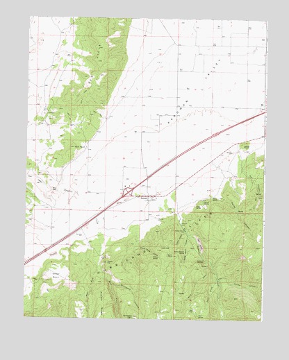
Summit, UT USGS Topographic Map
Click on map above to begin viewing in our Map Viewer.

This topographic map contains these locations and features:
Feature Name Type Latitude Longitude GNIS ID View Map
Cedar PeakSummitN37.7786°W112.9305°1426472View Map
Cheney SpringSpringN37.7761°W112.9302°1426548View Map
Cheney Spring CanyonValleyN37.7847°W112.9416°1426549View Map
Cinder HillSummitN37.7733°W112.9569°1426635View Map
Dalley CanyonValleyN37.8008°W112.8988°1427189View Map
Deer CreekStreamN37.7669°W112.8994°1427302View Map
Deer LakeLakeN37.7540°W112.9112°1427309View Map
Deer SpringSpringN37.7515°W112.9089°1427320View Map
East Fork Braffits CreekStreamN37.7730°W112.9611°1440791View Map
Elliker BasinBasinN37.7680°W112.9841°1427801View Map
First SpringSpringN37.7969°W112.9111°1427951View Map
Goat LedgesBenchN37.7816°W112.9086°1428212View Map
Parowan Front Wildlife Management AreaParkN37.7878°W112.9244°1448814View Map
Red CanyonValleyN37.8122°W112.8869°1431618View Map
Red PeakSummitN37.8214°W112.9752°1431678View Map
Second MoundSummitN37.8222°W112.8872°1432300View Map
Second SpringSpringN37.7986°W112.9073°1432303View Map
Spirit CanyonValleyN37.7872°W112.9169°1432799View Map
Spirit PeakSummitN37.7764°W112.9227°1432800View Map
Spring Branch CanyonValleyN37.7853°W112.9149°1445976View Map
Spring Branch SpringSpringN37.7779°W112.9166°1432815View Map
Squaw HollowValleyN37.7669°W112.8974°1446077View Map
Strawberry CanyonValleyN37.7644°W112.9555°1446177View Map
Strawberry PointCliffN37.7511°W112.9430°1433009View Map
SummitPopulated PlaceN37.8011°W112.9363°1433054View Map
Summit Census Designated PlaceCensusN37.8014°W112.9350°2629954View Map
Summit City CemeteryCemeteryN37.8055°W112.9397°1437377View Map
Summit CreekStreamN37.7972°W112.9297°1446236View Map
Summit NarrowsGapN37.7744°W112.9063°1433056View Map
Summit Post OfficePost OfficeN37.8009°W112.9357°2767343View Map
The Church of Jesus Christ of Latter Day SaintsChurchN37.8014°W112.9349°1437078View Map
Third SpringSpringN37.8004°W112.9024°1433461View Map
West Fork Braffits CreekStreamN37.7730°W112.9611°1447133View Map
West Fork Summit CreekStreamN37.7733°W112.9024°1447155View Map
Winn GapGapN37.8033°W112.9863°1434405View Map

Note: Coordinates in the location and feature list above are referenced to NAD83 datum.


Copyright (C) 2008-2025 Ryan Niemi / Sunset Dynamics ... All Rights Reserved