TopoQuest Logo
Do you find TopoQuest useful?
Help keep TopoQuest running and adding new maps/features by donating!
Bitcoin:  19c7KJd3qBynnjoSw5npx9KScwjBe4ifkT
Litecoin:  LXs6TkuXGGXo1vDsWCkWVdjQX94eUKd6ui
Home View Maps Find Maps Find Places Resources & Links


Sunbeam, Virginia Topographic Map

USGS Map Title: Sunbeam, VA
USGS Map MRC: 36077E1
DRG (GeoTIFF) Download: o36077e1.tif


Neighboring USGS Topographic Map Quads:


  Capron, VA  
36077F2
 

  Courtland, VA  
36077F1
 

  Franklin, VA  
36076F8
 

  Boykins, VA  
36077E2
 

  Sunbeam, VA  
36077E1
 

  Riverdale, VA  
36076E8
 

  Conway, NC  
36077D2
 

  Murfreesboro, NC  
36077D1
 

  Winton, NC  
36076D8


Map MRC Location:

N37°
W78°
N37°
W77°
H8 H7 H6 H5 H4 H3 H2 H1
G8 G7 G6 G5 G4 G3 G2 G1
F8 F7 F6 F5 F4 F3 F2 F1
E8 E7 E6 E5 E4 E3 E2 E1
D8 D7 D6 D5 D4 D3 D2 D1
C8 C7 C6 C5 C4 C3 C2 C1
B8 B7 B6 B5 B4 B3 B2 B1
A8 A7 A6 A5 A4 A3 A2 A1
N36°
W78°
N36°
W77°

Sunbeam, VA USGS 1:24K Topographic Map Preview:
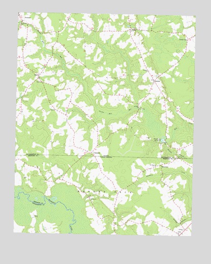
Sunbeam, VA USGS Topographic Map
Click on map above to begin viewing in our Map Viewer.

This topographic map contains these locations and features:
Feature Name Type Latitude Longitude GNIS ID View Map
Barnes ChurchChurchN36.5857°W77.1075°1462801View Map
Black Jack CemeteryCemeteryN36.5440°W77.0111°1463486View Map
Britts StoreLocaleN36.5402°W77.0219°981924View Map
Buckhorn ChurchChurchN36.5038°W77.0052°982139View Map
Cedar Dell School (historical)SchoolN36.5593°W77.0850°1738975View Map
ComoPopulated PlaceN36.5015°W77.0094°1025253View Map
Como Post OfficePost OfficeN36.5013°W77.0065°2505349View Map
Como Volunteer Fire and Emergency Medical ServicesBuildingN36.5013°W77.0065°2638961View Map
Darden Mill RunStreamN36.5707°W77.0361°1465602View Map
Drakes CornerPopulated PlaceN36.6118°W77.0044°1499356View Map
Harts BridgeBridgeN36.5715°W77.0386°1467800View Map
Hollywood CemeteryCemeteryN36.6182°W77.1227°1468165View Map
Hunts ChurchChurchN36.5704°W77.0975°1468407View Map
Hunts School (historical)SchoolN36.5971°W77.0789°1738998View Map
Martin Airport (historical)AirportN36.5007°W77.1111°997840View Map
Monroe Chapel (historical)ChurchN36.6040°W77.0064°1739008View Map
Mount Gilead ChurchChurchN36.5727°W77.0386°1470872View Map
Mount Horeb ChurchChurchN36.6165°W77.0441°1470907View Map
Mount Sinai ChurchChurchN36.5202°W77.0708°990578View Map
New Hope ChurchChurchN36.5399°W77.0261°991035View Map
NewsomsPopulated PlaceN36.6246°W77.1247°1471523View Map
Newsoms DistrictCivilN36.5935°W77.0283°1927421View Map
Newsoms Post OfficePost OfficeN36.6242°W77.1246°2519638View Map
SandsLocaleN36.5896°W77.1091°1474004View Map
Sandy Ridge FarmsLocaleN36.5897°W77.1094°2676180View Map
StatesvillePopulated PlaceN36.5460°W77.0716°1500153View Map
SunbeamPopulated PlaceN36.5877°W77.0277°1477791View Map
Sunbeam ChurchChurchN36.5935°W77.0330°1475326View Map
Town of ComoCivilN36.5011°W77.0073°2406303View Map
Township of Maneys NeckCivilN36.5028°W77.0140°1026796View Map
Whitley BranchStreamN36.5527°W77.0186°1025799View Map
Whitley BranchStreamN36.5527°W77.0186°1476684View Map
Windbourne DamDamN36.5532°W77.0191°1490855View Map
Windbourne Mill PondReservoirN36.5544°W77.0208°1502162View Map
Windmans Mill (historical)LocaleN36.5532°W77.0180°1739046View Map

Note: Coordinates in the location and feature list above are referenced to NAD83 datum.


Copyright (C) 2008-2024 Ryan Niemi / Sunset Dynamics ... All Rights Reserved