TopoQuest Logo
Do you find TopoQuest useful?
Help keep TopoQuest running and adding new maps/features by donating!
Bitcoin:  19c7KJd3qBynnjoSw5npx9KScwjBe4ifkT
Litecoin:  LXs6TkuXGGXo1vDsWCkWVdjQX94eUKd6ui
Home View Maps Find Maps Find Places Resources & Links


Boykins, Virginia Topographic Map

USGS Map Title: Boykins, VA
USGS Map MRC: 36077E2
DRG (GeoTIFF) Download: o36077e2.tif


Neighboring USGS Topographic Map Quads:


  Drewryville, VA  
36077F3
 

  Capron, VA  
36077F2
 

  Courtland, VA  
36077F1
 

  Margarettsville, NC  
36077E3
 

  Boykins, VA  
36077E2
 

  Sunbeam, VA  
36077E1
 

  Galatia, NC  
36077D3
 

  Conway, NC  
36077D2
 

  Murfreesboro, NC  
36077D1


Map MRC Location:

N37°
W78°
N37°
W77°
H8 H7 H6 H5 H4 H3 H2 H1
G8 G7 G6 G5 G4 G3 G2 G1
F8 F7 F6 F5 F4 F3 F2 F1
E8 E7 E6 E5 E4 E3 E2 E1
D8 D7 D6 D5 D4 D3 D2 D1
C8 C7 C6 C5 C4 C3 C2 C1
B8 B7 B6 B5 B4 B3 B2 B1
A8 A7 A6 A5 A4 A3 A2 A1
N36°
W78°
N36°
W77°

Boykins, VA USGS 1:24K Topographic Map Preview:
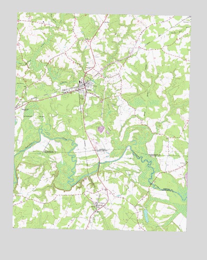
Boykins, VA USGS Topographic Map
Click on map above to begin viewing in our Map Viewer.

This topographic map contains these locations and features:
Feature Name Type Latitude Longitude GNIS ID View Map
Beechwood CemeteryCemeteryN36.5926°W77.1983°1463010View Map
Boone BridgeBridgeN36.5277°W77.1502°1003411View Map
BoykinsPopulated PlaceN36.5832°W77.2000°1492616View Map
Boykins Elementary SchoolSchoolN36.5793°W77.2143°1465824View Map
Boykins Police DepartmentBuildingN36.5835°W77.1989°2332077View Map
Boykins Post OfficePost OfficeN36.5838°W77.2001°2519591View Map
Boykins Volunteer Fire Department and Rescue SquadBuildingN36.5842°W77.2018°2331716View Map
BranchvillePopulated PlaceN36.5704°W77.2486°1463757View Map
Branchville Post OfficePost OfficeN36.5701°W77.2485°2768399View Map
Branchville Volunteer Fire DepartmentBuildingN36.5694°W77.2475°2331838View Map
Buckhorn SwampStreamN36.5571°W77.2322°1464008View Map
Buckhorn SwampSwampN36.5649°W77.2350°1464010View Map
Burnt Reeds SwampStreamN36.5540°W77.1761°1464140View Map
Cross KeysPopulated PlaceN36.6204°W77.1875°1477235View Map
Flat SwampStreamN36.5977°W77.2377°1466665View Map
Galilee ChurchChurchN36.5813°W77.2416°1466947View Map
Johnsons School (historical)SchoolN36.6132°W77.1775°1739002View Map
Mann AirportAirportN36.5490°W77.1914°1498596View Map
Meherrin SchoolSchoolN36.5104°W77.1900°989710View Map
Oak Grove ChurchChurchN36.5396°W77.1258°991409View Map
Rich Chapel (historical)ChurchN36.5504°W77.2500°1739020View Map
Rosa SwampStreamN36.6185°W77.2202°1473528View Map
SevernPopulated PlaceN36.5152°W77.1897°1022551View Map
Severn Fire DepartmentBuildingN36.5166°W77.1821°2638543View Map
Severn Police DepartmentBuildingN36.5146°W77.1886°2131003View Map
Severn Post OfficePost OfficeN36.5145°W77.1901°2773955View Map
ShilohPopulated PlaceN36.6096°W77.1997°1493581View Map
Smiths Mill (historical)LocaleN36.5924°W77.1752°1739029View Map
Southeastern Public Service Authority Boykins Transfer StationLocaleN36.5919°W77.1912°2518609View Map
Tarrara CreekStreamN36.5479°W77.1694°1475482View Map
Town of BoykinsCivilN36.5778°W77.1989°2390745View Map
Town of SevernCivilN36.5142°W77.1893°2407315View Map
Woodland ParkParkN36.5749°W77.2016°1476951View Map

Note: Coordinates in the location and feature list above are referenced to NAD83 datum.


Copyright (C) 2008-2025 Ryan Niemi / Sunset Dynamics ... All Rights Reserved