TopoQuest Logo
Do you find TopoQuest useful?
Help keep TopoQuest running and adding new maps/features by donating!
Bitcoin:  19c7KJd3qBynnjoSw5npx9KScwjBe4ifkT
Litecoin:  LXs6TkuXGGXo1vDsWCkWVdjQX94eUKd6ui
Home View Maps Find Maps Find Places Resources & Links


Bliss, New York Topographic Map

USGS Map Title: Bliss, NY
USGS Map MRC: 42078E3
DRG (GeoTIFF) Download: o42078e3.tif


Neighboring USGS Topographic Map Quads:


  Strykersville, NY  
42078F4
 

  Johnsonburg, NY  
42078F3
 

  Warsaw, NY  
42078F2
 

  Arcade, NY  
42078E4
 

  Bliss, NY  
42078E3
 

  Pike, NY  
42078E2
 

  Delevan, NY  
42078D4
 

  Freedom, NY  
42078D3
 

  Houghton, NY  
42078D2


Map MRC Location:

N43°
W79°
N43°
W78°
H8 H7 H6 H5 H4 H3 H2 H1
G8 G7 G6 G5 G4 G3 G2 G1
F8 F7 F6 F5 F4 F3 F2 F1
E8 E7 E6 E5 E4 E3 E2 E1
D8 D7 D6 D5 D4 D3 D2 D1
C8 C7 C6 C5 C4 C3 C2 C1
B8 B7 B6 B5 B4 B3 B2 B1
A8 A7 A6 A5 A4 A3 A2 A1
N42°
W79°
N42°
W78°

Bliss, NY USGS 1:24K Topographic Map Preview:
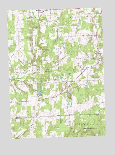
Bliss, NY USGS Topographic Map
Click on map above to begin viewing in our Map Viewer.

This topographic map contains these locations and features:
Feature Name Type Latitude Longitude GNIS ID View Map
BlissPopulated PlaceN42.5770°W78.2528°944258View Map
Bliss Census Designated PlaceCensusN42.5801°W78.2537°2627975View Map
Bliss Fire Department Eagle Hose Company 1BuildingN42.5797°W78.2534°2701267View Map
Bliss Post OfficePost OfficeN42.5792°W78.2539°2617818View Map
Cadwell Corners CemeteryCemeteryN42.5211°W78.2962°2544236View Map
Cadwells CornersLocaleN42.5212°W78.2972°945425View Map
Camp Deerwood ForestLocaleN42.5509°W78.2722°945570View Map
Davis Valley FarmLocaleN42.5994°W78.2833°2707184View Map
Dream LakeLakeN42.5604°W78.2978°948640View Map
Dziedzic FarmsLocaleN42.5689°W78.3111°2707185View Map
EaglePopulated PlaceN42.5487°W78.2981°948905View Map
Eagle Village CemeteryCemeteryN42.5539°W78.3007°948910View Map
East ArcadePopulated PlaceN42.5706°W78.3445°972408View Map
East Arcade AirportAirportN42.5852°W78.3503°977895View Map
Good News CampLocaleN42.5517°W78.3461°951310View Map
Hiram LakeLakeN42.5448°W78.3356°952893View Map
Keysa AirportAirportN42.5971°W78.3402°977916View Map
Lake WilleneLakeN42.5575°W78.3070°971289View Map
North Branch Wiscoy CreekStreamN42.5795°W78.2511°958729View Map
Saint Mary's Catholic ChurchChurchN42.5725°W78.3425°2515203View Map
Saint Mary's CemeteryCemeteryN42.5735°W78.3428°2515202View Map
Spring BrookStreamN42.5612°W78.3558°966051View Map
Waldos CornersLocaleN42.6226°W78.3333°968665View Map
WEZQ-FM (Town of Wethersfield)TowerN42.6231°W78.2875°978621View Map
Zielenieski FarmsLocaleN42.5325°W78.3361°2707191View Map

Note: Coordinates in the location and feature list above are referenced to NAD83 datum.


Copyright (C) 2008-2024 Ryan Niemi / Sunset Dynamics ... All Rights Reserved