TopoQuest Logo
Do you find TopoQuest useful?
Help keep TopoQuest running and adding new maps/features by donating!
Bitcoin:  19c7KJd3qBynnjoSw5npx9KScwjBe4ifkT
Litecoin:  LXs6TkuXGGXo1vDsWCkWVdjQX94eUKd6ui
Home View Maps Find Maps Find Places Resources & Links


Swede Peak, Arizona Topographic Map

USGS Map Title: Swede Peak, AZ
USGS Map MRC: 31109F3
DRG (GeoTIFF) Download: o31109f3.tif


Neighboring USGS Topographic Map Quads:


  Stanford Canyon, AZ  
31109G4
 

  Chiricahua Peak, AZ  
31109G3
 

  Portal Peak, AZ  
31109G2
 

  Bruno Peak, AZ  
31109F4
 

  Swede Peak, AZ  
31109F3
 

  Apache, AZ  
31109F2
 

  Pedregosa Mountains West, AZ  
31109E4
 

  Pedregosa Mountains East, AZ  
31109E3
 

  Paramore Crater, AZ  
31109E2


Map MRC Location:

N32°
W110°
N32°
W109°
H8 H7 H6 H5 H4 H3 H2 H1
G8 G7 G6 G5 G4 G3 G2 G1
F8 F7 F6 F5 F4 F3 F2 F1
E8 E7 E6 E5 E4 E3 E2 E1
D8 D7 D6 D5 D4 D3 D2 D1
C8 C7 C6 C5 C4 C3 C2 C1
B8 B7 B6 B5 B4 B3 B2 B1
A8 A7 A6 A5 A4 A3 A2 A1
N31°
W110°
N31°
W109°

Swede Peak, AZ USGS 1:24K Topographic Map Preview:
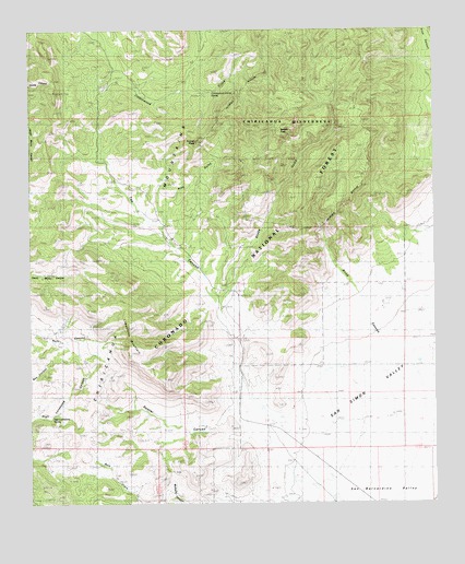
Swede Peak, AZ USGS Topographic Map
Click on map above to begin viewing in our Map Viewer.

This topographic map contains these locations and features:
Feature Name Type Latitude Longitude GNIS ID View Map
Blind CanyonValleyN31.6579°W109.2548°1958098View Map
Coal Pit TankReservoirN31.7494°W109.3218°21992View Map
Cottonwood Circle Two Hundred ThirtythreeTrailN31.7329°W109.3315°22009View Map
Cottonwood Corral SpringSpringN31.7336°W109.3192°22010View Map
Cottonwood TankReservoirN31.7382°W109.3131°22011View Map
Divil TankReservoirN31.6291°W109.3469°22023View Map
Division TankReservoirN31.7237°W109.3467°22025View Map
High Lonesome SpringSpringN31.6484°W109.3678°5794View Map
Hill TankReservoirN31.6995°W109.3284°22070View Map
Joe TankReservoirN31.6373°W109.3732°22096View Map
Juniper Tree TankReservoirN31.6924°W109.3629°22102View Map
Krentz RanchLocaleN31.6473°W109.3015°6774View Map
Limestone MountainSummitN31.6662°W109.3445°7018View Map
Limestone TankReservoirN31.6687°W109.3626°22121View Map
North Bruno TankReservoirN31.7075°W109.3750°22151View Map
Pine GulchValleyN31.6984°W109.3342°9461View Map
Price Shake Pine Gulch Trail 235-236TrailN31.7362°W109.2965°22182View Map
Rustler CanyonValleyN31.6495°W109.3134°10602View Map
Saner SpringSpringN31.6390°W109.3367°10931View Map
Shake GulchValleyN31.6793°W109.3173°11143View Map
Sunset PeakSummitN31.7207°W109.3240°11990View Map
Sunset TankReservoirN31.6994°W109.3572°22247View Map
Sunset TankReservoirN31.7376°W109.3375°22248View Map
Swede PeakSummitN31.7245°W109.2965°12043View Map
Tex CanyonValleyN31.6540°W109.3087°12270View Map
Upper Bruno TankReservoirN31.6860°W109.3716°22269View Map
Upper Tex TankReservoirN31.7059°W109.3568°22275View Map

Note: Coordinates in the location and feature list above are referenced to NAD83 datum.


Copyright (C) 2008-2024 Ryan Niemi / Sunset Dynamics ... All Rights Reserved