TopoQuest Logo
Do you find TopoQuest useful?
Help keep TopoQuest running and adding new maps/features by donating!
Bitcoin:  19c7KJd3qBynnjoSw5npx9KScwjBe4ifkT
Litecoin:  LXs6TkuXGGXo1vDsWCkWVdjQX94eUKd6ui
Home View Maps Find Maps Find Places Resources & Links


Chiricahua Peak, Arizona Topographic Map

USGS Map Title: Chiricahua Peak, AZ
USGS Map MRC: 31109G3
DRG (GeoTIFF) Download: o31109g3.tif


Neighboring USGS Topographic Map Quads:


  Fife Peak, AZ  
31109H4
 

  Rustler Park, AZ  
31109H3
 

  Portal, AZ  
31109H2
 

  Stanford Canyon, AZ  
31109G4
 

  Chiricahua Peak, AZ  
31109G3
 

  Portal Peak, AZ  
31109G2
 

  Bruno Peak, AZ  
31109F4
 

  Swede Peak, AZ  
31109F3
 

  Apache, AZ  
31109F2


Map MRC Location:

N32°
W110°
N32°
W109°
H8 H7 H6 H5 H4 H3 H2 H1
G8 G7 G6 G5 G4 G3 G2 G1
F8 F7 F6 F5 F4 F3 F2 F1
E8 E7 E6 E5 E4 E3 E2 E1
D8 D7 D6 D5 D4 D3 D2 D1
C8 C7 C6 C5 C4 C3 C2 C1
B8 B7 B6 B5 B4 B3 B2 B1
A8 A7 A6 A5 A4 A3 A2 A1
N31°
W110°
N31°
W109°

Chiricahua Peak, AZ USGS 1:24K Topographic Map Preview:
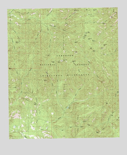
Chiricahua Peak, AZ USGS Topographic Map
Click on map above to begin viewing in our Map Viewer.

This topographic map contains these locations and features:
Feature Name Type Latitude Longitude GNIS ID View Map
Anita ParkGapN31.8537°W109.2881°659View Map
Anita SpringSpringN31.8515°W109.2852°660View Map
Baker CanyonValleyN31.7929°W109.2526°961View Map
Bathtub Forest CampLocaleN31.7795°W109.3103°1079View Map
Bear CanyonValleyN31.7857°W109.3023°1105View Map
Bear SpringSpringN31.8233°W109.3168°1135View Map
Black MountainSummitN31.7995°W109.3665°1555View Map
Booger SpringSpringN31.8674°W109.2821°21955View Map
Brushy CanyonValleyN31.7595°W109.3451°2030View Map
Brushy CreekStreamN31.7559°W109.3470°2039View Map
Buckskin SaddleGapN31.8243°W109.3231°2116View Map
Camp Rucker CampgroundLocaleN31.7604°W109.3673°21974View Map
Chiricahua PeakSummitN31.8465°W109.2915°2878View Map
Chiricahua WildernessReserveN31.8397°W109.2798°2767365View Map
Cima ParkGapN31.8612°W109.2873°2940View Map
Cima Ranger StationLocaleN31.8393°W109.2756°2941View Map
Cima SaddleGapN31.8654°W109.2826°21989View Map
Coal Pit TankReservoirN31.8448°W109.3623°21991View Map
Coronado National ForestForestN31.8300°W109.3019°44988View Map
Cottonwood Canyon Trail Two Hundred SixtysixTrailN31.8334°W109.3673°22008View Map
Cottonwood CreekStreamN31.7562°W109.3617°3335View Map
Cottonwood SpringSpringN31.8412°W109.3692°3358View Map
Crest Trail Two Hundred SeventyTrailN31.8529°W109.2892°22013View Map
Cummings TankReservoirN31.7504°W109.3673°22014View Map
Cypress Forest CampLocaleN31.7754°W109.3120°3670View Map
Deer SpringSpringN31.8359°W109.2704°3810View Map
Dobson PeakSummitN31.7554°W109.2745°3985View Map
Douglas Ranger DistrictForestN31.8279°W109.3012°2038445View Map
Eagle SpringSpringN31.8360°W109.2793°4248View Map
Erickson PeakSummitN31.7620°W109.2831°4467View Map
Flys PeakSummitN31.8729°W109.2837°4712View Map
Hermitage Forest CampLocaleN31.7648°W109.3292°5739View Map
Junction SaddleGapN31.8498°W109.2892°6537View Map
Juniper SpringSpringN31.8354°W109.2773°11089View Map
Lone Juniper SpringSpringN31.8276°W109.2726°7297View Map
Monte Vista PeakSummitN31.8245°W109.3145°8219View Map
Mormon Ridge Trail Two Hundred SixtynineTrailN31.8390°W109.3090°22143View Map
Mormon SpringSpringN31.8571°W109.3233°8298View Map
Morse CanyonValleyN31.8640°W109.3390°8313View Map
Morse Canyon CampgroundLocaleN31.8540°W109.3284°8314View Map
North Fork Rucker CanyonValleyN31.7770°W109.3128°8732View Map
North Ward CanyonValleyN31.8618°W109.3131°8794View Map
Paint RockSummitN31.8323°W109.3001°9962View Map
Pole Bridge CanyonValleyN31.8615°W109.3378°9620View Map
Pole Bridge Canyon Natural AreaParkN31.8501°W109.3395°22175View Map
Pole Bridge Trail Two Hundred SixtyfourTrailN31.8520°W109.3395°22176View Map
Price Canyon Trail Two Hundred TwentyfourTrailN31.7798°W109.2534°22181View Map
Price SpringSpringN31.7719°W109.2598°9771View Map
Raspberry PeakSummitN31.8243°W109.3034°42951View Map
Raspberry RidgeRidgeN31.8181°W109.2965°9963View Map
Red Rock CanyonValleyN31.7609°W109.3290°10121View Map
Round ParkGapN31.8684°W109.2848°10536View Map
Rucker Canyon DamDamN31.7801°W109.3106°22202View Map
Rucker Canyon RanchLocaleN31.7534°W109.3576°10578View Map
Rucker Canyon Trail Two Hundred TwentytwoTrailN31.7918°W109.2756°22203View Map
Rucker Forest CampLocaleN31.7848°W109.3040°10580View Map
Rucker LakeReservoirN31.7801°W109.3084°10581View Map
Rucker Lake CampgroundLocaleN31.7790°W109.3076°22204View Map
Rucker Ranger StationLocaleN31.7657°W109.3492°10582View Map
Rucker Raspberry Ridge Trail Two Hundred TwentyeightTrailN31.8079°W109.2840°22205View Map
Sage PeakSummitN31.7832°W109.2659°10667View Map
Sanders PeakSummitN31.8595°W109.2648°10913View Map
Saulsbury CanyonValleyN31.8645°W109.3320°10968View Map
Snowshed PeakSummitN31.8390°W109.2684°11505View Map
Sycamore CanyonValleyN31.7737°W109.3428°12070View Map
Sycamore SpringSpringN31.7831°W109.3441°12082View Map
Turkey Creek CampgroundLocaleN31.8606°W109.3351°12868View Map
Turkey Creek Ranger StationLocaleN31.8665°W109.3470°12869View Map
Turkey Pen CanyonValleyN31.8723°W109.3712°12873View Map
Turtle MountainSummitN31.8059°W109.3353°12899View Map
Turtle Mountain Trail Two Hundred NineteenTrailN31.8090°W109.3395°22265View Map
Walnut Grove CampgroundLocaleN31.7582°W109.3712°22279View Map
Ward CanyonValleyN31.8640°W109.3390°13338View Map
West Turkey Creek CampgroundLocaleN31.8645°W109.3592°13539View Map
Winn FallsFallsN31.8556°W109.2609°13928View Map

Note: Coordinates in the location and feature list above are referenced to NAD83 datum.


Copyright (C) 2008-2024 Ryan Niemi / Sunset Dynamics ... All Rights Reserved