TopoQuest Logo
Do you find TopoQuest useful?
Help keep TopoQuest running and adding new maps/features by donating!
Bitcoin:  19c7KJd3qBynnjoSw5npx9KScwjBe4ifkT
Litecoin:  LXs6TkuXGGXo1vDsWCkWVdjQX94eUKd6ui
Home View Maps Find Maps Find Places Resources & Links


Sylvan Reservoir, Colorado Topographic Map

USGS Map Title: Sylvan Reservoir, CO
USGS Map MRC: 39106H1
DRG (GeoTIFF) Download: o39106h1.tif


Neighboring USGS Topographic Map Quads:


  Parshall, CO  
40106A2
 

  Hot Sulphur Springs, CO  
40106A1
 

  Granby, CO  
40105A8
 

  Battle Mountain, CO  
39106H2
 

  Sylvan Reservoir, CO  
39106H1
 

  Bottle Pass, CO  
39105H8
 

  Squaw Creek, CO  
39106G2
 

  Ute Peak, CO  
39106G1
 

  Byers Peak, CO  
39105G8


Map MRC Location:

N40°
W107°
N40°
W106°
H8 H7 H6 H5 H4 H3 H2 H1
G8 G7 G6 G5 G4 G3 G2 G1
F8 F7 F6 F5 F4 F3 F2 F1
E8 E7 E6 E5 E4 E3 E2 E1
D8 D7 D6 D5 D4 D3 D2 D1
C8 C7 C6 C5 C4 C3 C2 C1
B8 B7 B6 B5 B4 B3 B2 B1
A8 A7 A6 A5 A4 A3 A2 A1
N39°
W107°
N39°
W106°

Sylvan Reservoir, CO USGS 1:24K Topographic Map Preview:
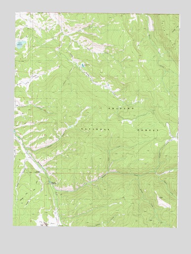
Sylvan Reservoir, CO USGS Topographic Map
Click on map above to begin viewing in our Map Viewer.

This topographic map contains these locations and features:
Feature Name Type Latitude Longitude GNIS ID View Map
Brinker DitchCanalN39.9670°W106.0947°2764958View Map
Cook CreekStreamN39.9069°W106.0531°175705View Map
Cub CreekStreamN39.9861°W106.0845°175708View Map
De Koevend LakeLakeN39.9692°W106.0733°196755View Map
Hermosa SchoolSchoolN39.9972°W106.1217°175710View Map
Horseshoe CampgroundLocaleN39.9003°W106.0961°197424View Map
Horseshoe Guard StationBuildingN39.9067°W106.1047°197423View Map
Horseshoe Ranger StationLocaleN39.9069°W106.1045°175695View Map
Horseshoe Sulfur TrailTrailN39.9305°W106.0859°175714View Map
Kelly CreekStreamN39.9844°W106.0825°175707View Map
Keyser CreekStreamN39.8967°W106.0925°175667View Map
Keyser DitchCanalN39.9058°W106.1025°2764999View Map
Long ParkFlatN39.9614°W106.1117°196754View Map
Morgan GulchValleyN39.9200°W106.1160°175718View Map
Muddy Keyser TrailTrailN39.9547°W106.0039°175706View Map
Pease GulchValleyN39.9147°W106.1146°196757View Map
Ranger GulchValleyN39.9076°W106.1053°175696View Map
Richey CreekStreamN39.9058°W106.0300°175703View Map
Simpson CreekStreamN39.9080°W106.0178°175666View Map
Sulfur TrailTrailN39.9933°W106.0914°175709View Map
Sylvan DamDamN39.9833°W106.1170°201470View Map
Sylvan DitchCanalN39.9760°W106.0941°2765005View Map
Sylvan ReservoirReservoirN39.9813°W106.1208°175711View Map
Timber CreekStreamN39.9683°W106.0772°1947598View Map
Upson CreekStreamN39.9061°W106.0153°175668View Map
Ute CreekStreamN39.8855°W106.0903°175700View Map
Ute ParkFlatN39.8753°W106.0981°175698View Map
Ute Park SchoolSchoolN39.8861°W106.0917°175697View Map

Note: Coordinates in the location and feature list above are referenced to NAD83 datum.


Copyright (C) 2008-2024 Ryan Niemi / Sunset Dynamics ... All Rights Reserved