TopoQuest Logo
Do you find TopoQuest useful?
Help keep TopoQuest running and adding new maps/features by donating!
Bitcoin:  19c7KJd3qBynnjoSw5npx9KScwjBe4ifkT
Litecoin:  LXs6TkuXGGXo1vDsWCkWVdjQX94eUKd6ui
Home View Maps Find Maps Find Places Resources & Links


Ute Peak, Colorado Topographic Map

USGS Map Title: Ute Peak, CO
USGS Map MRC: 39106G1
DRG (GeoTIFF) Download: o39106g1.tif


Neighboring USGS Topographic Map Quads:


  Battle Mountain, CO  
39106H2
 

  Sylvan Reservoir, CO  
39106H1
 

  Bottle Pass, CO  
39105H8
 

  Squaw Creek, CO  
39106G2
 

  Ute Peak, CO  
39106G1
 

  Byers Peak, CO  
39105G8
 

  Willow Lakes, CO  
39106F2
 

  Dillon, CO  
39106F1
 

  Loveland Pass, CO  
39105F8


Map MRC Location:

N40°
W107°
N40°
W106°
H8 H7 H6 H5 H4 H3 H2 H1
G8 G7 G6 G5 G4 G3 G2 G1
F8 F7 F6 F5 F4 F3 F2 F1
E8 E7 E6 E5 E4 E3 E2 E1
D8 D7 D6 D5 D4 D3 D2 D1
C8 C7 C6 C5 C4 C3 C2 C1
B8 B7 B6 B5 B4 B3 B2 B1
A8 A7 A6 A5 A4 A3 A2 A1
N39°
W107°
N39°
W106°

Ute Peak, CO USGS 1:24K Topographic Map Preview:
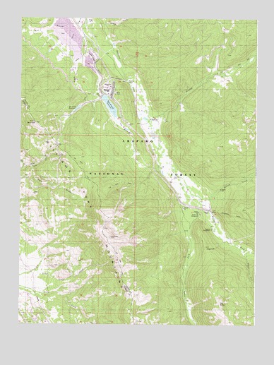
Ute Peak, CO USGS Topographic Map
Click on map above to begin viewing in our Map Viewer.

This topographic map contains these locations and features:
Feature Name Type Latitude Longitude GNIS ID View Map
Amax Mill HeliportAirportN39.8330°W106.0678°204362View Map
Barker Number 1 DitchCanalN39.8387°W106.0574°2764941View Map
Berry GulchValleyN39.8142°W106.1195°175679View Map
Boham CreekStreamN39.8730°W106.0817°175704View Map
Darling CreekStreamN39.7997°W106.0278°175670View Map
East Branch DamDamN39.8430°W106.0825°199456View Map
East Branch ReservoirReservoirN39.8394°W106.0780°197559View Map
East Branch Ute CreekStreamN39.8605°W106.0953°175727View Map
Henderson MillLocaleN39.8467°W106.0795°197555View Map
Henderson TunnelTunnelN39.7947°W106.0117°197551View Map
Hole CreekStreamN39.8139°W106.1231°175701View Map
Keyser Divide TrailTrailN39.8714°W106.0164°202316View Map
Kinney CreekStreamN39.8319°W106.0545°175669View Map
LealPopulated PlaceN39.8103°W106.0445°175675View Map
Middle Fork Williams ForkStreamN39.7803°W106.0056°175726View Map
Old BaldySummitN39.7589°W106.0192°175672View Map
Prairie MountainSummitN39.8330°W106.1175°175686View Map
South Fork CampgroundLocaleN39.7955°W106.0295°197556View Map
South Fork Williams ForkStreamN39.8025°W106.0303°175725View Map
SugarloafSummitN39.7811°W106.0259°175674View Map
Sugarloaf CampgroundLocaleN39.7889°W106.0234°1947560View Map
Trails End RanchLocaleN39.8097°W106.0439°1947565View Map
Ute Creek DamDamN39.8333°W106.0972°200546View Map
Ute Creek ReservoirReservoirN39.8382°W106.0954°197554View Map
Ute PassGapN39.8242°W106.1053°175685View Map
Ute Pass TrailTrailN39.8239°W106.1075°175684View Map
Ute PeakSummitN39.7858°W106.0775°175673View Map
Ute Peak TrailTrailN39.8053°W106.0814°175724View Map
West Branch Ute CreekStreamN39.8747°W106.0922°175699View Map
Williams Fork MountainsRangeN39.8319°W106.1170°175657View Map

Note: Coordinates in the location and feature list above are referenced to NAD83 datum.


Copyright (C) 2008-2024 Ryan Niemi / Sunset Dynamics ... All Rights Reserved