TopoQuest Logo
Do you find TopoQuest useful?
Help keep TopoQuest running and adding new maps/features by donating!
Bitcoin:  19c7KJd3qBynnjoSw5npx9KScwjBe4ifkT
Litecoin:  LXs6TkuXGGXo1vDsWCkWVdjQX94eUKd6ui
Home View Maps Find Maps Find Places Resources & Links


Table Rock, Maryland Topographic Map

USGS Map Title: Table Rock, MD
USGS Map MRC: 39079C4
DRG (GeoTIFF) Download: o39079c4.tif


Neighboring USGS Topographic Map Quads:


  Terra Alta, WV  
39079D5
 

  Oakland, MD  
39079D4
 

  Deer Park, MD  
39079D3
 

  Aurora, WV  
39079C5
 

  Table Rock, MD  
39079C4
 

  Gorman, MD  
39079C3
 

  Lead Mine, WV  
39079B5
 

  Davis, WV  
39079B4
 

  Mount Storm Lake, WV  
39079B3


Map MRC Location:

N40°
W80°
N40°
W79°
H8 H7 H6 H5 H4 H3 H2 H1
G8 G7 G6 G5 G4 G3 G2 G1
F8 F7 F6 F5 F4 F3 F2 F1
E8 E7 E6 E5 E4 E3 E2 E1
D8 D7 D6 D5 D4 D3 D2 D1
C8 C7 C6 C5 C4 C3 C2 C1
B8 B7 B6 B5 B4 B3 B2 B1
A8 A7 A6 A5 A4 A3 A2 A1
N39°
W80°
N39°
W79°

Table Rock, MD USGS 1:24K Topographic Map Preview:
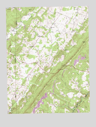
Table Rock, MD USGS Topographic Map
Click on map above to begin viewing in our Map Viewer.

This topographic map contains these locations and features:
Feature Name Type Latitude Longitude GNIS ID View Map
Allegheny HeightsSummitN39.3329°W79.3792°589633View Map
Ambrose RunStreamN39.3462°W79.4323°582890View Map
Aronhalt ForkStreamN39.2815°W79.3917°582923View Map
Beckman CemeteryCemeteryN39.3295°W79.3998°583122View Map
Charcoal HillSummitN39.3718°W79.4645°589937View Map
Cherry CreekStreamN39.3698°W79.4578°583715View Map
Clark RunStreamN39.3270°W79.4295°583797View Map
Conneway HillSummitN39.3045°W79.4128°583863View Map
Corunna SchoolSchoolN39.2829°W79.3773°583901View Map
District 8, Red HouseCivilN39.2957°W79.4101°1929698View Map
Douglass RunStreamN39.3448°W79.4281°584141View Map
Fairview CemeteryCemeteryN39.2704°W79.4123°1711132View Map
Fairview ChurchChurchN39.2715°W79.4164°584331View Map
Fox RunStreamN39.3123°W79.4348°584479View Map
Frozen Camp RunStreamN39.3526°W79.4453°584530View Map
Glade View Church of the BrethrenChurchN39.3107°W79.4559°1711137View Map
Gnegy CemeteryCemeteryN39.2770°W79.4862°1711138View Map
Gnegy ChurchChurchN39.2765°W79.4864°584629View Map
GortnerPopulated PlaceN39.3551°W79.4275°584667View Map
Gortner CemeteryCemeteryN39.3531°W79.4270°1711140View Map
Gortner Union ChurchChurchN39.3534°W79.4270°1711142View Map
Greater Gortner AirportAirportN39.3388°W79.4362°595327View Map
Lynndale SchoolSchoolN39.3473°W79.3992°585643View Map
Maple RunStreamN39.3143°W79.4862°1551996View Map
McMillan ForkStreamN39.2765°W79.3895°585770View Map
Moon RidgeRidgeN39.2741°W79.4384°1711151View Map
North Fork Sand RunStreamN39.2590°W79.4095°586229View Map
Pleasant ValleyValleyN39.3663°W79.4015°586592View Map
Pleasant Valley ChurchChurchN39.3709°W79.3900°586597View Map
Pleasant Valley GreenhouseBuildingN39.3606°W79.3936°2651560View Map
Red House CemeteryCemeteryN39.3101°W79.4534°1711159View Map
Red House Elementary SchoolSchoolN39.3073°W79.4556°1711160View Map
Red Oak CreekStreamN39.2534°W79.3984°1552608View Map
RedhousePopulated PlaceN39.3087°W79.4539°586795View Map
Rhine CreekStreamN39.3384°W79.4962°1552640View Map
Roth RockSummitN39.2659°W79.4556°591189View Map
Saint Johns Lutheran ChurchChurchN39.3104°W79.4531°1711162View Map
Sand RunStreamN39.2548°W79.3998°587186View Map
Sand Spring RunStreamN39.2720°W79.4745°587188View Map
Shady Dell Grange HallBuildingN39.3237°W79.4070°598386View Map
Shields RunStreamN39.2718°W79.3789°587331View Map
Silver LakeReservoirN39.2547°W79.4957°1546784View Map
Silver LakePopulated PlaceN39.2543°W79.4978°1555626View Map
South Fork Sand RunStreamN39.2590°W79.4092°587461View Map
SunnysidePopulated PlaceN39.3404°W79.4470°1711170View Map
Sunnyside Grange HallBuildingN39.3404°W79.4464°598387View Map
Sunnyside SchoolSchoolN39.3287°W79.4600°587633View Map
Swan Meadow K - 8 SchoolSchoolN39.3494°W79.4338°587655View Map
Swans MeadowFlatN39.3529°W79.4289°1711173View Map
Table RockLocaleN39.3015°W79.4173°587682View Map
Triple Silo FarmLocaleN39.3669°W79.4158°2585728View Map
Wesley CemeteryCemeteryN39.3718°W79.3903°1711158View Map
WilsonPopulated PlaceN39.2543°W79.3978°1549992View Map
Wilson Post Office (historical)Post OfficeN39.2536°W79.3981°1697283View Map

Note: Coordinates in the location and feature list above are referenced to NAD83 datum.


Copyright (C) 2008-2024 Ryan Niemi / Sunset Dynamics ... All Rights Reserved