TopoQuest Logo
Do you find TopoQuest useful?
Help keep TopoQuest running and adding new maps/features by donating!
Bitcoin:  19c7KJd3qBynnjoSw5npx9KScwjBe4ifkT
Litecoin:  LXs6TkuXGGXo1vDsWCkWVdjQX94eUKd6ui
Home View Maps Find Maps Find Places Resources & Links


Taintor Desert, Montana Topographic Map

USGS Map Title: Taintor Desert, MT
USGS Map MRC: 45106C7
DRG (GeoTIFF) Download: o45106c7.tif


Neighboring USGS Topographic Map Quads:


  Birdseye Spring, MT  
45106D8
 

  Bull Creek Lookout, MT  
45106D7
 

  Cook Creek Butte, MT  
45106D6
 

  Kirby, MT  
45106C8
 

  Taintor Desert, MT  
45106C7
 

  Birney SW, MT  
45106C6
 

  Half Moon Hill, MT  
45106B8
 

  Tongue River Dam, MT  
45106B7
 

  Spring Gulch, MT  
45106B6


Map MRC Location:

N46°
W107°
N46°
W106°
H8 H7 H6 H5 H4 H3 H2 H1
G8 G7 G6 G5 G4 G3 G2 G1
F8 F7 F6 F5 F4 F3 F2 F1
E8 E7 E6 E5 E4 E3 E2 E1
D8 D7 D6 D5 D4 D3 D2 D1
C8 C7 C6 C5 C4 C3 C2 C1
B8 B7 B6 B5 B4 B3 B2 B1
A8 A7 A6 A5 A4 A3 A2 A1
N45°
W107°
N45°
W106°

Taintor Desert, MT USGS 1:24K Topographic Map Preview:
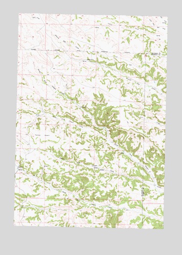
Taintor Desert, MT USGS Topographic Map
Click on map above to begin viewing in our Map Viewer.

This topographic map contains these locations and features:
Feature Name Type Latitude Longitude GNIS ID View Map
06N39E09BBBD01 WellWellN45.2941°W106.8598°808772View Map
06S40E01CDDC01 WellWellN45.3391°W106.7812°809004View Map
06S40E02CBAB01 SpringSpringN45.3455°W106.8070°809029View Map
06S40E02DBDA01 WellWellN45.3444°W106.7956°809023View Map
06S40E03BDDA01 SpringSpringN45.3479°W106.8210°809037View Map
06S40E20DCCC01 SpringSpringN45.2964°W106.8603°808788View Map
06S40E26CDAB01 SpringSpringN45.2841°W106.8013°808722View Map
06S40E29ABBA01 WellWellN45.2950°W106.8595°808777View Map
06S40E29BCCD01 SpringSpringN45.2886°W106.8701°808743View Map
06S40E29CAAD01 SpringSpringN45.2872°W106.8617°808732View Map
06S40E29CABA01 SpringSpringN45.2872°W106.8639°808733View Map
06S40E29DADD01 SpringSpringN45.2854°W106.8517°808724View Map
06S40E30DDAA01 WellWellN45.2839°W106.8678°808718View Map
06S40E30DDAA02 WellWellN45.2839°W106.8720°808719View Map
06S40E31ADDA01 SpringSpringN45.2755°W106.8726°808681View Map
06S40E32BADD01 SpringSpringN45.2775°W106.8623°808689View Map
06S40E33BCCA01 SpringSpringN45.2744°W106.8489°808680View Map
06S40E36ABBC01 WellWellN45.2797°W106.7781°808703View Map
06S41E06ABBC01 WellWellN45.3503°W106.7573°809049View Map
06S41E18DCBA01 WellWellN45.3116°W106.7548°808861View Map
06S41E30CCAD01 WellWellN45.2833°W106.7637°808716View Map
07S40E01BDDB01 WellWellN45.2608°W106.7803°808624View Map
07S40E01DCBB01 WellWellN45.2550°W106.7801°808601View Map
07S40E05DDDC01 WellWellN45.2528°W106.8526°808591View Map
Brewster CampLocaleN45.3480°W106.8176°769206View Map
Clarks Fork Canyon CreekStreamN45.3011°W106.7976°769906View Map
Hosford CampLocaleN45.3200°W106.8226°772577View Map
Jordan RanchLocaleN45.2836°W106.8728°772906View Map
Taintor DesertPlainN45.3036°W106.8534°777407View Map
Taintor Fork Canyon CreekStreamN45.2758°W106.7573°777408View Map

Note: Coordinates in the location and feature list above are referenced to NAD83 datum.


Copyright (C) 2008-2025 Ryan Niemi / Sunset Dynamics ... All Rights Reserved