TopoQuest Logo
Do you find TopoQuest useful?
Help keep TopoQuest running and adding new maps/features by donating!
Bitcoin:  19c7KJd3qBynnjoSw5npx9KScwjBe4ifkT
Litecoin:  LXs6TkuXGGXo1vDsWCkWVdjQX94eUKd6ui
Home View Maps Find Maps Find Places Resources & Links


Tongue River Dam, Montana Topographic Map

USGS Map Title: Tongue River Dam, MT
USGS Map MRC: 45106B7
DRG (GeoTIFF) Download: o45106b7.tif


Neighboring USGS Topographic Map Quads:


  Kirby, MT  
45106C8
 

  Taintor Desert, MT  
45106C7
 

  Birney SW, MT  
45106C6
 

  Half Moon Hill, MT  
45106B8
 

  Tongue River Dam, MT  
45106B7
 

  Spring Gulch, MT  
45106B6
 

  Pearl School, MT  
45106A8
 

  Decker, MT  
45106A7
 

  Holmes Ranch, MT  
45106A6


Map MRC Location:

N46°
W107°
N46°
W106°
H8 H7 H6 H5 H4 H3 H2 H1
G8 G7 G6 G5 G4 G3 G2 G1
F8 F7 F6 F5 F4 F3 F2 F1
E8 E7 E6 E5 E4 E3 E2 E1
D8 D7 D6 D5 D4 D3 D2 D1
C8 C7 C6 C5 C4 C3 C2 C1
B8 B7 B6 B5 B4 B3 B2 B1
A8 A7 A6 A5 A4 A3 A2 A1
N45°
W107°
N45°
W106°

Tongue River Dam, MT USGS 1:24K Topographic Map Preview:
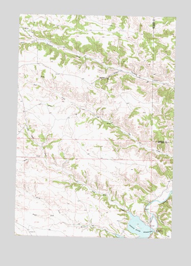
Tongue River Dam, MT USGS Topographic Map
Click on map above to begin viewing in our Map Viewer.

This topographic map contains these locations and features:
Feature Name Type Latitude Longitude GNIS ID View Map
07S40E07DADD01 SpringSpringN45.2415°W106.8713°808548View Map
07S40E08CCBD01 WellWellN45.2397°W106.8692°808544View Map
07S40E08CCDA01 WellWellN45.2405°W106.8687°808546View Map
07S40E09ABCA01 SpringSpringN45.2500°W106.8381°808582View Map
07S40E09CDDA01 SpringSpringN45.2389°W106.8406°808541View Map
07S40E11BADC01 SpringSpringN45.2491°W106.8003°808575View Map
07S40E15DCBD01 WellWellN45.2255°W106.8181°808499View Map
07S40E16BDAA01 SpringSpringN45.2336°W106.8409°808520View Map
07S40E16DBCC01 SpringSpringN45.2272°W106.8395°808503View Map
07S40E17AACD01 SpringSpringN45.2347°W106.8537°808526View Map
07S40E17AADC01 WellWellN45.2341°W106.8520°808522View Map
07S40E17ACBD01 SpringSpringN45.2322°W106.8590°808515View Map
07S40E17BADA01 WellWellN45.2355°W106.8609°808531View Map
07S40E18ADAC01 SpringSpringN45.2316°W106.8731°808513View Map
07S40E27CDAD01 WellWellN45.1964°W106.8198°808389View Map
07S40E29DAAC01 SpringSpringN45.1998°W106.8523°808400View Map
07S40E35BDAC01 SpringSpringN45.1892°W106.8007°808360View Map
07S41E19DCAA01 WellWellN45.2116°W106.7528°808438View Map
07S48E17BBCD01 SpringSpringN45.2341°W106.8695°808523View Map
07T5S40E32DBDA WellWellN45.1741°W106.8556°808308View Map
08S40E01BBCD01 WellWellN45.1650°W106.7703°808258View Map
08S40E02ABAB01 SpringSpringN45.1689°W106.7967°808283View Map
08S40E11CAAC01 WellWellN45.1455°W106.8006°808174View Map
08S40E15DBAD01 WellWellN45.1314°W106.8142°808086View Map
08S40E17DACD01 WellWellN45.1294°W106.8528°808070View Map
08S40E17DDAA01 WellWellN45.1289°W106.8498°808068View Map
08S41E18CBBB01 WellWellN45.1328°W106.7667°808093View Map
Barber DrawValleyN45.2191°W106.7951°768505View Map
Coal CreekStreamN45.1389°W106.7662°769973View Map
Four Mile School (historical)SchoolN45.2439°W106.8640°1716420View Map
Leaf Rock CreekStreamN45.1394°W106.7851°773272View Map
Monument Creek School (historical)SchoolN45.1291°W106.8487°1716442View Map
North Fork Fourmile CreekStreamN45.2353°W106.8617°774757View Map
North Fork Monument CreekStreamN45.1316°W106.8278°774786View Map
Post Creek School (historical)SchoolN45.1972°W106.8201°1716454View Map
South Fork Fourmile CreekStreamN45.2353°W106.8617°776827View Map
South Fork Leaf Rock CreekStreamN45.1672°W106.8523°776842View Map
South Fork Monument CreekStreamN45.1269°W106.7956°776853View Map
Tongue River DamDamN45.1308°W106.7662°777703View Map
Tongue River Post Office (historical)Post OfficeN45.1394°W106.7867°1716485View Map

Note: Coordinates in the location and feature list above are referenced to NAD83 datum.


Copyright (C) 2008-2025 Ryan Niemi / Sunset Dynamics ... All Rights Reserved