TopoQuest Logo
Do you find TopoQuest useful?
Help keep TopoQuest running and adding new maps/features by donating!
Bitcoin:  19c7KJd3qBynnjoSw5npx9KScwjBe4ifkT
Litecoin:  LXs6TkuXGGXo1vDsWCkWVdjQX94eUKd6ui
Home View Maps Find Maps Find Places Resources & Links


Bloomfield, Montana Topographic Map

USGS Map Title: Bloomfield, MT
USGS Map MRC: 47104D8
DRG (GeoTIFF) Download: o47104d8.tif


Neighboring USGS Topographic Map Quads:


  Richey SE, MT  
47105E1
 

  Clay Butte, MT  
47104E8
 

  Enid SE, MT  
47104E7
 

  Johnson Reservoir NE, MT  
47105D1
 

  Bloomfield, MT  
47104D8
 

  Red Top, MT  
47104D7
 

  Johnson Reservoir, MT  
47105C1
 

  Stinking Coulee, MT  
47104C8
 

  Morgan Creek School, MT  
47104C7


Map MRC Location:

N48°
W105°
N48°
W104°
H8 H7 H6 H5 H4 H3 H2 H1
G8 G7 G6 G5 G4 G3 G2 G1
F8 F7 F6 F5 F4 F3 F2 F1
E8 E7 E6 E5 E4 E3 E2 E1
D8 D7 D6 D5 D4 D3 D2 D1
C8 C7 C6 C5 C4 C3 C2 C1
B8 B7 B6 B5 B4 B3 B2 B1
A8 A7 A6 A5 A4 A3 A2 A1
N47°
W105°
N47°
W104°

Bloomfield, MT USGS 1:24K Topographic Map Preview:
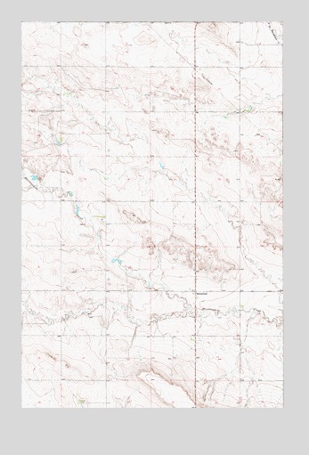
Bloomfield, MT USGS Topographic Map
Click on map above to begin viewing in our Map Viewer.

This topographic map contains these locations and features:
Feature Name Type Latitude Longitude GNIS ID View Map
19N53E12DCBB01 WellWellN47.4161°W104.9080°822774View Map
19N53E24BBBB01 WellWellN47.3981°W104.9169°822656View Map
19N53E24CCDC01 WellWellN47.3839°W104.9139°822582View Map
19N54E30BABC01 WellWellN47.3825°W104.8908°822565View Map
20N53E14BBCC01 WellWellN47.4967°W104.9386°823395View Map
20N53E16AADB01 WellWellN47.4989°W104.9616°823413View Map
20N53E22BCCC01 WellWellN47.4786°W104.9594°823288View Map
20N53E26AAAD01 WellWellN47.4703°W104.9177°823213View Map
20N53E26BCCB01 WellWellN47.4647°W104.9377°823168View Map
20N53E32DBBD01 WellWellN47.4478°W104.9911°822985View Map
20N54E18BCCA01 WellWellN47.4945°W104.8839°823381View Map
20N54E19DC__01 WellWellN47.4722°W104.8825°823241View Map
BloomfieldPopulated PlaceN47.4128°W104.9172°780133View Map
Bloomfield Christian Missionary Alliance ChurchChurchN47.4128°W104.9172°1715454View Map
Bloomfield Post OfficePost OfficeN47.4130°W104.9171°1715387View Map
Bloomfield SchoolSchoolN47.4133°W104.9200°1715501View Map
Everett Hill School (historical)SchoolN47.4617°W104.9305°1715526View Map
Oh No DamDamN47.4500°W104.9939°798224View Map
Pleasant Valley School (historical)SchoolN47.4714°W104.9183°1715562View Map
Raise Number 1 DamDamN47.4383°W104.9739°797529View Map
Steffen School (historical)SchoolN47.4558°W105.0000°1715575View Map

Note: Coordinates in the location and feature list above are referenced to NAD83 datum.


Copyright (C) 2008-2025 Ryan Niemi / Sunset Dynamics ... All Rights Reserved