TopoQuest Logo
Do you find TopoQuest useful?
Help keep TopoQuest running and adding new maps/features by donating!
Bitcoin:  19c7KJd3qBynnjoSw5npx9KScwjBe4ifkT
Litecoin:  LXs6TkuXGGXo1vDsWCkWVdjQX94eUKd6ui
Home View Maps Find Maps Find Places Resources & Links


Tallman, Michigan Topographic Map

USGS Map Title: Tallman, MI
USGS Map MRC: 43086H1
DRG (GeoTIFF) Download: o43086h1.tif


Neighboring USGS Topographic Map Quads:


  Free Soil, MI  
44086A2
 

  Millerton, MI  
44086A1
 

  Peacock, MI  
44085A8
 

  Custer, MI  
43086H2
 

  Tallman, MI  
43086H1
 

  Townsend Lake, MI  
43085H8
 

  Crystal Valley, MI  
43086G2
 

  Carr, MI  
43086G1
 

  Big Star Lake, MI  
43085G8


Map MRC Location:

N44°
W87°
N44°
W86°
H8 H7 H6 H5 H4 H3 H2 H1
G8 G7 G6 G5 G4 G3 G2 G1
F8 F7 F6 F5 F4 F3 F2 F1
E8 E7 E6 E5 E4 E3 E2 E1
D8 D7 D6 D5 D4 D3 D2 D1
C8 C7 C6 C5 C4 C3 C2 C1
B8 B7 B6 B5 B4 B3 B2 B1
A8 A7 A6 A5 A4 A3 A2 A1
N43°
W87°
N43°
W86°

Tallman, MI USGS 1:24K Topographic Map Preview:
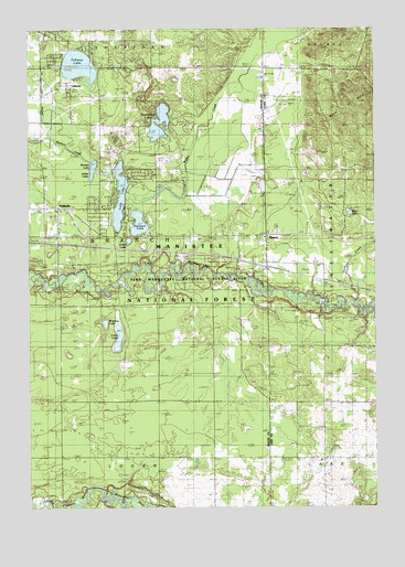
Tallman, MI USGS Topographic Map
Click on map above to begin viewing in our Map Viewer.

This topographic map contains these locations and features:
Feature Name Type Latitude Longitude GNIS ID View Map
BranchLocaleN43.9458°W86.0392°1622874View Map
Branch Post OfficePost OfficeN43.9464°W86.0389°2500857View Map
Branch StationLocaleN43.9375°W86.0389°2514585View Map
Branch Township Fire DepartmentBuildingN43.9527°W86.1120°2626831View Map
Branch Township HallBuildingN43.9467°W86.1142°2514591View Map
Campbell BridgeBridgeN43.8761°W86.1140°1622875View Map
Carr CreekStreamN43.8775°W86.0940°1619440View Map
Carr Fire DepartmentBuildingN43.8829°W86.0395°2626832View Map
Casin LakeLakeN43.9197°W86.0928°1619448View Map
Dollar LakeLakeN43.9448°W86.0890°1619731View Map
Emerson LakeLakeN43.9491°W86.0854°1619854View Map
Gooseneck LakeLakeN43.9755°W86.0775°1620041View Map
Juliet LakeLakeN43.9634°W86.1018°1620392View Map
Lake SchoolSchoolN43.8886°W86.0192°1620472View Map
Long LakeLakeN43.9562°W86.0920°1620609View Map
Lower Branch Bridge AccessLocaleN43.9358°W86.0506°1622873View Map
McPherson CemeteryCemeteryN43.9114°W86.0381°2513388View Map
Pere Marquette CampgroundLocaleN43.9167°W86.0028°2500856View Map
Romeo LakeLakeN43.9634°W86.1018°1621430View Map
TallmanPopulated PlaceN43.9847°W86.1123°1621859View Map
Tallman CemeteryCemeteryN43.9822°W86.1103°2514620View Map
Tallman LakeLakeN43.9905°W86.1066°1621860View Map
Tallman Post Office (historical)Post OfficeN43.9847°W86.1122°2514257View Map
Tallman Station (historical)LocaleN43.9842°W86.1153°2514245View Map
Tank CreekStreamN43.9292°W86.0081°1621865View Map
Township of BranchCivilN43.9465°W86.0994°1625970View Map
Upper Branch Bridge AccessLocaleN43.9286°W86.0206°1622871View Map
WalhallaPopulated PlaceN43.9536°W86.1148°1623743View Map
Walhalla Post OfficePost OfficeN43.9531°W86.1136°2514589View Map
Walhalla StationLocaleN43.9444°W86.1186°2514588View Map
Ward LakeLakeN43.9517°W86.0091°1622872View Map
Watassa LakeLakeN43.9232°W86.0977°1622062View Map

Note: Coordinates in the location and feature list above are referenced to NAD83 datum.


Copyright (C) 2008-2024 Ryan Niemi / Sunset Dynamics ... All Rights Reserved