TopoQuest Logo
Do you find TopoQuest useful?
Help keep TopoQuest running and adding new maps/features by donating!
Bitcoin:  19c7KJd3qBynnjoSw5npx9KScwjBe4ifkT
Litecoin:  LXs6TkuXGGXo1vDsWCkWVdjQX94eUKd6ui
Home View Maps Find Maps Find Places Resources & Links


Free Soil, Michigan Topographic Map

USGS Map Title: Free Soil, MI
USGS Map MRC: 44086A2
DRG (GeoTIFF) Download: o44086a2.tif


Neighboring USGS Topographic Map Quads:


  Star Corners, MI  
44086B2
 

  Udell, MI  
44086B1


  Free Soil, MI  
44086A2
 

  Millerton, MI  
44086A1


  Custer, MI  
43086H2
 

  Tallman, MI  
43086H1


Map MRC Location:

N45°
W87°
N45°
W86°
H8 H7 H6 H5 H4 H3 H2 H1
G8 G7 G6 G5 G4 G3 G2 G1
F8 F7 F6 F5 F4 F3 F2 F1
E8 E7 E6 E5 E4 E3 E2 E1
D8 D7 D6 D5 D4 D3 D2 D1
C8 C7 C6 C5 C4 C3 C2 C1
B8 B7 B6 B5 B4 B3 B2 B1
A8 A7 A6 A5 A4 A3 A2 A1
N44°
W87°
N44°
W86°

Free Soil, MI USGS 1:24K Topographic Map Preview:
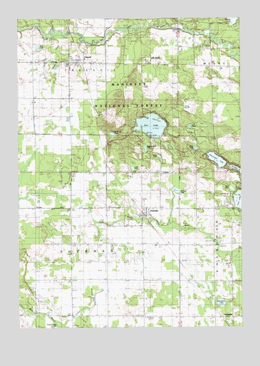
Free Soil, MI USGS Topographic Map
Click on map above to begin viewing in our Map Viewer.

This topographic map contains these locations and features:
Feature Name Type Latitude Longitude GNIS ID View Map
Alma LakeLakeN44.0691°W86.1710°620005View Map
Bachelor Evangelical ChurchChurchN44.0042°W86.1356°2514606View Map
Bachelor Post Office (historical)Post OfficeN44.0042°W86.1308°2514343View Map
BatchellerPopulated PlaceN44.0042°W86.1309°1622853View Map
Batcheller LakeLakeN44.0098°W86.1368°1619106View Map
Batcheller SchoolLocaleN44.0042°W86.1412°620733View Map
Batchelor Christ CemeteryCemeteryN44.0042°W86.1306°2514619View Map
Batchelor Station (historical)LocaleN44.0042°W86.1361°2514252View Map
Camp Sauble State Prison (historical)BuildingN44.1083°W86.1781°1622845View Map
Chancellor LakeLakeN44.0676°W86.1386°623062View Map
Edging LakeLakeN44.0724°W86.1787°1619832View Map
Elm Flats SchoolLocaleN44.0045°W86.2409°625506View Map
Ford Lake SchoolLocaleN44.0481°W86.1415°626232View Map
FountainPopulated PlaceN44.0467°W86.1787°1619960View Map
Fountain Area Fire DepartmentBuildingN44.0459°W86.1791°2626848View Map
Fountain CemeteryCemeteryN44.0480°W86.2000°2514616View Map
Fountain Post OfficePost OfficeN44.0458°W86.1822°2514604View Map
Fountain StationLocaleN44.0453°W86.1797°2514607View Map
Fountain United Methodist ChurchChurchN44.0453°W86.1786°2514605View Map
Free SoilPopulated PlaceN44.1069°W86.2167°1617399View Map
Free Soil Post OfficePost OfficeN44.1075°W86.2167°2514595View Map
Freesoil - Meade Township Fire DepartmentBuildingN44.1069°W86.2166°2627071View Map
Freesoil Community SchoolSchoolN44.1089°W86.2125°2514602View Map
Freesoil StationLocaleN44.1081°W86.2142°2514592View Map
Freesoil United Methodist ChurchChurchN44.1069°W86.2172°2514597View Map
Frog MarshSwampN44.0894°W86.1547°1619976View Map
Frog Paradise DrainStreamN44.0025°W86.2309°1619977View Map
Grass LakeLakeN44.0723°W86.1507°1620061View Map
Gun LakeLakeN44.0816°W86.1751°627532View Map
Howell SchoolLocaleN44.1064°W86.1504°1620261View Map
Lake MeadeLakeN44.0810°W86.1537°1620783View Map
Lake TwoLakeN44.0643°W86.1858°1615292View Map
Meade CemeteryCemeteryN44.1122°W86.1467°632043View Map
Mud LakeLakeN44.0560°W86.1305°1622846View Map
Mud LakeLakeN44.1134°W86.2387°632983View Map
Pickerel LakeLakeN44.1241°W86.1282°1621229View Map
Reek SchoolLocaleN44.0042°W86.1804°1621366View Map
Ritters CreekStreamN44.1172°W86.2306°1622844View Map
Roderick LakeLakeN44.0783°W86.1971°636104View Map
Saint John Cantius Catholic ChurchChurchN44.1069°W86.2083°2514594View Map
Saint John Cantius' CemeteryCemeteryN44.1050°W86.2086°2514614View Map
Sherman Township HallBuildingN44.0458°W86.1806°2514603View Map
Stewart SchoolSchoolN44.0339°W86.1304°638840View Map
Township of ShermanCivilN44.0344°W86.2202°1627075View Map
Village of FountainCivilN44.0482°W86.1811°2398908View Map
Village of Free SoilCivilN44.1071°W86.2110°2398922View Map
Williams LakeLakeN44.0554°W86.1616°1622172View Map

Note: Coordinates in the location and feature list above are referenced to NAD83 datum.


Copyright (C) 2008-2024 Ryan Niemi / Sunset Dynamics ... All Rights Reserved