TopoQuest Logo
Do you find TopoQuest useful?
Help keep TopoQuest running and adding new maps/features by donating!
Bitcoin:  19c7KJd3qBynnjoSw5npx9KScwjBe4ifkT
Litecoin:  LXs6TkuXGGXo1vDsWCkWVdjQX94eUKd6ui
Home View Maps Find Maps Find Places Resources & Links


Millerton, Michigan Topographic Map

USGS Map Title: Millerton, MI
USGS Map MRC: 44086A1
DRG (GeoTIFF) Download: o44086a1.tif


Neighboring USGS Topographic Map Quads:


  Star Corners, MI  
44086B2
 

  Udell, MI  
44086B1
 

  Wellston, MI  
44085B8
 

  Free Soil, MI  
44086A2
 

  Millerton, MI  
44086A1
 

  Peacock, MI  
44085A8
 

  Custer, MI  
43086H2
 

  Tallman, MI  
43086H1
 

  Townsend Lake, MI  
43085H8


Map MRC Location:

N45°
W87°
N45°
W86°
H8 H7 H6 H5 H4 H3 H2 H1
G8 G7 G6 G5 G4 G3 G2 G1
F8 F7 F6 F5 F4 F3 F2 F1
E8 E7 E6 E5 E4 E3 E2 E1
D8 D7 D6 D5 D4 D3 D2 D1
C8 C7 C6 C5 C4 C3 C2 C1
B8 B7 B6 B5 B4 B3 B2 B1
A8 A7 A6 A5 A4 A3 A2 A1
N44°
W87°
N44°
W86°

Millerton, MI USGS 1:24K Topographic Map Preview:
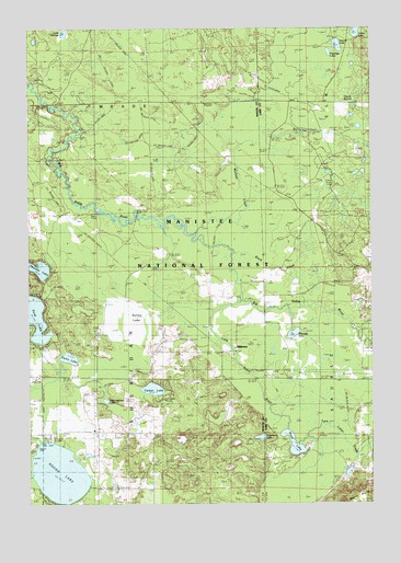
Millerton, MI USGS Topographic Map
Click on map above to begin viewing in our Map Viewer.

This topographic map contains these locations and features:
Feature Name Type Latitude Longitude GNIS ID View Map
Black CreekStreamN44.0664°W86.0504°1619226View Map
Burley LakeSwampN44.0470°W86.0876°1619372View Map
Cartier LakeLakeN44.0301°W86.0801°1619444View Map
Cranberry LakeLakeN44.0174°W86.0409°1620485View Map
Cunningham LakeLakeN44.0271°W86.0972°1619641View Map
Duck MarshSwampN44.1068°W86.0083°1619776View Map
Ford LakeLakeN44.0494°W86.1233°1619952View Map
Indian LakeLakeN44.1243°W86.0053°1620299View Map
Lake GeorgeLakeN44.1237°W86.1118°1620009View Map
Little Sable RiverStreamN44.0533°W86.0479°1622494View Map
MillertonPopulated PlaceN44.0397°W86.0504°1620835View Map
Millerton Post OfficePost OfficeN44.0397°W86.0503°2514263View Map
Millerton Station (historical)LocaleN44.0397°W86.0506°2514247View Map
Muckwa CreekStreamN44.0708°W86.0654°1620923View Map
Noud LakeLakeN44.0157°W86.0291°1621071View Map
Papoose LakeLakeN44.1186°W86.0152°1621148View Map
Picnic LakeLakeN44.0384°W86.1106°1621232View Map
Pleasant LakeLakeN44.0447°W86.0288°1621262View Map
Round LakeLakeN44.0081°W86.1145°1621446View Map
Round Lake SchoolLocaleN44.0045°W86.1012°1621451View Map
Saint Joseph ChurchChurchN44.0197°W86.0998°1621483View Map
Saint Joseph's Catholic Cemetery (historical)CemeteryN44.0197°W86.0997°2514613View Map
Squaw LakeLakeN44.1204°W86.0121°1621750View Map
Thunder LakeLakeN44.0623°W86.1226°1621909View Map
Township of MeadeCivilN44.1227°W86.1009°1626715View Map
Township of SheridanCivilN44.0334°W86.0999°1627067View Map
Twin Lakes CreekStreamN44.0164°W86.0290°1620581View Map

Note: Coordinates in the location and feature list above are referenced to NAD83 datum.


Copyright (C) 2008-2024 Ryan Niemi / Sunset Dynamics ... All Rights Reserved