TopoQuest Logo
Do you find TopoQuest useful?
Help keep TopoQuest running and adding new maps/features by donating!
Bitcoin:  19c7KJd3qBynnjoSw5npx9KScwjBe4ifkT
Litecoin:  LXs6TkuXGGXo1vDsWCkWVdjQX94eUKd6ui
Home View Maps Find Maps Find Places Resources & Links


Teague South, Texas Topographic Map

USGS Map Title: Teague South, TX
USGS Map MRC: 31096E3
DRG (GeoTIFF) Download: o31096e3.tif


Neighboring USGS Topographic Map Quads:


  Mexia, TX  
31096F4
 

  Teague North, TX  
31096F3
 

  Fairfield, TX  
31096F2
 

  Fallon, TX  
31096E4
 

  Teague South, TX  
31096E3
 

  Dew, TX  
31096E2
 

  Box Church, TX  
31096D4
 

  Farrar, TX  
31096D3
 

  Donie, TX  
31096D2


Map MRC Location:

N32°
W97°
N32°
W96°
H8 H7 H6 H5 H4 H3 H2 H1
G8 G7 G6 G5 G4 G3 G2 G1
F8 F7 F6 F5 F4 F3 F2 F1
E8 E7 E6 E5 E4 E3 E2 E1
D8 D7 D6 D5 D4 D3 D2 D1
C8 C7 C6 C5 C4 C3 C2 C1
B8 B7 B6 B5 B4 B3 B2 B1
A8 A7 A6 A5 A4 A3 A2 A1
N31°
W97°
N31°
W96°

Teague South, TX USGS 1:24K Topographic Map Preview:
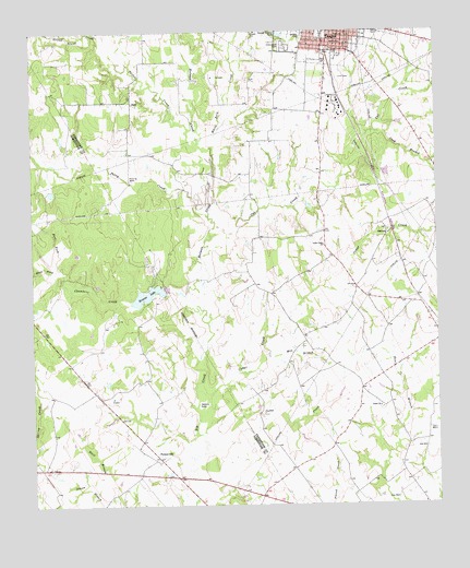
Teague South, TX USGS Topographic Map
Click on map above to begin viewing in our Map Viewer.

This topographic map contains these locations and features:
Feature Name Type Latitude Longitude GNIS ID View Map
AsiaLocaleN31.6063°W96.3441°1372349View Map
Browns DamDamN31.5568°W96.3336°1856312View Map
Browns LakeReservoirN31.5554°W96.3403°1372748View Map
Camp CreekStreamN31.5124°W96.3258°1372887View Map
Cash BranchStreamN31.5985°W96.2689°1372966View Map
Cat CreekStreamN31.5710°W96.3200°1372968View Map
Cedar CreekStreamN31.5282°W96.3211°1373008View Map
Cedar Creek ChurchChurchN31.5685°W96.2853°1373017View Map
Chambers CreekStreamN31.5518°W96.3219°1373047View Map
East Fork Chambers CreekStreamN31.5621°W96.3675°1373534View Map
Greenwood CemeteryCemeteryN31.6210°W96.2969°1373922View Map
Grove Island CreekStreamN31.6218°W96.3505°1372155View Map
Holman CreekStreamN31.5518°W96.3225°1374114View Map
Mill BranchStreamN31.5402°W96.3025°1374932View Map
Patton CreekStreamN31.5993°W96.3258°1375376View Map
Perry CreekStreamN31.5760°W96.3211°1375422View Map
PersonvillePopulated PlaceN31.5127°W96.3366°1380900View Map
Personville DivisionCivilN31.5131°W96.3733°1939084View Map
Saint James United Methodist ChurchChurchN31.6216°W96.2883°2018800View Map
Salem ChurchChurchN31.5716°W96.2647°1375916View Map
Sellers LakeLakeN31.5268°W96.3239°1376062View Map
Teague Public LibraryBuildingN31.5271°W96.2841°2014729View Map
Union ChurchChurchN31.5260°W96.2680°1376554View Map
West Fork Chambers CreekStreamN31.5621°W96.3675°1376694View Map
White Rock CreekStreamN31.5874°W96.3189°1376760View Map

Note: Coordinates in the location and feature list above are referenced to NAD83 datum.


Copyright (C) 2008-2025 Ryan Niemi / Sunset Dynamics ... All Rights Reserved